
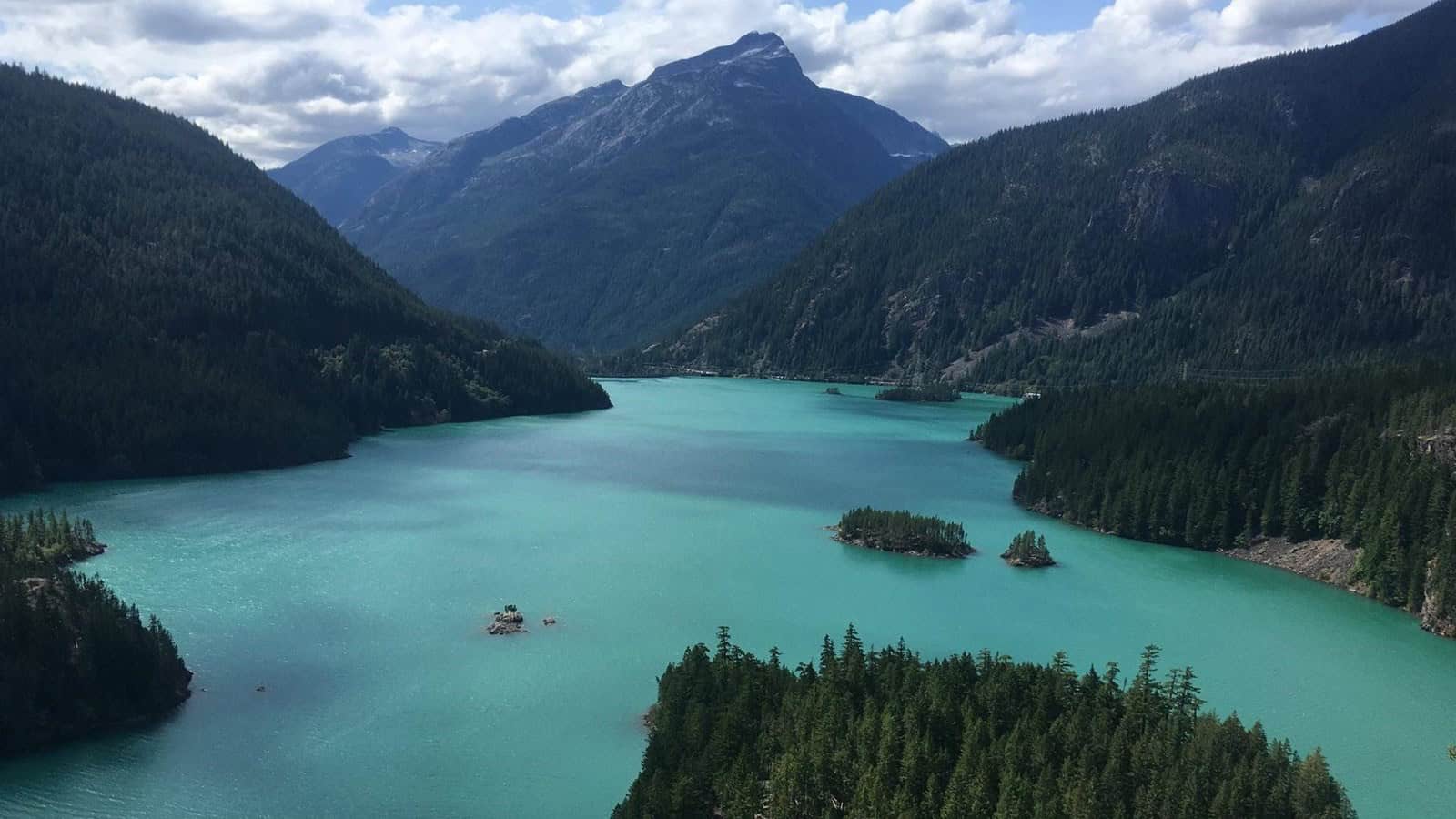
The Pacific Northwest has no shortage of beautiful scenery, but every once in a while you find a place that looks like somebody got a little carried away designing it. Turquoise lakes sit beneath jagged mountains, waterfalls plunge through ancient basalt canyons, forests are buried beneath curtains of moss, and entire hillsides come striped in red, gold, and black.
The strange part is that none of it requires Photoshop. From Washington’s Olympic Peninsula to Oregon’s volcanic coastline and the lava fields of Idaho, these nine places are very real, even when your eyes are suggesting otherwise.
Hoh Rain Forest, Washington
©National Park Service
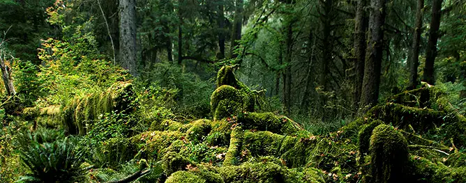
The Hoh Rain Forest already looks like somebody turned the saturation up too far. Moss hangs from bigleaf maples, ferns cover the forest floor, and old-growth conifers disappear into a canopy that seems to swallow the daylight. This is one of the great temperate rainforest landscapes in Olympic National Park, where the west-side valleys receive enormous amounts of precipitation. The National Park Service says the Hoh averages about 140 inches of rain a year. For the full storybook effect, the 0.8-mile Hall of Mosses loop is the obvious place to start. It winds through old-growth forest and a grove of maples draped in club moss. The scenery can look almost staged, except this particular set has been growing for a very long time. Summer parking can be extremely busy, so checking current park conditions before making the drive is a good idea.
Cape Flattery, Washington
©National Park Service
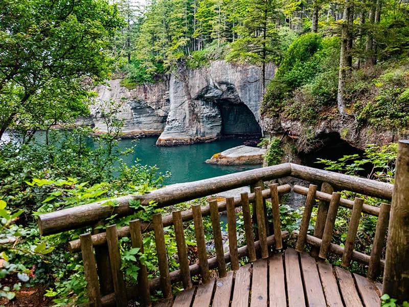
At Cape Flattery, the edge of the continent looks appropriately dramatic. Forest-covered cliffs drop toward dark Pacific water, sea stacks rise just offshore, and narrow channels cut through rock below the overlooks. The cape sits on the Makah Reservation at the northwestern tip of the contiguous United States, which makes the view feel remote even before the weather rolls in. The Cape Flattery Trail is managed by the Makah Tribe, and visitors need a Makah Recreation Permit for recreational access to trails and beaches on the reservation. The trail is open year-round from dawn until 30 minutes after sunset, according to the Tribe. This is one of those places where gray skies are not necessarily bad news. A little fog around the cliffs can make the entire coastline look even less believable.
Palouse Falls, Washington
©National Park Service
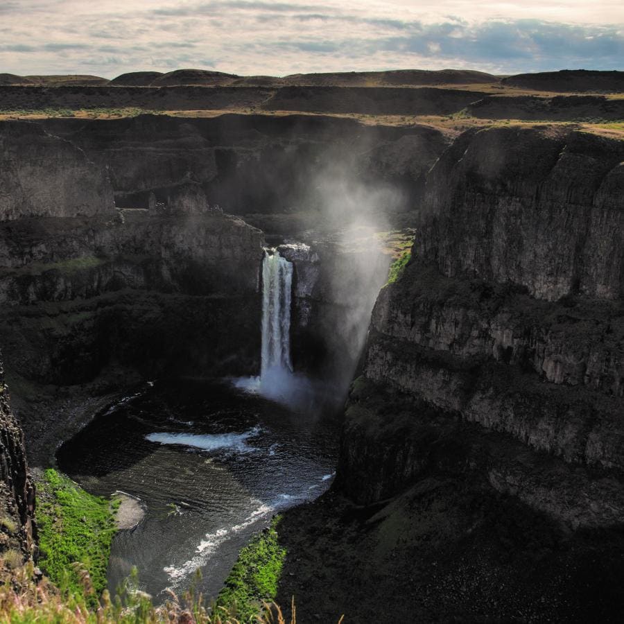
Palouse Falls looks like someone dropped a major waterfall into the middle of a dry basalt canyon and forgot to explain how it got there. The Palouse River narrows before plunging roughly 200 feet into a bowl below, then continues through a winding gorge toward the Snake River. Washington State Parks says the canyon and falls were carved more than 13,000 years ago. The state park has three established viewpoints, including the higher Fryxell Overlook, which gives you the wide-angle version of the scene. That is the image to chase here: the full falls, the layered canyon walls, and the river curling away in the distance. The park is remote and cell service is limited, so this is not the place to discover that your entire plan exists only in an app that refuses to load.
Diablo Lake, Washington
©National Park Service
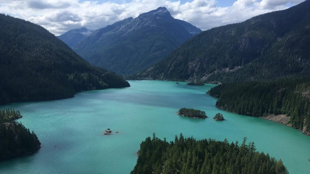
Diablo Lake does not need a filter. In summer, the water can turn such a vivid turquoise that it looks more like a glacial lake in the Canadian Rockies than something sitting beside Washington’s North Cascades Highway. The color is real. The National Park Service says fine rock particles known as glacial flour wash into the lake and refract sunlight, creating the distinctive blue-green appearance. The easiest big view is the Diablo Lake Overlook along State Route 20 at mile 131.7. From there, the lake winds between steep forested mountains with Diablo Dam visible in the distance. The color is generally most intense on sunny days in July, August, and September, when seasonal glacial melt carries more of that suspended rock into the water.
Paradise at Mount Rainier, Washington
©National Park Service
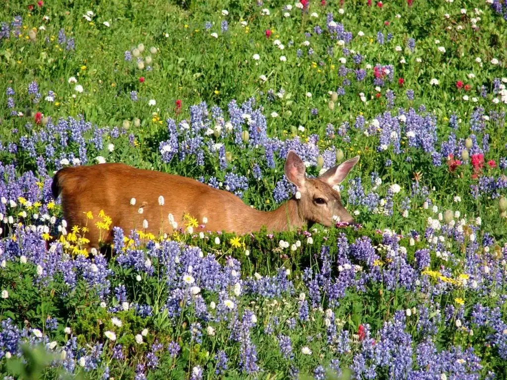
Paradise has one of those names that sounds like the tourism board got carried away until you actually see it. Sitting around 5,400 feet on the south side of Mount Rainier, the area opens into subalpine meadows with the massive, glacier-covered mountain rising directly behind them. When the summer wildflowers arrive, the foreground can fill with lupine, bistort, arnica, paintbrush, and other blooms while snow still streaks the upper slopes. The exact timing changes with weather and snowmelt, but the National Park Service says many flowers are usually blooming by mid-July and the meadows are often especially impressive by early August. Stay on the established trails while photographing them. These meadows have a very short growing season, and stepping off trail for a better angle can damage the plants people came to see.
Painted Hills, Oregon
©National Park Service
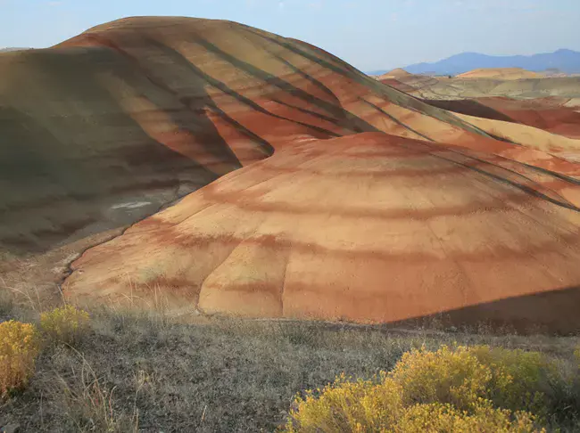
The Painted Hills look like central Oregon briefly decided to borrow its color palette from another planet. Rounded hills carry bands of red, gold, tan, orange, and black, with the colors shifting depending on light and moisture. The landscape is part of the Painted Hills Unit of John Day Fossil Beds National Monument, about 10 miles northwest of Mitchell. Those stripes are more than scenery. The National Park Service says the layers preserve evidence of ancient environments and climate change, including fossil soils and sediments influenced by volcanic activity. The park notes that late afternoon often provides especially good light for photography, while changing moisture can make the colors appear dramatically different. It is a landscape worth viewing from the trails rather than walking onto the fragile hills themselves.
Thor’s Well, Oregon
©National Park Service
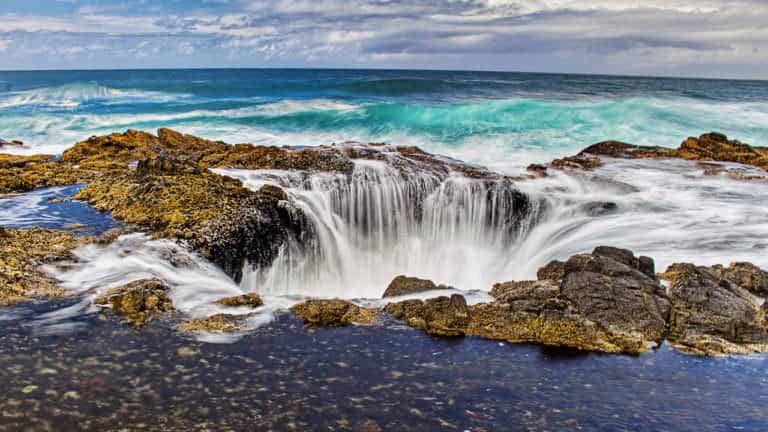
Thor’s Well is one of those coastal features that makes more sense in video than in a still photo. Waves surge across the dark basalt shoreline at Cape Perpetua, water pours into the opening, and then another swell can make the whole thing seem to refill from underneath. From the right angle it looks like somebody pulled the drain plug on the Pacific. The feature sits along the central Oregon Coast near Cape Perpetua Scenic Area. Travel Oregon specifically warns photographers to keep their distance because sneaker waves, slippery rock, and unexpectedly large swells can make the area dangerous. That is worth taking seriously. The best image is the water spilling into the opening with the ocean behind it, not a picture taken three feet closer because social media demanded a sacrifice.
Natural Bridges, Oregon
©National Park Service
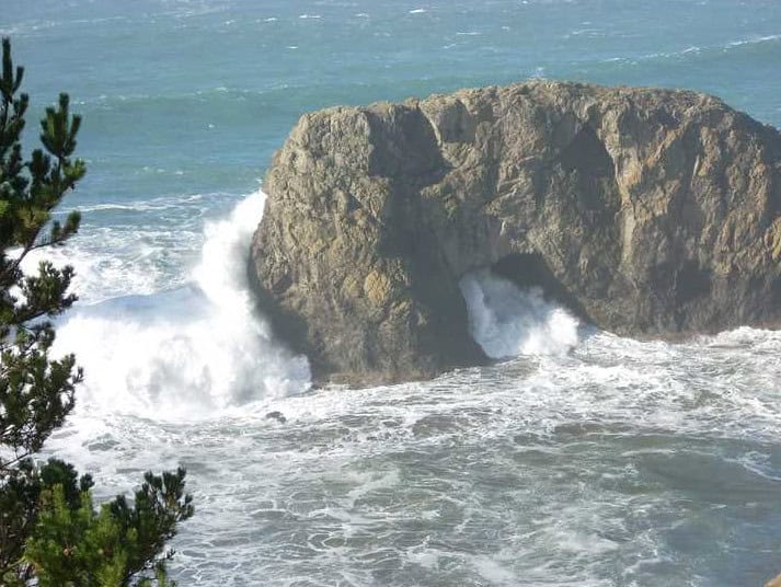
The Natural Bridges area inside Samuel H. Boardman State Scenic Corridor is the kind of Oregon Coast view that looks suspiciously like concept art. Forested cliffs break apart into arches, rocky islands, narrow channels, and blowholes while Pacific water moves through everything below. Oregon State Parks describes seven iconic arch rocks and blowholes visible from the Natural Bridge area. The scenic corridor stretches along the southern Oregon Coast near Brookings and packs an absurd amount of scenery into a relatively short section of Highway 101. For this stop, the official viewpoint is the move. Some unofficial routes around the cliffs are steep, exposed, and not maintained as park trails. You do not need to stand on top of an arch to appreciate how ridiculous this coastline looks from above.
Craters of the Moon, Idaho
©National Park Service
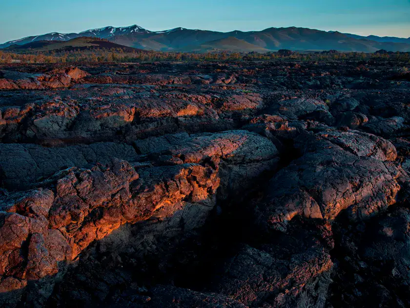
Craters of the Moon is what happens when a Pacific Northwest road trip suddenly turns into a geology field trip on another planet. Black lava fields stretch across the landscape between cinder cones, spatter cones, fissures, and pockets of hardy vegetation. The National Park Service says volcanic activity here occurred during eight major eruptive periods between roughly 15,000 and 2,100 years ago. The lava came through the Great Rift, a system of cracks extending about 52 miles across the Snake River Plain. Today, visitors can explore trails, overlooks, and volcanic features that make the name feel surprisingly reasonable once you are standing there. For the strongest image, go wide: dark lava in the foreground, a cinder cone rising behind it, and enough open sky to make the place look as empty and strange as it actually feels.

