
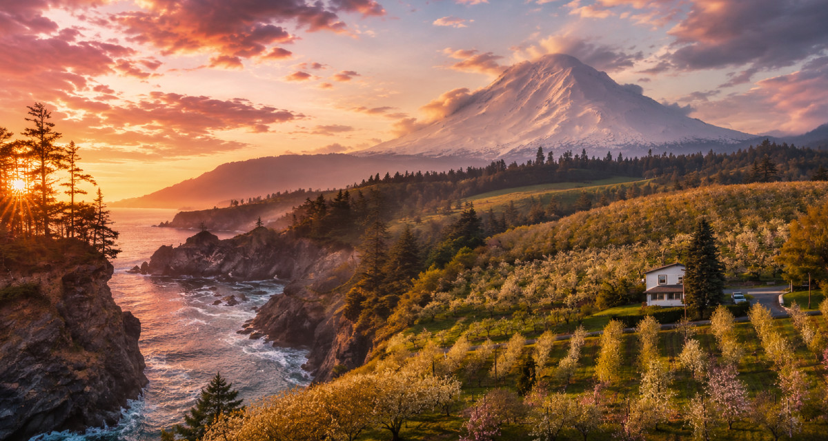
Oregon is anything but uncharted territory. Places like Crater Lake, Cannon Beach, and Multnomah Falls attract tourists from all around the country. Despite this, Oregon still has its gems. Tourists usually visit the same spots, making them overcrowded and leaving behind places that can surprise even the most seasoned explorer.
Some of these places are easy to reach, while others will have you hiking for a few hours. Some are to the east, a fairly untapped region of Oregon. Others sit along the coast and are conveniently sandwiched between the more popular sites that you would end up visiting anyway.
Today, we’re looking at the most awe-inspiring places in Oregon that have flown under tourists’ radars for decades now.
The Alvord Desert
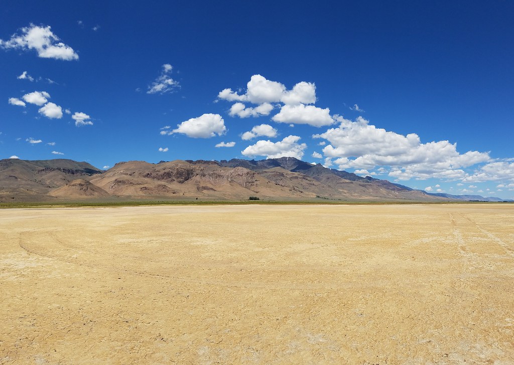
©"Alvord Desert" by BLM Oregon & Washington is licensed under BY 2.0. - Original / License
Most people skip the Alvord Desert without a second thought. It’s a dry lake bed in Harney County, roughly 7 miles wide and 12 miles long, lying in the rain shadow of the neighboring Steens Mountain. The surface is made up of cracked alkali flats known as the playa, which is one of the reasons why some choose to avoid it. Here, you are actually able to enjoy absolute silence without a tourist in sight.
Although Oregon’s desert is not on most tourist itineraries, the Alvord Hot Springs make it particularly attractive for those who actually know about it. The geothermal springs are a short walk away from the desert itself, and the water temperature sits between 100 and 110 degrees Fahrenheit. Watching the flat white expanse of scenery and the nearly 10,000-foot mountain rising beyond it while soaking in hot water is a unique combination.
The Alvord Desert is not for the weak of heart, but if you’re planning on visiting, you should spend at least one night in the desert to get the full experience. You should carry as much water as possible and remember to avoid the desert after heavy rainstorms as the mud from the playa becomes dangerously sticky.
Steens Mountain
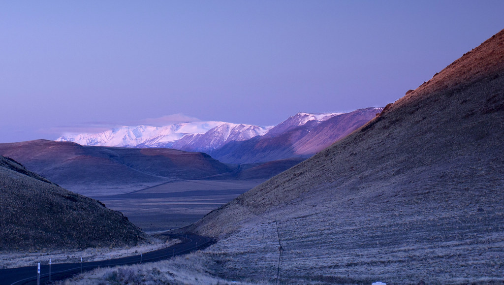
©"Steens Mountain, Oregon" by Bonnie Moreland (free images) is licensed under CC0 1.0. - Original / License
Steens Mountain isn’t really a mountain in the traditional sense of the word. It’s a fault-block range raised on one side and torn away on the other. It has a mild slope on the western side and a rugged cliff on the east, plunging about 5,000 feet down to the Alvord Desert floor. The peak itself is just under 10,000 feet tall, and the east rim overlook has one of the best views in the American West. It can be reached via the Steens Mountain Backcountry Byway.
The byway runs through glacially sculpted canyons and U-shaped valleys, climbing all the way up to alpine country where Kiger wild mustangs roam the ridge. Lower sections can open as early as May, while higher parts around the summits, including the Kiger Gorge, are typically closed until late June. Once they are available, they usually remain open through October, depending on the snow.
Afternoon thunderstorms at this elevation are not to be taken lightly. Mornings can start out clear and inviting, but conditions change quickly up there. Be sure to bring extra layers, even if it’s sunny.
Samuel H. Boardman State Scenic Corridor
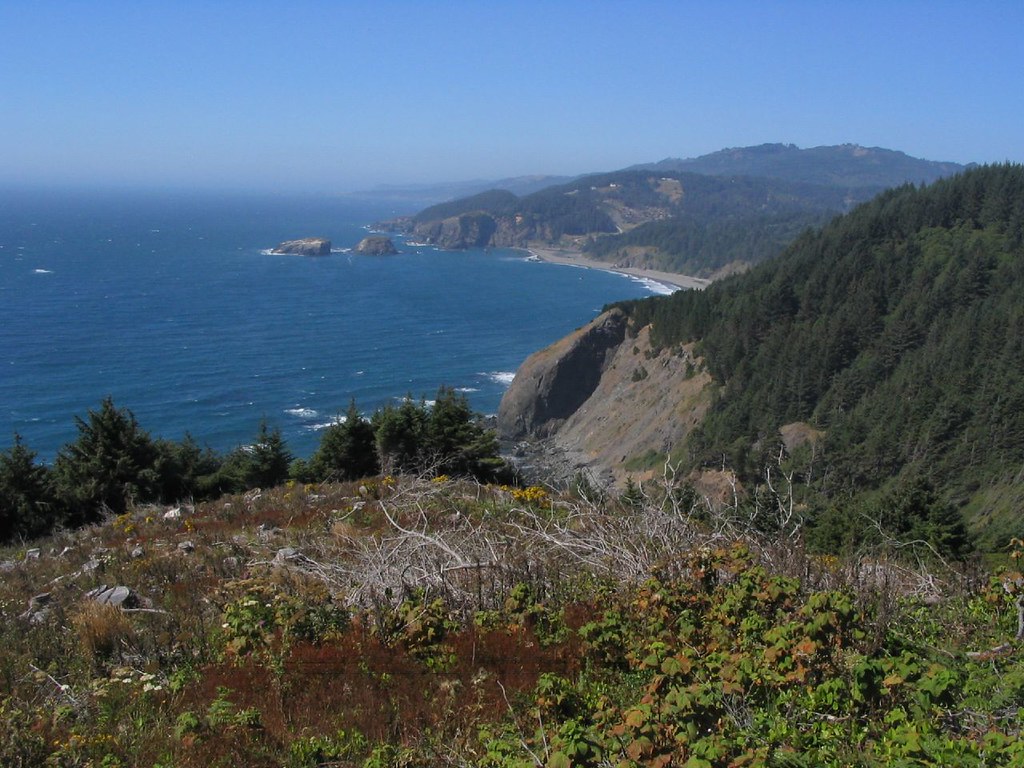
©"Samuel H. Boardman State Scenic Corridor, Near Pistol River, Oregon" by Ken Lund is licensed under BY-SA 2.0. - Original / License
Tourism on the Oregon Coast tends to concentrate in the north. Typically in the stretch between Cannon Beach and Newport. But if you head south, you’ll find the Samuel H. Boardman State Scenic Corridor. It sits towards the southern end and runs for 12 miles along Highway 101 between Gold Beach and Brookings.
It’s one of the most picturesque stretches along the state coastline, with natural arches and hidden cove beaches popping up one after another as you drive through it. Tourists usually miss it because it’s five hours south of Portland and not on the way to any other major destination.
If you’re headed to the Samuel H. Boardman State Scenic Corridor, make sure to stop by Natural Bridges, Arch Rock, Secret Beach, and China Beach. These spots are easy to reach, and if you’re into hiking, they’re all connected through longer trail sections.
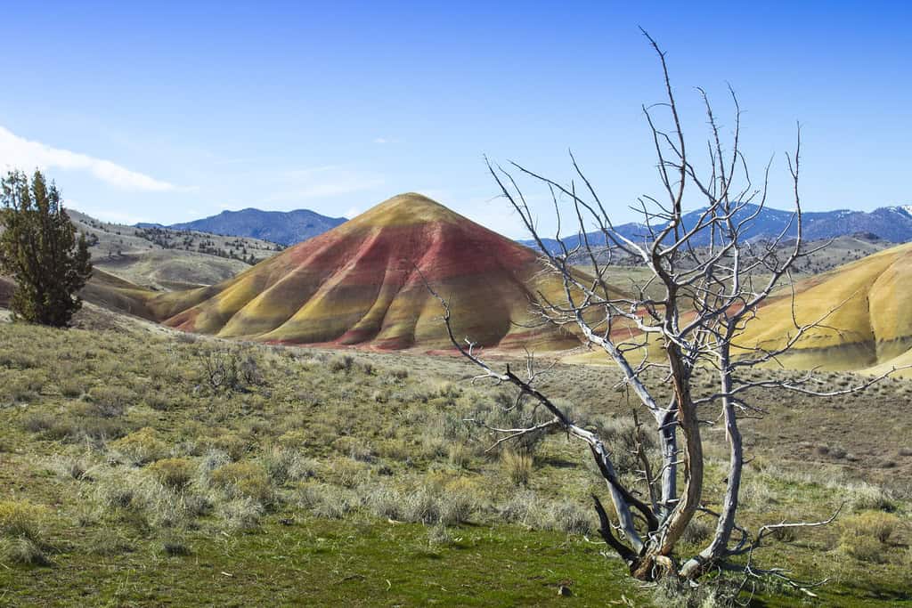
Painted Hills
©"Painted Hills, Oregon" by Bonnie Moreland (free images) is licensed under CC0 1.0. - Original / License
The Painted Hills are a geological formation in the John Day Fossil Beds National Monument in Wheeler County. They look like something you’d find in Utah rather than Oregon. Most tourists never make it to the Painted Hills because getting there requires a planned detour off Highway 26, near the small town of Mitchell.
The Painted Hills were formed by ash deposits and shifting climate conditions over roughly 35 million years. The rock layers come in red, gold, black, and ochre, and the colors shift visibly as clouds pass overhead and as the afternoon light changes.
Hiking trails here are short and sweet. Carroll Rim is the longest at 2.6 miles, but it’s worth the hike. It has an excellent vantage point that looks down on the hills. The Painted Hills Overlook Trail is slightly over a mile long and offers eye-level views of the colorful layers. The best time to visit the Painted Hills is during late spring, when the colors are at their most vivid.
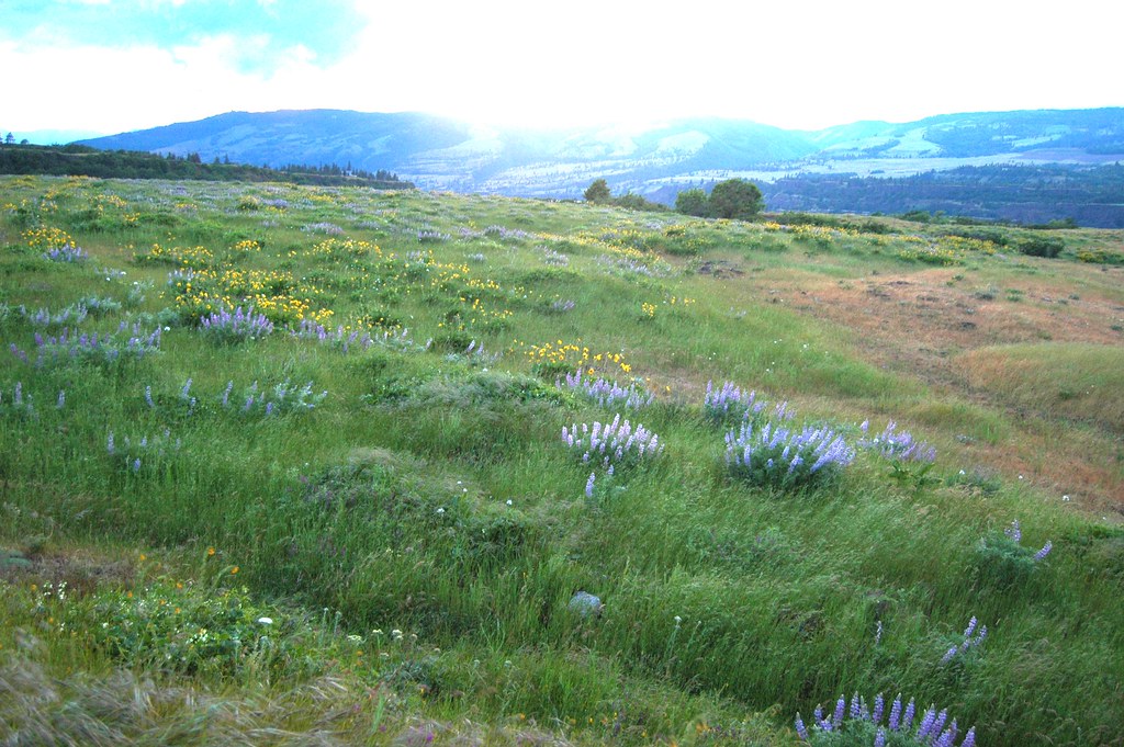
Rowena Crest
©"Rowena Crest wildflowers." by pirateyjoe is licensed under BY-SA 2.0. - Original / License
Rowena Crest is a viewpoint on the Historic Columbia River Highway, east of Hood River. It is often overlooked in favor of more famous sites like Multnomah Falls and Vista House further west. The viewpoint sits atop a basalt plateau within the Columbia River Gorge and provides an amazing view across the Columbia into Washington state.
The viewpoint itself is accessible directly from the highway. The trails within the Tom McCall Preserve add about two miles of loop hiking for those who want to see the wildflowers within the preserve rather than just view them from the viewpoint itself. Rowena Crest is far less crowded than Multnomah Falls during the spring, so it’s ideal if you’re looking for a place with great views but fewer tourists.
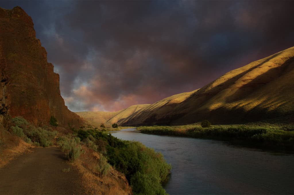
Cottonwood Canyon State Park
©"Cottonwood Canyon State Park and the John Day River, Oregon" by Bonnie Moreland (free images) is licensed under PDM 1.0. - Original / License
Despite having some of the most spectacular canyon scenery in Oregon, Cottonwood Canyon is among the least visited parks in the state. It runs through 16 miles of the John Day River, a designated Wild and Scenic River, in Sherman and Gilliam counties and lies between basalt cliffs that rise 1,250 feet above the river.
The reason so few people visit is that it takes two hours to reach from both Bend and Pendleton, and it’s not accessible along any other route. Getting there requires commitment, but it’s worth doing. The canyon is a peaceful place, and the only sounds you’ll hear are the river flowing and the raptors hunting along its edges.
If you’re visiting Cottonwood Canyon State Park, you should do so during the spring, when the water in the John Day runs crystal clear, and the setting sun shines upon the canyon walls from the west.
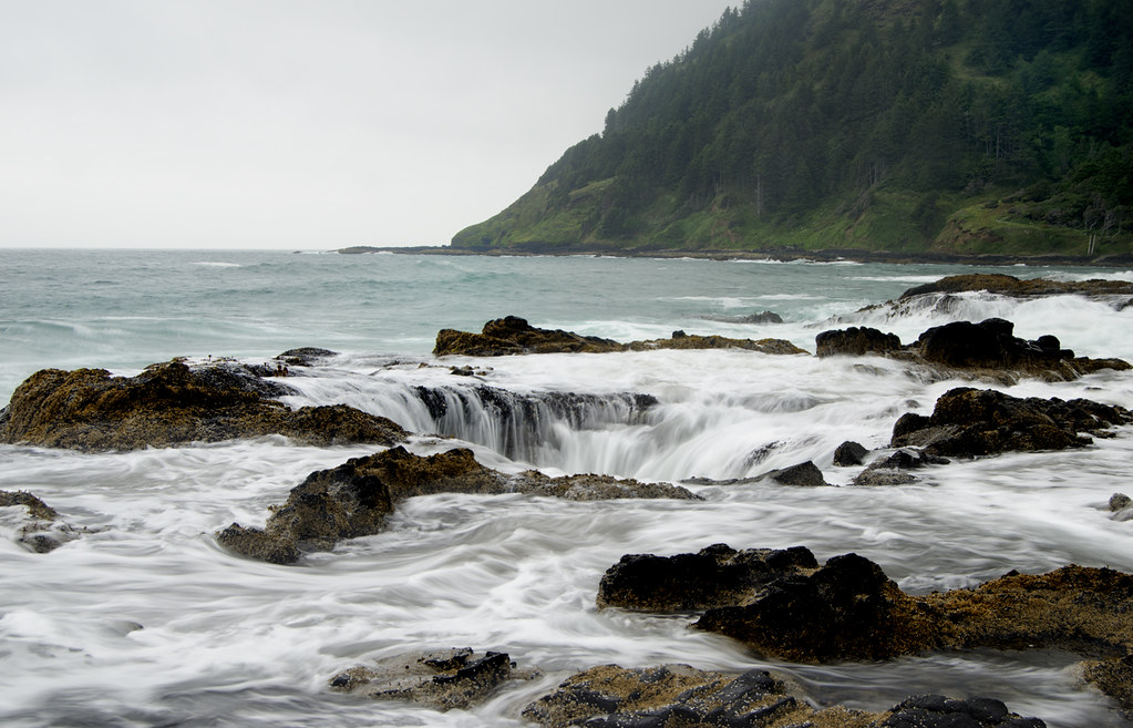
Thor’s Well at Cape Perpetua
©"Thor's -- Well???" by snowpeak is licensed under BY 2.0. - Original / License
Thor’s Well is a natural sinkhole on the basalt shelf of Cape Perpetua, located a few miles south of Yachats. During high tides, waves fill the well and drain through it, which gives the impression that the sea is being drained into the formation. During winter storms, the surge becomes extremely powerful, making the location quite dangerous.
Despite being easy to access, Thor’s Well is often missed by tourists who rarely venture beyond the more popular northern stops. If you’re visiting, make sure to check out the surrounding Cape Perpetua area as well. It offers a two-mile round trip hike to a viewpoint at 800 feet, and there’s another interesting formation nearby called Cook’s Chasm, known for its own surge channel effect.
Be sure to visit Thor’s Well during high tide at sunrise or sunset, especially if you’re looking to get some photos. At midday low tide, there’s not much to photograph other than a hole in the rock.
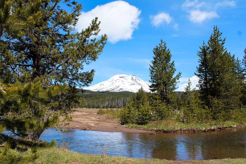
Cascade Lakes Scenic Byway
©"Cascade Lakes Scenic Byway [IMG_5971_2]" by trekkyandy is licensed under BY-SA 2.0. - Original / License
The Cascade Lakes Scenic Byway is a 66-mile route heading southwest of Bend deep into the Cascades. It runs through a sequence of alpine lakes surrounded by volcanic peaks. In the northern section, South Sister and Broken Top dominate the scenery, giving way to Mount Bachelor as you travel south. The late afternoon light on the lakes alone is worth the drive.
Most tourists who visit Bend head east towards Smith Rock or south towards Newberry Volcano, and end up never taking this route. The byway is open between late June and October. The whole route takes about 90 minutes to complete without stops but you can make a full day out of it if you stop by each lake.
Port Orford
©"Oregon Coastline near Port Orford" by Kirt Edblom is licensed under BY-SA 2.0. - Original / License
Port Orford is a small fishing community on the southern Oregon coast whose geography keeps most tourists from ever finding it. It sits between Highway 101 and the coast, and the main roads north and south bypass the town center entirely.
Port Orford is home to the only dolly dock on the Pacific West Coast, where about thirty fishing vessels are lifted by cranes each morning and placed into the ocean rather than being moored overnight. The town has several galleries that are run by working artists and a seafood scene that punches above its weight.
Just above the town sits Port Orford Heads State Park, featuring a former Coast Guard lifeboat station dating back to 1934 and 200-foot cliffs with views of Cape Blanco and Humbug Mountain.
The dolly dock alone makes Port Orford worth the detour. Watching thirty fishing boats get craned into the ocean makes for an interesting morning that cannot be replicated anywhere else on the Pacific West Coast.
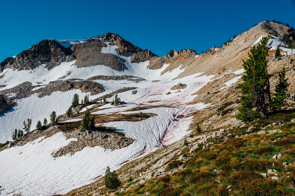
Wallowa Mountains
©"Wallowa Mountains" by lorenkerns is licensed under BY 2.0. - Original / License
The Wallowa Mountains lie in the northeasternmost part of the state of Oregon. Getting there takes about six hours by car from Portland, and many tourists avoid the Wallowas because they think there is nothing worth seeing in northeastern Oregon. They’re wrong.
The Wallowas have 18 peaks rising above 9,000 feet. They encompass the Eagle Cap Wilderness, which is the largest wilderness region in Oregon, covering an area of roughly 360,000 acres. There, you’ll find granite mountains and glacial valleys. The scenery feels reminiscent of the Sierra Nevada range or the Alps, not of the typical Oregon landscape.
Wallowa Lake is located just south of the town of Joseph, and is used as the main entrance to the mountains. From there, a gondola goes up to the top of Mount Howard, which is 8,150 feet tall. It’s a great option for those who want to enjoy the view without the hike. If you’re looking to make a day out of it, you can take the trails of the Eagle Cap Wilderness, which lead deep into the alpine territory.
If you want to get the full experience, visit between July and September, when the larch trees add a touch of gold against the granite peaks.
