
Washington’s scenery gets most of the attention, and fair enough. It is hard to compete with Mount Rainier, the Cascades, Puget Sound, and the Columbia River. But some of the state’s most interesting sights exist because engineers looked at deep lakes, tidal channels, steep canyons, fast rivers, and difficult terrain and decided to build over, across, or directly into them.
The results range from the world’s longest floating bridge and a power plant buried beneath Snoqualmie Falls to enormous hydroelectric dams, century-old navigation locks, and the modern descendants of one of the most famous bridge failures in history. Some are destinations in their own right. Others are structures thousands of people pass every day without realizing how unusual they actually are. Here are nine Washington engineering feats that deserve a closer look.
Hiram M. Chittenden Locks
©"Ballard Locks" by montztermash is licensed under BY-SA 2.0. - Original / License
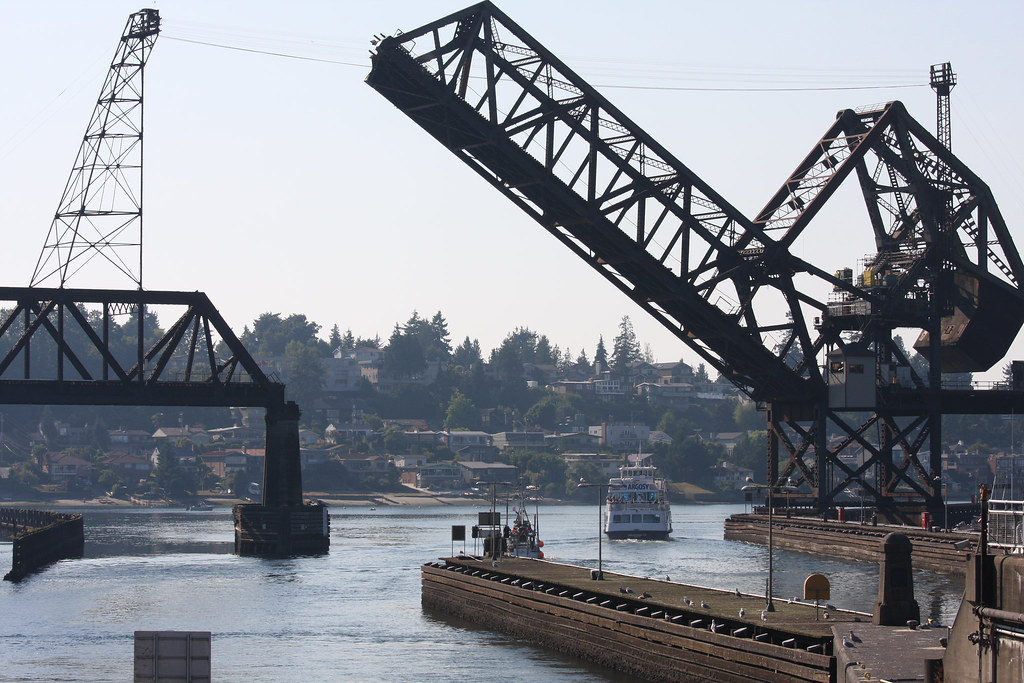
The Ballard Locks solve several problems at once, which is part of what makes them so interesting to watch. Completed by the U.S. Army Corps of Engineers in 1917, the locks connect Seattle’s freshwater Lake Washington and Lake Union system with the tidal waters of Puget Sound. They move boats between different water levels, help keep Lake Washington and Lake Union roughly 20 to 22 feet above sea level, and limit saltwater intrusion into the freshwater lakes. The complex has both a small lock and a large lock, along with a spillway and a fish ladder used by migrating salmon. Visitors can stand close enough to watch the gates, valves, boats and changing water levels do their work in real time. The surrounding botanical gardens and fish ladder make the stop worthwhile even when marine traffic is light. It is century-old infrastructure that still performs a very modern job in the middle of Seattle.
Space Needle
©"Space Needle with skyline and Mount Rainier at sunset, 2000" by Seattle Municipal Archives is licensed under BY 2.0. - Original / License
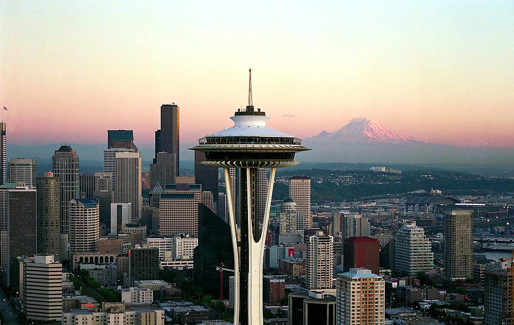
The Space Needle is so familiar that it is easy to forget how ambitious the structure was when it went up. Built as a centerpiece of Seattle’s 1962 World’s Fair, the 605-foot tower opened on April 21, 1962 after roughly 400 days of construction. Its foundation alone used about 5,600 tons of concrete, and the tower was assembled with tens of thousands of bolts. More than six decades later, the basic silhouette still looks futuristic. The engineering is easier to appreciate from the base, where the narrow tower rises into a much wider top house, and from the observation levels, where the structure has to handle wind while giving visitors wide-open views. A major renovation completed in 2018 added floor-to-ceiling glass and the Loupe, a rotating glass floor. Plenty of buildings are taller, but few have become so inseparable from the skyline around them.
Deception Pass Bridge
©"Deception Pass Bridge Washington State" by PatrickMcNallyMolokai is licensed under BY 2.0. - Original / License
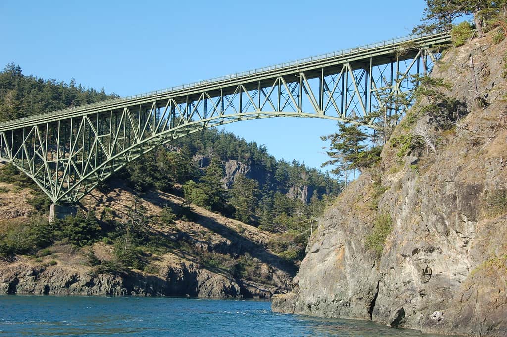
The drive between Fidalgo Island and Whidbey Island gets a dramatic assist from the Deception Pass bridges. The two steel spans cross Deception Pass and neighboring Canoe Pass, with WSDOT listing lengths of 976 feet and 511 feet. Construction began in 1934, and the bridges were dedicated on July 31, 1935. Before they opened, travelers relied on ferry service to make the crossing. New Deal emergency relief money helped fund the project, while Civilian Conservation Corps crews worked on the approach roads inside what is now Deception Pass State Park. The setting does a lot of the visual heavy lifting, with steep cliffs, fast-moving tidal water and forest on both sides, but the bridge itself holds up just fine under inspection. Park viewpoints and trails give visitors a chance to see the steelwork from several angles instead of simply driving across and wondering where the view went.
SR 520 Evergreen Point Floating Bridge
©Wikimedia
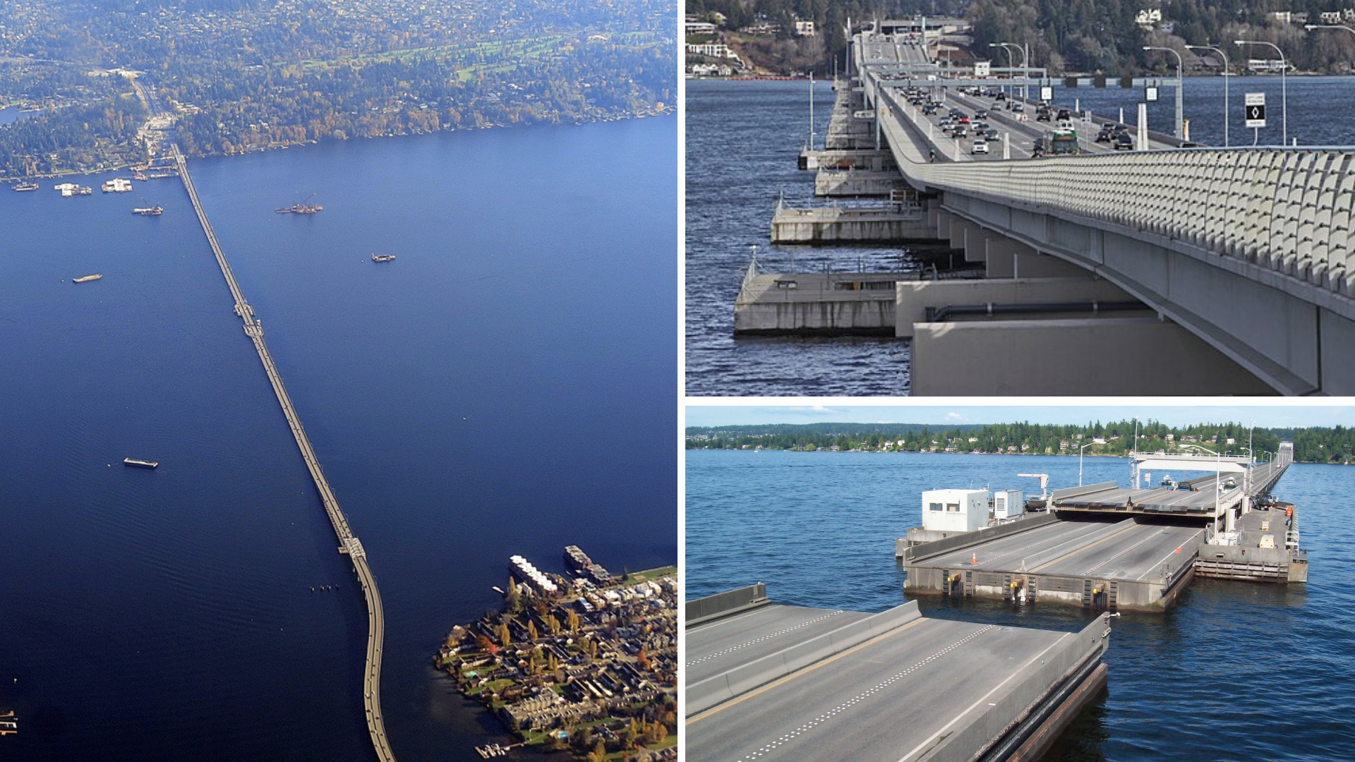
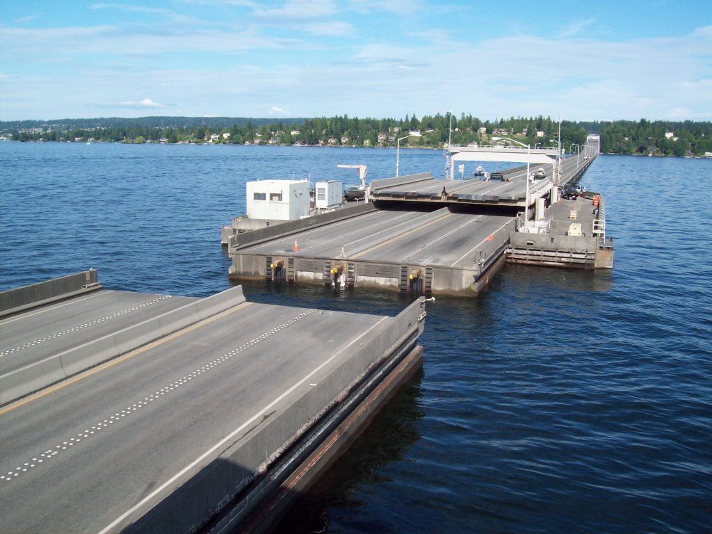
Washington has a habit of making floating bridges look almost normal, but SR 520 is anything but ordinary. The current bridge opened in April 2016 and replaced the aging 1960s span across Lake Washington between Seattle and the Eastside. At 7,708 feet of floating length, WSDOT identifies it as the world’s longest floating bridge. Its roadway sits on massive concrete pontoons anchored to the lakebed, a solution that makes sense here because Lake Washington is both deep and lined with soft soils that make a conventional bridge far more difficult. The new span carries six lanes and includes a separated 14-foot-wide path for people walking and biking. That path is one of the best ways to appreciate the scale of the structure. From shore, it can look like another highway. Out over the lake, with the road riding just above the water and Seattle in the distance, the engineering becomes much harder to ignore.
Tacoma Narrows Bridges
©"Tacoma Narrows Bridge DSC_5168" by Five-O Photography is licensed under BY-ND 2.0. - Original / License
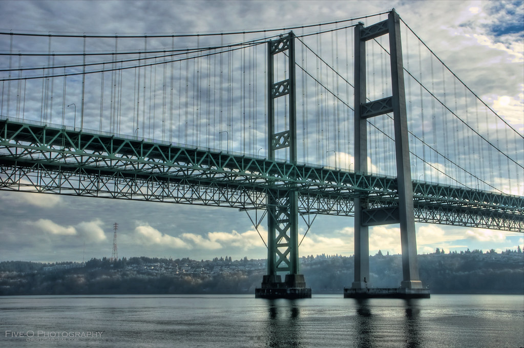
Few bridges come with an engineering backstory as famous as the Tacoma Narrows. The original 1940 suspension bridge, nicknamed Galloping Gertie, collapsed in a windstorm on November 7 of that year. WSDOT notes that the failure changed the way engineers design suspension bridges, particularly how they account for aerodynamic forces. The replacement westbound bridge opened in 1950 with a 2,800-foot center span and a much stiffer design. A second parallel suspension bridge opened for eastbound traffic in 2007, creating the twin-span crossing seen today between Tacoma and Gig Harbor. The newer bridge includes a separated path for bicycles and pedestrians, giving visitors a way to experience the Narrows without viewing everything through a windshield. It is a rare place where one crossing tells two stories at once: a famous engineering failure and the safer designs that followed it.
Hood Canal Bridge
©"Hood Canal Bridge 2" by brewbooks is licensed under BY-SA 2.0. - Original / License
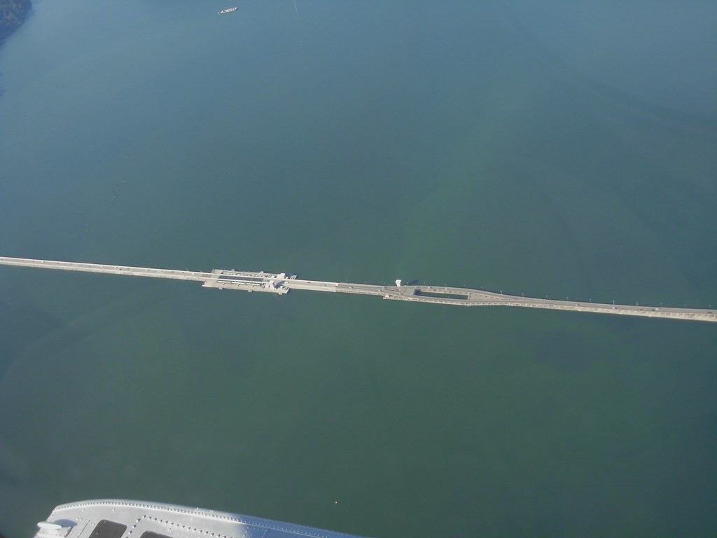
The Hood Canal Bridge looks straightforward from a distance, which is almost unfair to the machinery underneath it. WSDOT describes the roughly 7,867-foot State Route 104 crossing as the world’s longest floating bridge in a saltwater tidal basin. Its floating section stretches for more than a mile across Hood Canal, where deep water and challenging marine conditions make a conventional fixed bridge difficult. The bridge also has to make room for boat traffic. Hydraulic systems raise portions of the roadway while two 300-foot floating spans retract, creating an opening that can reach 600 feet. Wind, tides and saltwater keep the structure moving and make maintenance a constant part of its life. For travelers heading between the Kitsap and Olympic peninsulas, it is easy to treat the crossing as just part of the drive. Knowing that much of the road is literally floating makes the trip considerably more interesting.
Snoqualmie Falls Hydroelectric Project
©US Dept of Energy
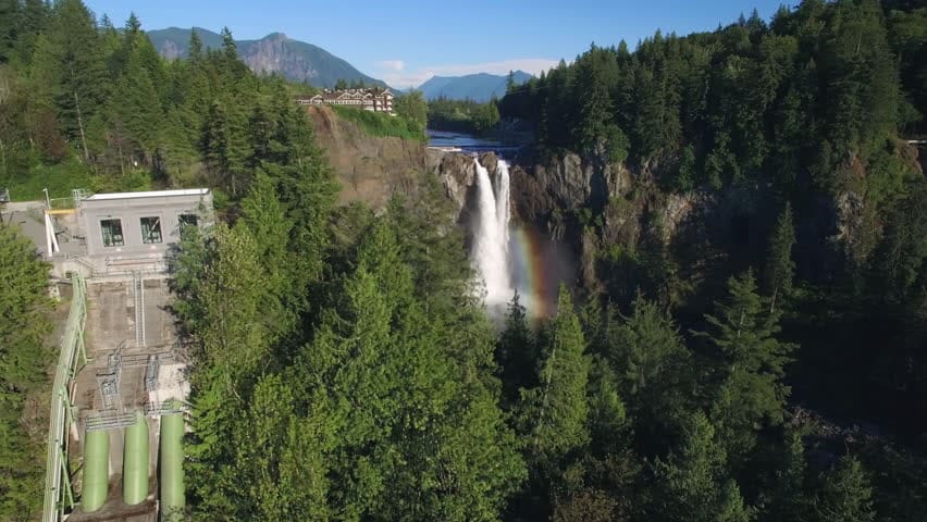
Most visitors come to Snoqualmie Falls for the 270-foot waterfall. Hidden beneath the scenery is an engineering landmark. Puget Sound Energy’s Plant 1 was built in 1898 and 1899 inside a cavern roughly 270 feet below the falls, making it the world’s first completely underground powerhouse. A second powerhouse was added downstream in 1910, and the hydroelectric project is still operating more than a century later. You cannot see the underground plant simply by looking over the railing, which is part of the fun of knowing it is there. PSE operates a hydroelectric museum in historic buildings near the falls, and the surrounding park includes overlooks, trails and interpretive displays. The result is an unusual combination of natural spectacle and industrial history. The waterfall gets the postcard, but the hidden powerhouse is the detail that turns a familiar Washington stop into an engineering destination.
Diablo Dam
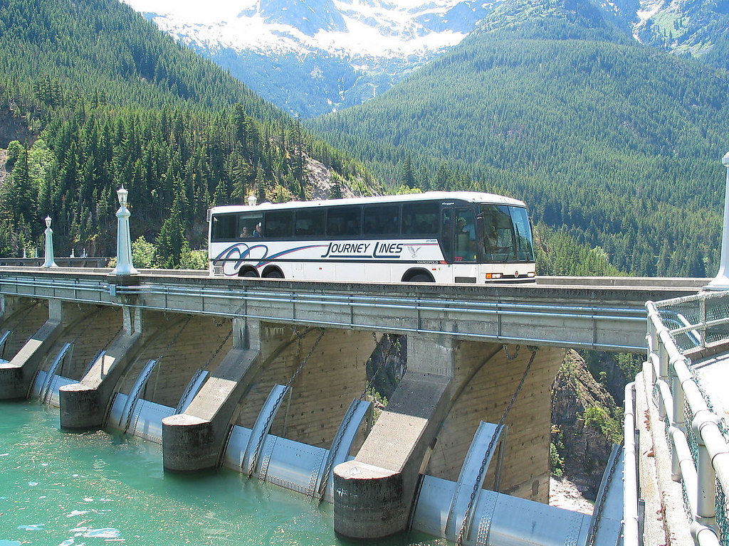
©"Skagit Tours bus on Diablo Dam, 2004" by Seattle Municipal Archives is licensed under BY 2.0. - Original / License
Diablo Dam sits in the North Cascades in a setting that would be memorable even without a 389-foot concrete arch blocking the Skagit River. Completed in 1930, it was the tallest dam in the world at the time. The structure rises from bedrock with a crest about 1,170 feet long, and its design includes the decorative arches and lighting that give the dam a look closer to monumental architecture than bare utility infrastructure. Diablo is part of Seattle City Light’s Skagit River Hydroelectric Project, along with Ross and Gorge dams. The reservoir behind it became Diablo Lake, famous for its blue-green water and mountain backdrop. Seattle City Light also operates seasonal Skagit tours that bring visitors onto the lake and explain the area’s hydroelectric history. Between the dam, the lake and the surrounding peaks, this is one engineering site where nobody has to work very hard to make the scenery cooperate.
Grand Coulee Dam
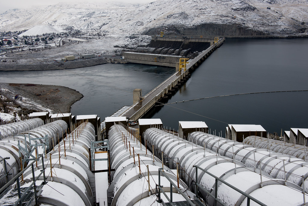
©"Winter at Grand Coulee Dam - 2" by Bureau of Reclamation is licensed under BY 2.0. - Original / License
Grand Coulee Dam is the kind of structure that makes measurements sound slightly ridiculous. The Bureau of Reclamation lists the full dam complex at 5,223 feet long and 550 feet high above bedrock, with roughly 12 million cubic yards of concrete. Its power facilities have a combined generating capacity of 6,809 megawatts, making Grand Coulee the largest hydropower-producing complex in the United States. Construction on the original project began in 1933, and the dam and power system expanded in stages for decades afterward. It now serves multiple purposes, including hydropower, irrigation and flood control. The scale is best understood in person, where the powerhouses and spillway stretch across a broad section of the Columbia River. A visitor center explains the project and its history, including the effects the dam had on Native communities and the river system. In season, the nighttime laser show gives travelers one more reason to stick around after sunset.

