
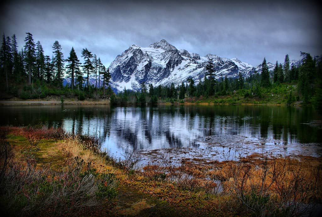
Seattle is one of the best home bases in the country for National Park Service trips. Within a few hours of the city, travelers can reach glacier-covered mountains, temperate rainforests, wild coastlines, alpine lakes, historic military sites, and landscapes that feel a long way from downtown.
Only three of the destinations below are designated national parks in the strict sense. The others are national historical parks or a national historical reserve, but all seven are part of the National Park System and worth the trip. Some work as easy day trips from Seattle. Others make a lot more sense as an overnight or weekend escape, especially once ferries, traffic, and mountain roads enter the equation.
Mount Rainier National Park

©"Mount Rainier, Washington State" by Harold Litwiler, Poppy is licensed under BY-ND 2.0. - Original / License
Distance from Seattle: About 107 miles to Paradise via SR 706, roughly 2.5 hours before heavy traffic or entrance delays.
Mount Rainier is the obvious place to start. The volcano rises about 14,410 feet above sea level and is visible from Seattle on clear days, but the scale does not really register until you start climbing into the park. Paradise is one of the most popular areas for good reason, with subalpine meadows, glacier views, waterfalls, and trail access directly below the mountain. The wildflower season is short and weather-dependent, but in most years plenty of flowers are blooming by mid-July and the meadows are especially impressive around late July and early August.
Summer crowds are the tradeoff. July and August are peak season, and the National Park Service warns that parking at Paradise and Sunrise can fill by late morning on busy weekends. Sunrise sits at 6,400 feet and is the highest point in the park you can reach by vehicle, with huge views of Rainier and the Emmons Glacier. Mount Rainier is not using timed-entry reservations in 2026, but that does not mean you can roll in whenever you feel like it and expect an empty parking space. A weekday visit or an early start is still the safer play.
Olympic National Park
©Adam Reck/Shutterstock.com
Distance from Seattle: Plan on roughly 3.5 to 4 hours to Hurricane Ridge when using the Seattle-Bainbridge ferry and driving through Port Angeles, depending on ferry waits and traffic. The Hoh Rain Forest is about 218 road miles from Seattle and roughly a 4.5-hour drive when traveling around Puget Sound.
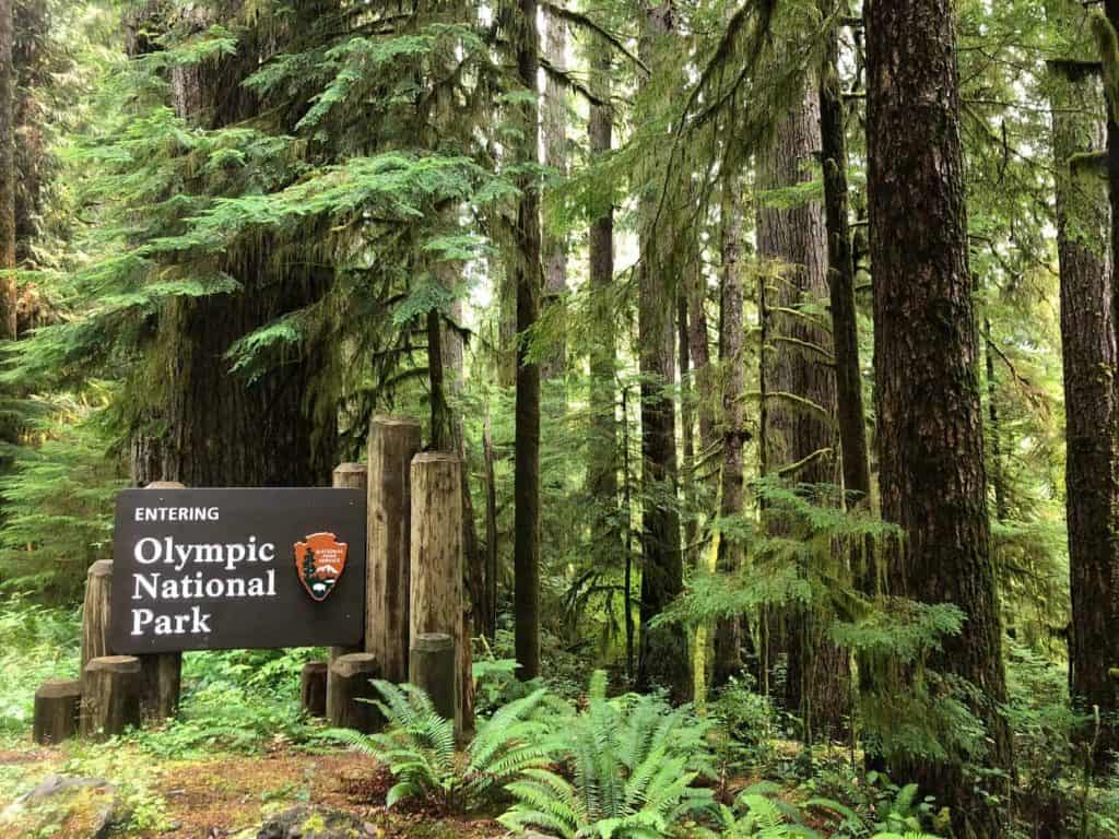
Olympic is basically several vacations packed into one enormous park. Hurricane Ridge reaches 5,242 feet and opens up broad views across the Olympic Mountains. On the western side, the Hoh Rain Forest receives an average of about 140 inches of precipitation each year, enough to keep its maples, conifers, mosses, and ferns almost aggressively green. Then there is the Pacific coast, where beaches such as Ruby Beach add sea stacks, tide pools, driftwood, and surf to a park that was already showing off.
For Hurricane Ridge and the northern side of the park, the Seattle-Bainbridge ferry is a scenic route that puts you on the road toward Port Angeles. The Hoh Rain Forest sits much farther west, about two hours from Port Angeles and less than an hour from Forks, so it is not a quick extension of a Hurricane Ridge visit. Depending on where you are headed, driving around Puget Sound can also make sense and avoids building a ferry wait into the schedule.
The biggest planning mistake at Olympic is assuming everything is close together because it shares one park boundary. There is no road crossing directly through the Olympic Mountains. Highway 101 circles much of the peninsula, while separate spur roads lead toward places such as Hurricane Ridge, the Hoh, and the coast. For a first visit, pick one region and actually enjoy it. Trying to check off the mountains, rainforest, and coast in a single day is a very efficient way to spend most of Olympic National Park looking through a windshield.
North Cascades National Park
©"Diablo Lake" by Paul Schultz is licensed under BY 2.0. - Original / License
Distance from Seattle: Roughly 120 to 125 miles to the Newhalem and Diablo Lake corridor, usually about 2.5 to 3 hours via State Route 20.
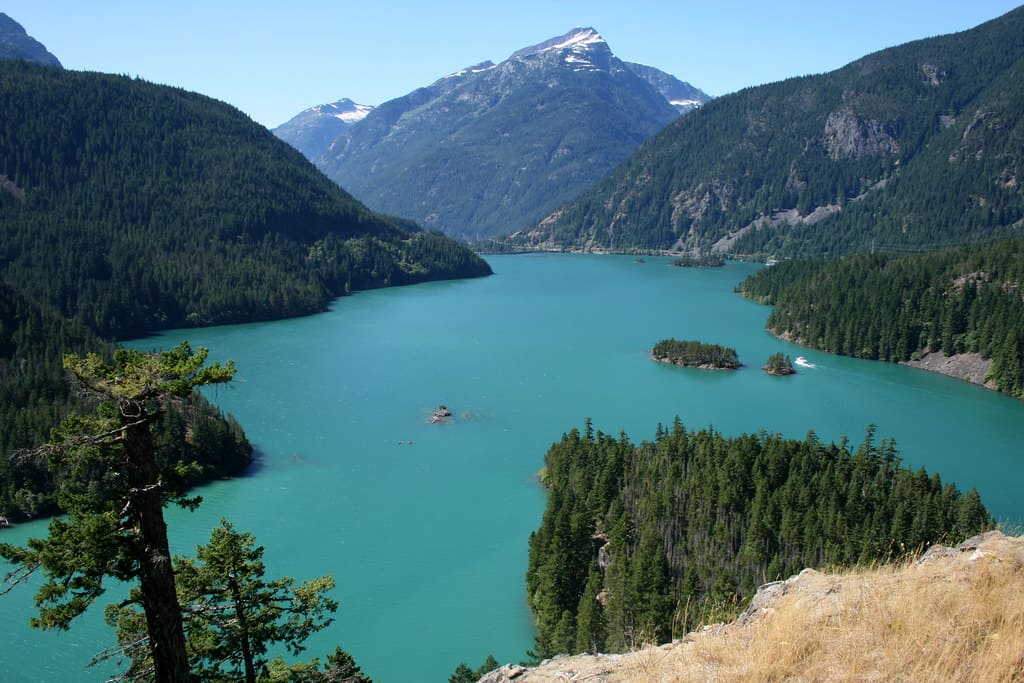
The North Cascades have earned the nickname “American Alps,” and once the jagged peaks start closing in around State Route 20, the comparison makes sense. One of the easiest payoffs is Diablo Lake, where glacial flour suspended in the water creates its striking turquoise color during the summer. The North Cascades Highway also passes old-growth forests, waterfalls, mountain overlooks, and trailheads, making the drive worthwhile even if a major hike is not part of the plan.
There is one geographic quirk worth knowing before you go. State Route 20 primarily crosses Ross Lake National Recreation Area, which sits between the north and south units of North Cascades National Park and is managed as part of the same National Park Service complex. Much of the actual national park is wilderness without road access, which is exactly why it still feels so wild. Hikes such as Cascade Pass take you deeper into that landscape, while shorter trails around Newhalem and Diablo Lake require much less commitment. State Route 20 also closes seasonally across the mountains because of snow, so always check road conditions before making the drive.
San Juan Island National Historical Park
©"San Juan Island National Historical Park" by tinyfroglet is licensed under BY 2.0. - Original / License
Distance from Seattle: About 80 miles to the Anacortes ferry terminal, roughly a 1.5-hour drive in normal traffic, followed by a Washington State Ferries sailing to Friday Harbor. Vehicle reservations are recommended for the Anacortes-San Juan Islands route.
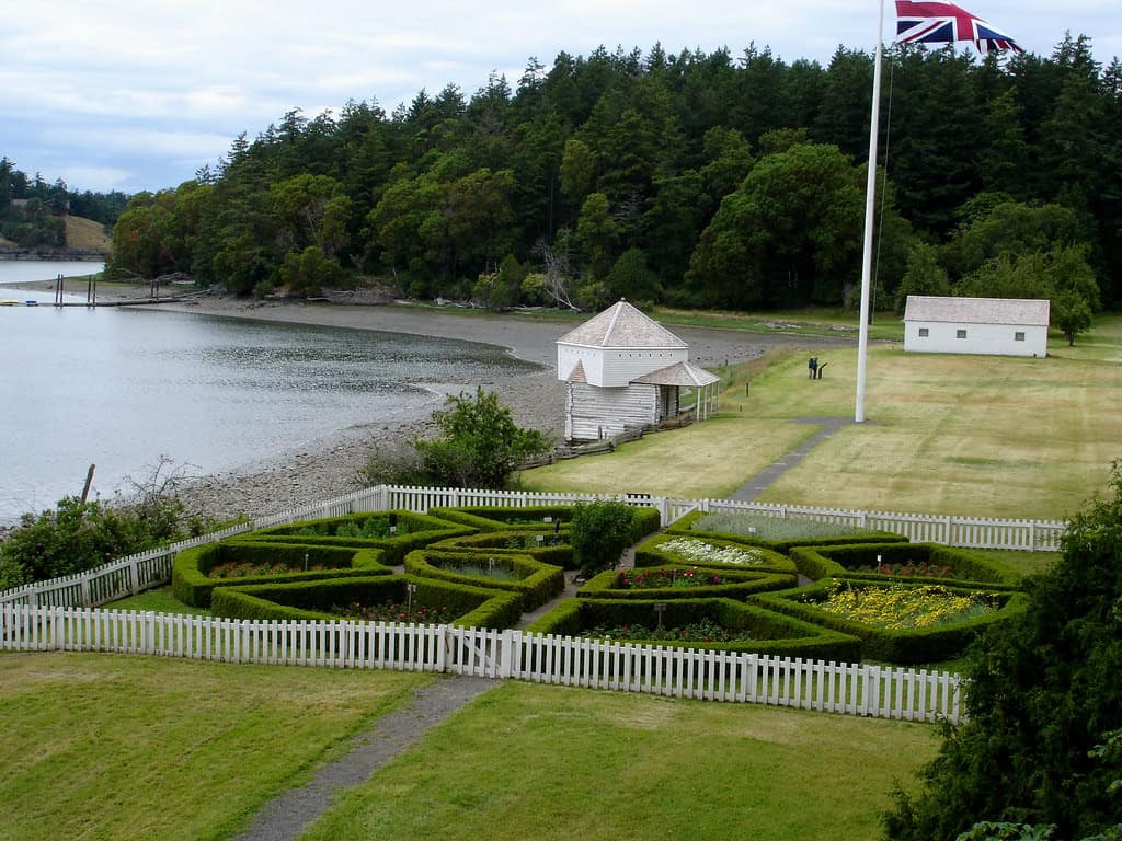
San Juan Island National Historical Park preserves the sites at the center of one of the strangest border disputes in American history. In June 1859, American settler Lyman Cutlar shot a pig owned by the British Hudson’s Bay Company after finding it rooting in his garden. The argument over the pig collided with a much larger dispute over sovereignty in the San Juan Islands, and American and British forces soon faced each other across the island. No shots were exchanged between the two militaries. The nations instead agreed to a joint occupation that lasted 12 years, and in 1872 an arbitration decision issued through Kaiser Wilhelm I of Germany settled the boundary in favor of the United States. The pig remained the crisis’s only casualty.
American Camp occupies the southeastern end of the island, while English Camp sits on Garrison Bay in the northwest. Both preserve pieces of the joint military occupation, and neither charges an entrance fee. American Camp also protects prairie and shoreline habitat, including one of the remaining native prairies in the Puget Sound and Northern Straits region. South Beach adds a long stretch of publicly accessible coastline with broad views toward the Strait of Juan de Fuca and Haro Strait.
Lime Kiln Point State Park, just outside the national historical park on the island’s west side, makes an excellent add-on. Washington State Parks calls it one of the world’s top whale-watching locations, and killer whales, humpbacks, minkes, porpoises, and other marine mammals can sometimes be seen from shore. The key word is sometimes. These are wild animals, not performers working the 2 p.m. shift. Lime Kiln is a Washington state park rather than part of the national historical park, so state parking rules and Discover Pass requirements apply.
Ebey’s Landing National Historical Reserve
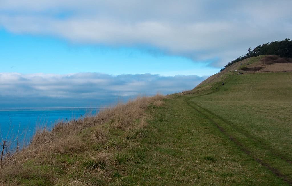
©"The Pacific Northwest Trail climbing the bluffs of Ebey's Landing on Whidbey Island" by Forest Service Pacific Northwest Region is licensed under PDM 1.0. - Original / License
Distance from Seattle: About 25 miles north to the Mukilteo ferry terminal, followed by a roughly 20-minute ferry crossing to Clinton and about 30 more miles of driving to the Coupeville area.
Ebey’s Landing is not a conventional national park, and that is exactly what makes it interesting. Congress established it in 1978 as the country’s first national historical reserve, protecting a living cultural landscape rather than fencing off a single historic site. Much of the 17,400-acre reserve remains privately owned, with working farms, historic homes, prairie, shoreline, and the town of Coupeville all sharing the landscape. The reserve also recognizes Central Whidbey Island as the homeland of the Lower Skagit people, whose connection to these prairies and shorelines predates the 19th-century settlement history preserved across the reserve.
The 3.5-mile Bluff Loop Trail is the obvious hike, combining coastal bluffs, beach, prairie, and big views across Admiralty Inlet and the surrounding Salish Sea. Historic Coupeville, one of Washington’s oldest towns, sits inside the reserve and still has buildings dating to the territorial era along with its waterfront and wharf. There is no National Park Service entrance fee for Ebey’s Landing itself, although several Washington state parks lie within the reserve and may require a Discover Pass for parking. It is an easy place to underestimate on a map and a difficult one to regret once you actually stop.
Klondike Gold Rush National Historical Park
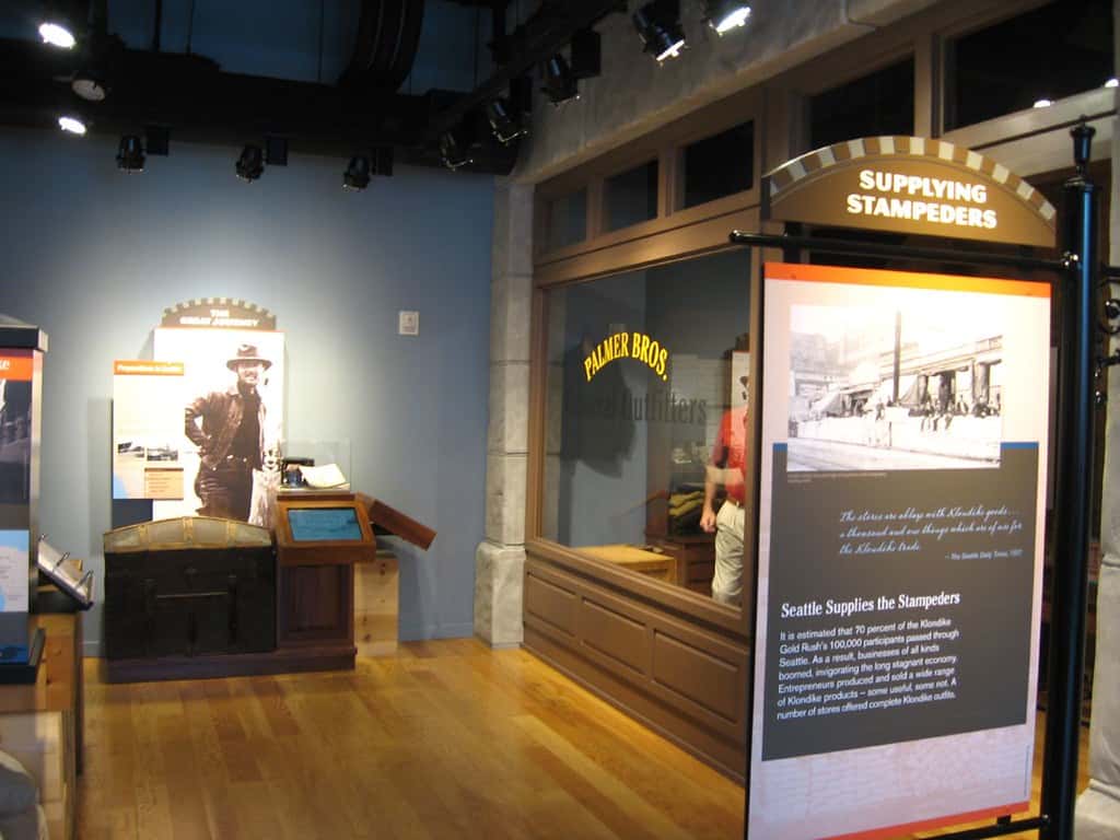
©"Klondike Gold Rush National Historical Park, Seattle, Washington" by Ken Lund is licensed under BY-SA 2.0. - Original / License
Distance from Seattle: Zero. The Seattle unit is in Pioneer Square.
This one requires no road trip at all. The Seattle unit of Klondike Gold Rush National Historical Park is housed entirely inside the historic Cadillac Hotel in Pioneer Square and is free to visit. Gold was discovered in Canada’s Klondike region in August 1896, but the rush exploded after successful prospectors returned to the West Coast the following summer. On July 17, 1897, the steamship Portland reached Seattle carrying miners and a fortune in gold, and the city quickly marketed itself as the gateway to the gold fields. Of roughly 100,000 people who set out for the Klondike, the National Park Service estimates that about 70,000 passed through Seattle to buy supplies and arrange transportation north.
The rush helped transform Seattle. The National Park Service estimates that the city’s merchants sold as much as $25 million in goods between July 1897 and March 1898, compared with roughly $325,000 in sales during all of 1896. Today the park tells that story through two floors of exhibits, films, maps, artifacts, and seasonal ranger programs. You do not need an entire day. An hour or two is enough for most visitors, which makes this one particularly easy to work into a Pioneer Square day without sacrificing the rest of Seattle.
Lewis and Clark National Historical Park
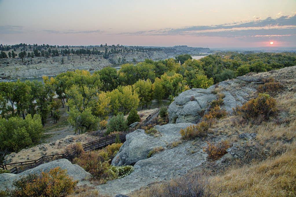
©"Lewis and Clark National Historic Trail, Montana" by mypubliclands is licensed under BY 2.0. - Original / License
Distance from Seattle: About 180 miles to the Astoria and Fort Clatsop area, roughly 3.5 hours each way before traffic and stops.
Fort Clatsop, just outside Astoria, Oregon, preserves the area where the Corps of Discovery spent the winter before beginning its return journey east. Lewis, Clark, Sacagawea, York, and the rest of the expedition occupied the fort from Dec. 7, 1805, until March 23, 1806. It was not exactly a resort stay. Sergeant Patrick Gass recorded precipitation on all but 12 of the 106 days the expedition spent there, and only six of those dry days were sunny. The reconstructed fort and surrounding exhibits help put the expedition’s final months on the Pacific Coast into much better perspective than a paragraph in a history textbook ever could.
There is plenty around Fort Clatsop to stretch the visit. The Fort to Sea Trail runs about 6.5 miles one way from the park toward Sunset Beach, while other shorter trails stay closer to the visitor center. Astoria is only a short drive away, and the Astoria Column adds one of the best elevated views around the mouth of the Columbia River. Fort Clatsop currently charges a $10 per-person entrance fee for visitors 16 and older, with children 15 and younger admitted free. From Seattle, this is technically possible as a very long day trip, but adding Astoria or the Oregon coast makes an overnight stay considerably more civilized.

