
Some places on Earth look so strange they barely seem real. From Mexico’s giant crystal cave and Brazil’s flooded white-sand dunes to glowing beaches, rainbow-colored mountains, endless salt flats, and a bridge straight out of folklore, these destinations are unlike anywhere else on the planet. Some are easy to visit, while others are remote, restricted, or downright dangerous, but all 23 are the kind of places that make you stop scrolling and ask, “Wait, that’s actually real?”
Tsingy de Bemaraha
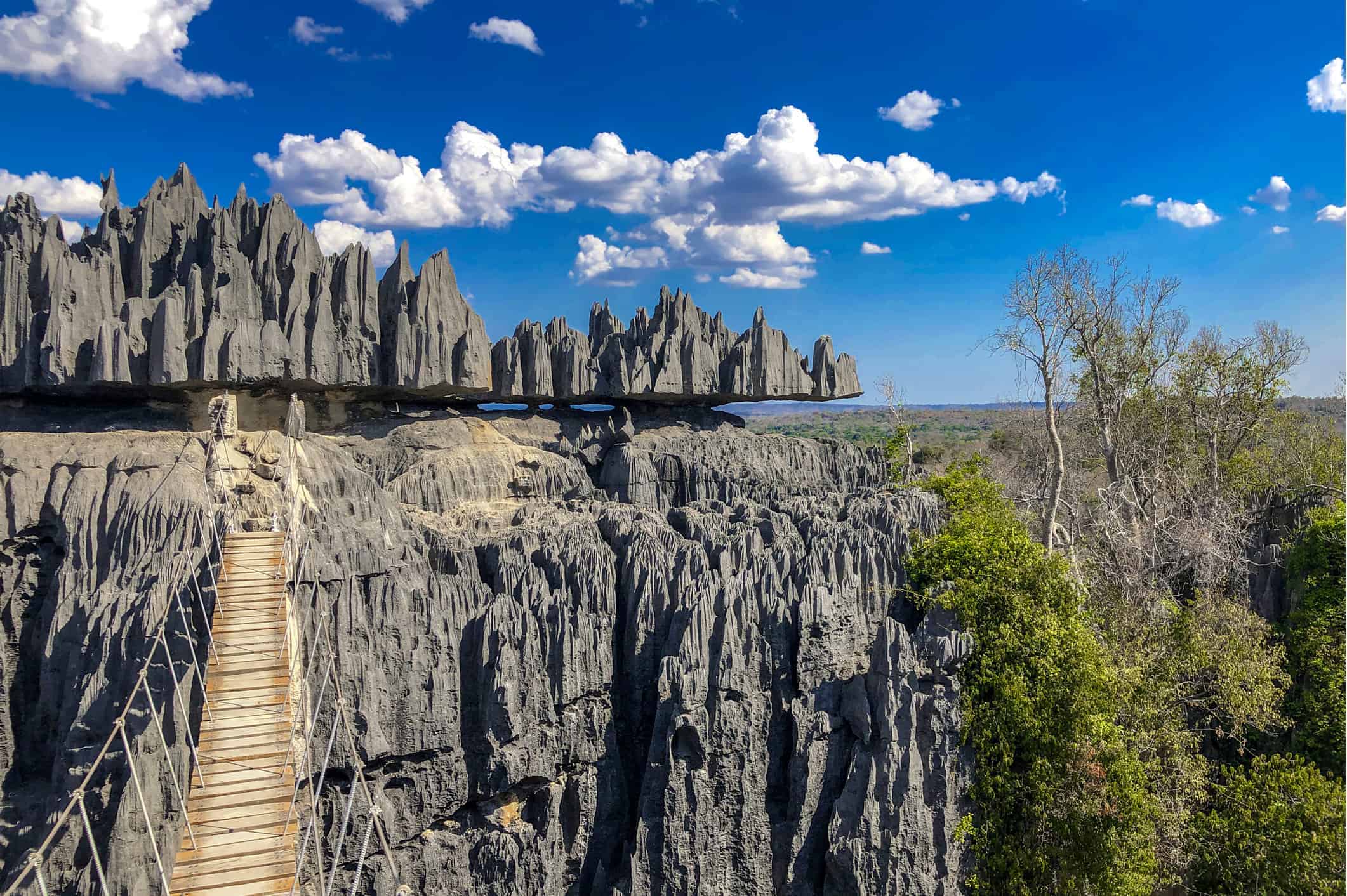
Western Madagascar’s Tsingy de Bemaraha is a vast karst landscape filled with razor-like limestone pinnacles, deep canyons, caves, and forests tucked between the rocks. Some of the limestone formations rise roughly 300 feet, creating what UNESCO describes as a spectacular “forest” of sharp stone. Parts of the protected area can be explored on established routes, but this is rugged terrain that may involve steep climbs, narrow passages, ladders, and suspension bridges. The landscape is strange from a distance and even stranger once you are standing inside it.
Chocolate Hills
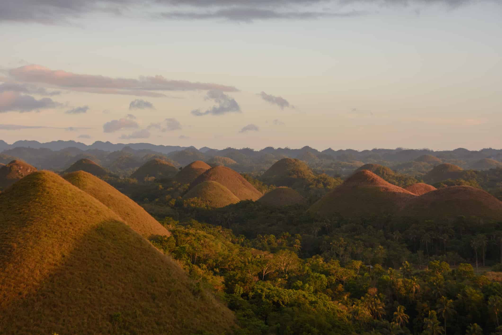
More than 1,700 remarkably similar cone-shaped hills spread across parts of Bohol in the Philippines, creating one of the country’s most recognizable landscapes. The Chocolate Hills are limestone formations shaped by long-term erosion and other karst processes. For much of the year they are covered in green grass, but during the dry season that vegetation turns brown, giving the hills their chocolate-colored appearance and their name. Several viewpoints around Bohol offer sweeping looks across what can seem like an endless field of nearly identical mounds.
Zhangye Danxia
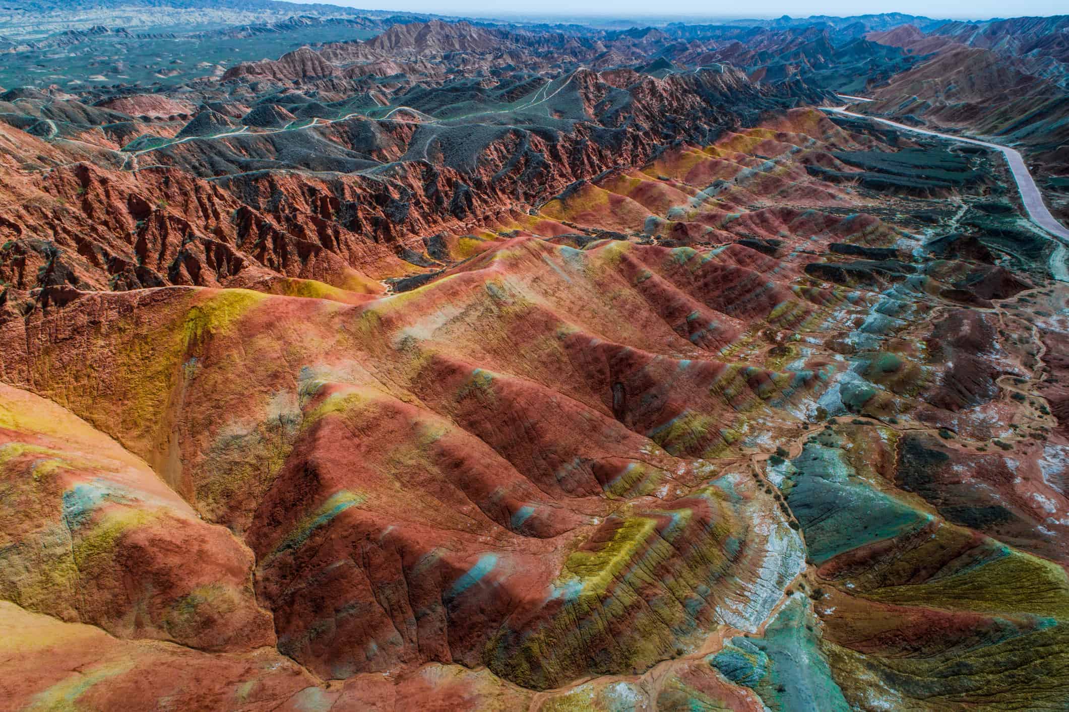
The striped mountains of Zhangye UNESCO Global Geopark in China’s Gansu Province look almost painted. Their reds, oranges, yellows, and other shades come from layers of sandstone and other sedimentary rock that were deposited over millions of years, then folded, uplifted, and exposed by erosion. The area’s famous Colorful Hills are part of a much larger geological landscape around Zhangye. Established scenic areas and viewpoints allow visitors to see the layers without scrambling across the fragile formations themselves.
Naica’s Cave of Crystals
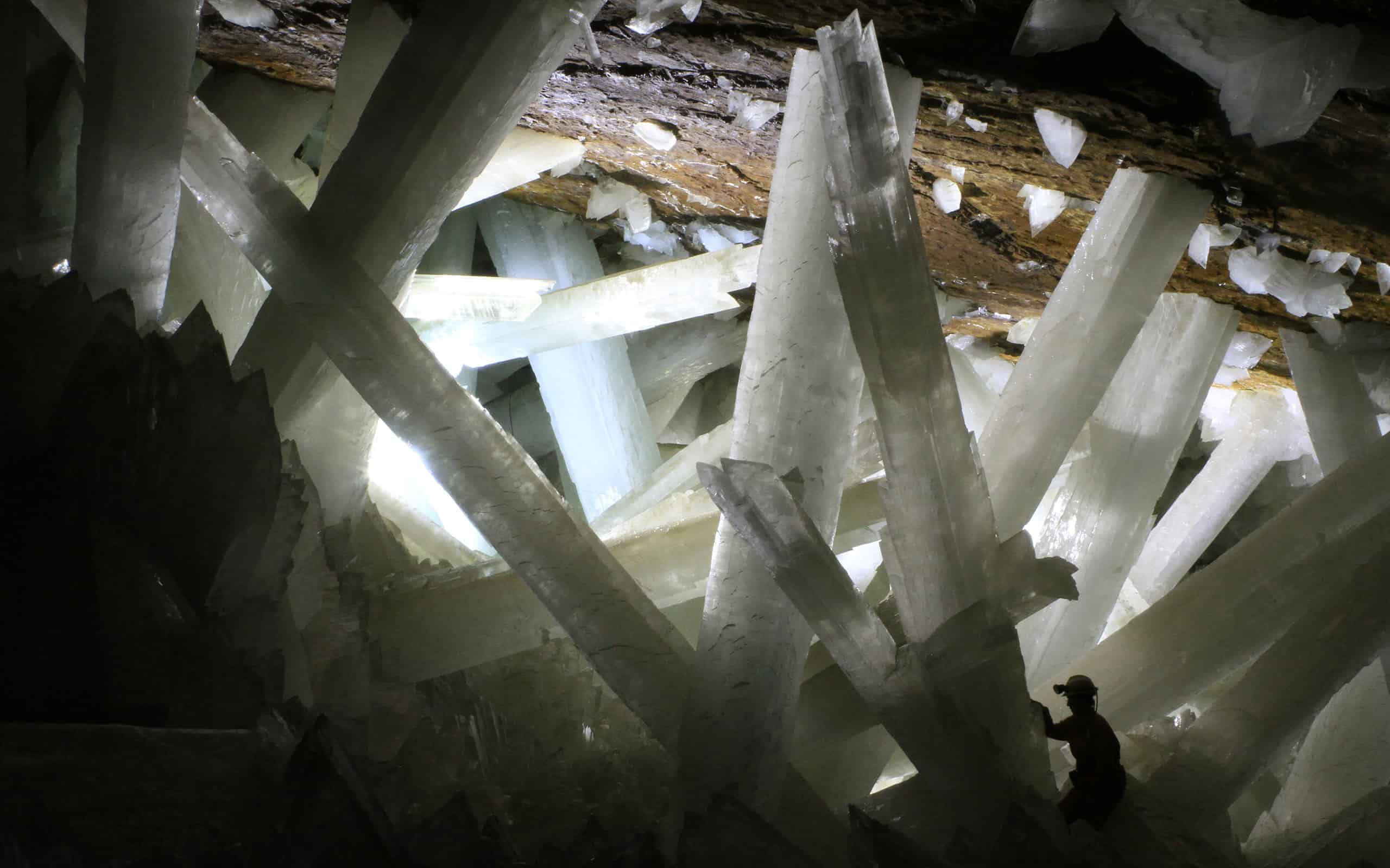
Hidden beneath Naica, Chihuahua, Mexico, the Cave of Crystals looks like a set built for a science-fiction movie. The chamber contains enormous selenite crystals, a form of gypsum, with some reaching about 36 feet long. They grew over hundreds of thousands of years in exceptionally stable underground conditions. The cave is also brutally hot, with temperatures around 118 to 126 degrees Fahrenheit and humidity close to 100 percent. This is one natural wonder travelers have to admire from a distance: the cave is not open to the public, both because of the dangerous conditions and the need to protect its fragile crystals.
Danakil Depression
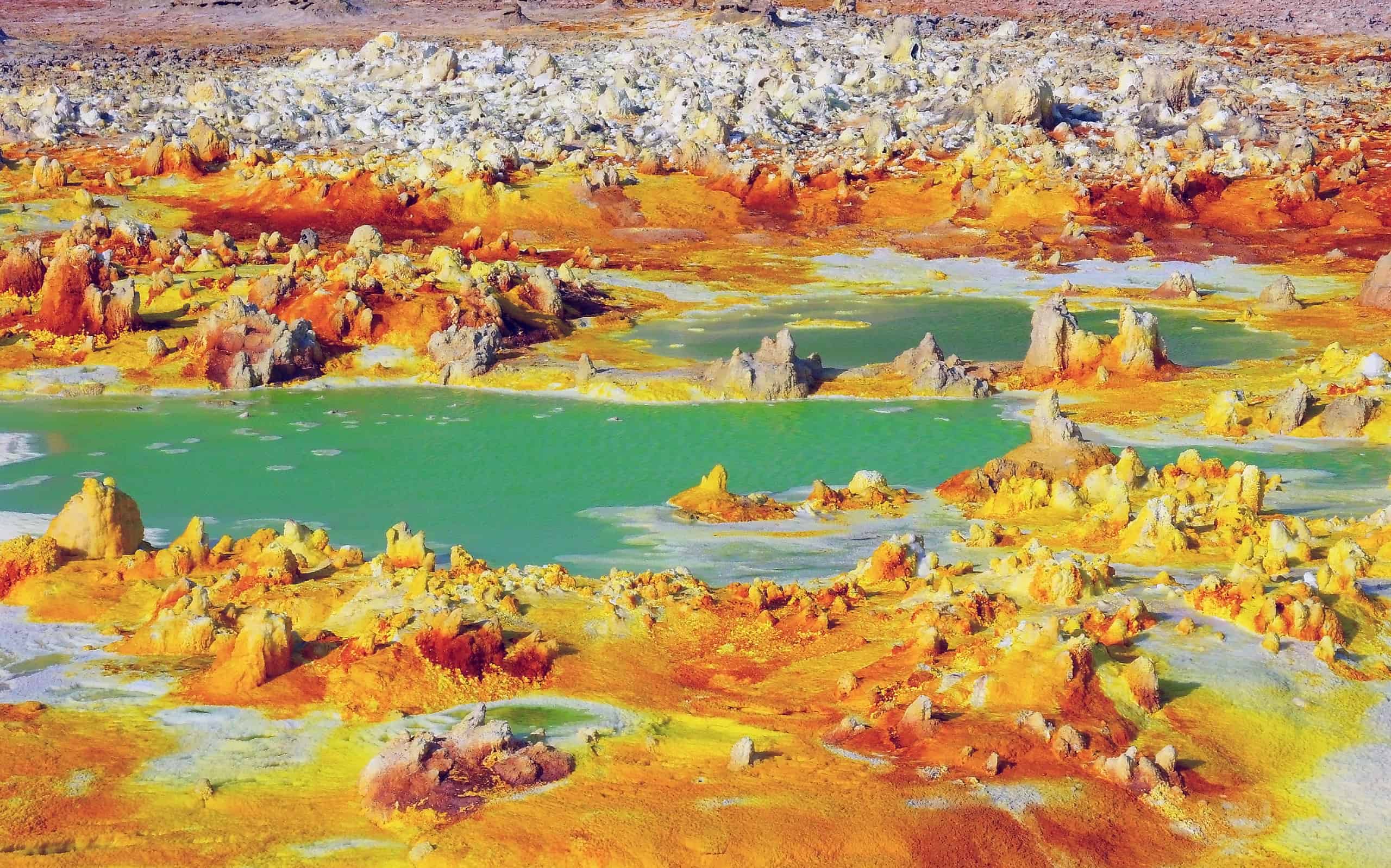
The Danakil Depression in northeastern Ethiopia sits within the Afar region, where the Arabian, Nubian, and Somali tectonic plates are pulling apart. That active geology helps produce the area’s volcanoes, hot springs, hydrothermal fields, salt flats, and surreal mineral colors. It is one of the most visually extreme landscapes on Earth, but it is also remote, intensely hot, and located in a region where security conditions can change. Travelers considering the Danakil should use experienced local operators and check current government travel guidance before making plans.
Socotra
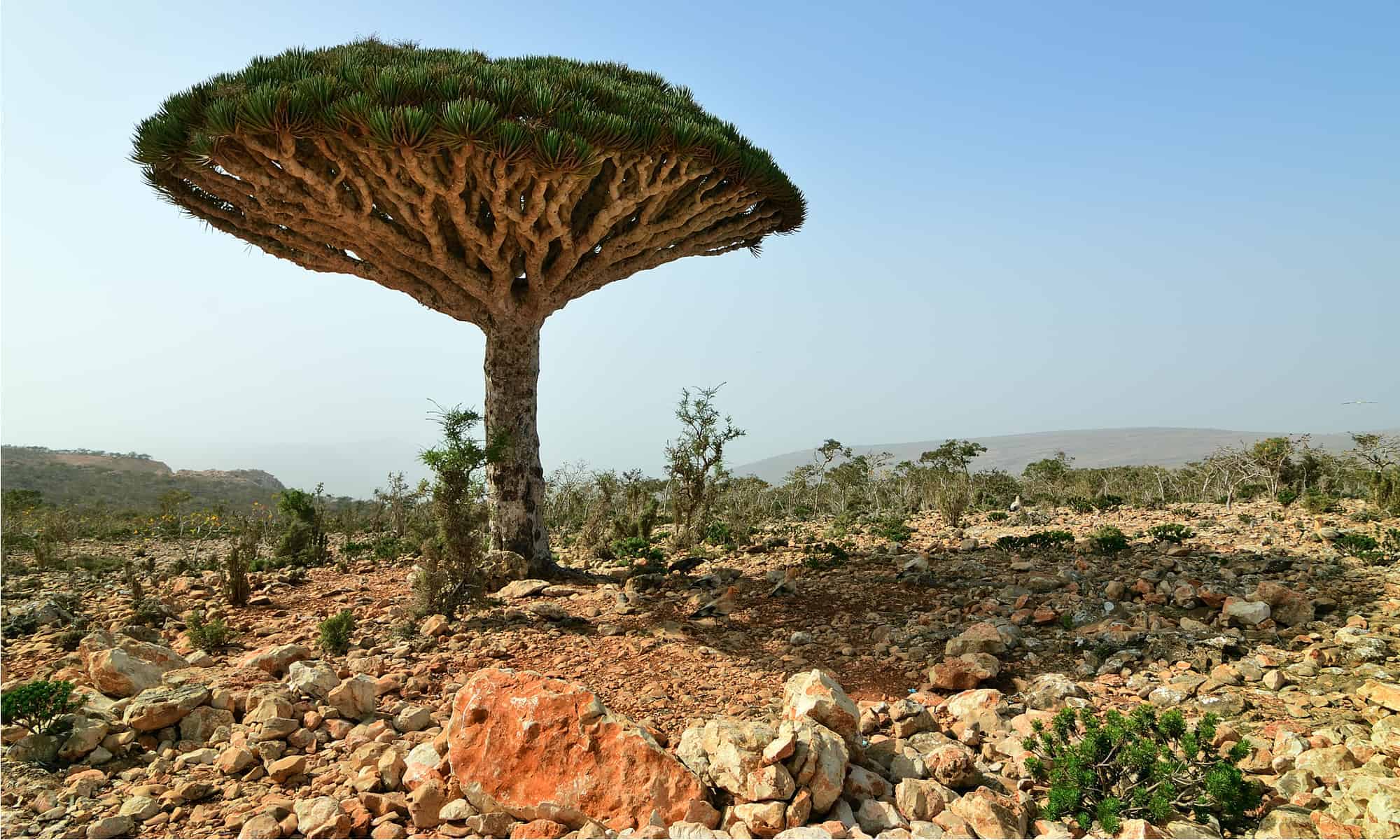
Socotra’s famously strange vegetation makes parts of the Yemeni archipelago look like another planet. According to UNESCO, 37 percent of its plant species, 90 percent of its reptile species, and 95 percent of its land snails are found nowhere else on Earth. The umbrella-shaped dragon’s blood tree is its best-known resident, but the entire archipelago is a biodiversity standout. That does not make it a straightforward vacation destination. As of 2026, the U.S. State Department advises Americans not to travel anywhere in Yemen and specifically includes Socotra in that warning.
Catatumbo Lightning
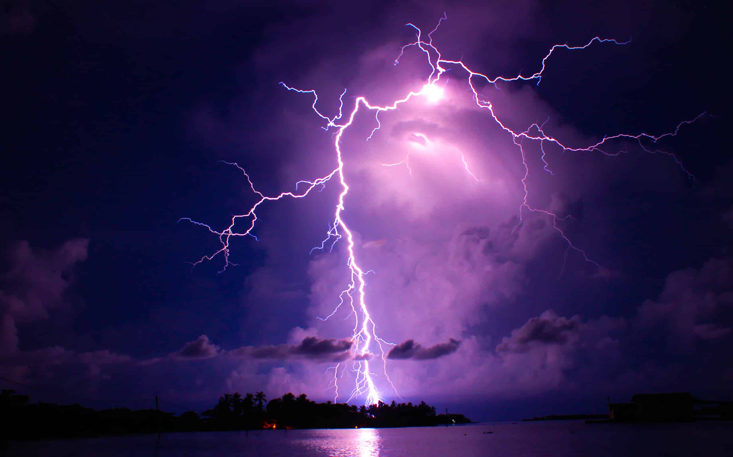
Near the mouth of Venezuela’s Catatumbo River, where it meets Lake Maracaibo, thunderstorms occur with extraordinary frequency. NASA research has identified the Lake Maracaibo region as one of the world’s great lightning hotspots, with storms occurring on roughly 160 nights a year in some estimates. During active periods, lightning can flash dozens of times per minute and storms may continue for hours. The spectacle is known as Catatumbo lightning, and unlike a one-off freak storm, it is a recurring weather phenomenon shaped by the region’s geography and atmospheric conditions.
Spotted Lake
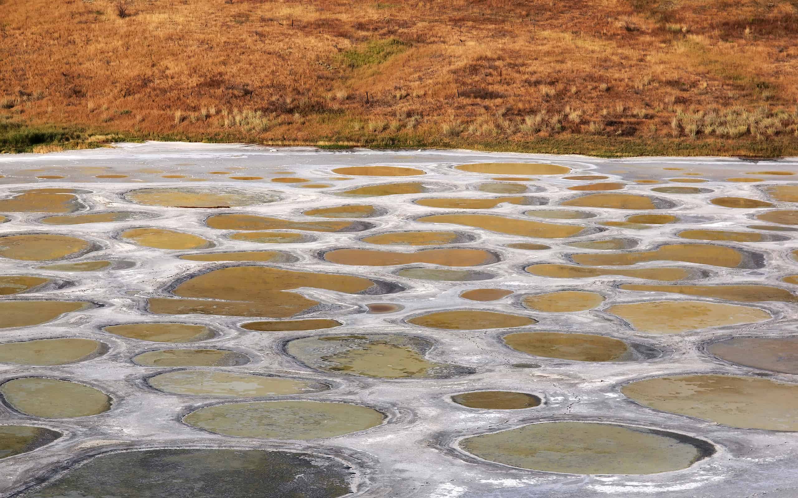
Spotted Lake, known as kłlilx’w by the Syilx Okanagan people, lies west of Osoyoos in British Columbia. The mineral-rich lake changes dramatically as summer heat evaporates much of its water, leaving separate pools that can appear blue, green, yellow, and other colors depending on their mineral concentrations. The lake also has deep cultural and spiritual importance to the Syilx Okanagan Nation. Visitors should view it from the roadside observation area rather than entering the protected site itself.
Deadvlei
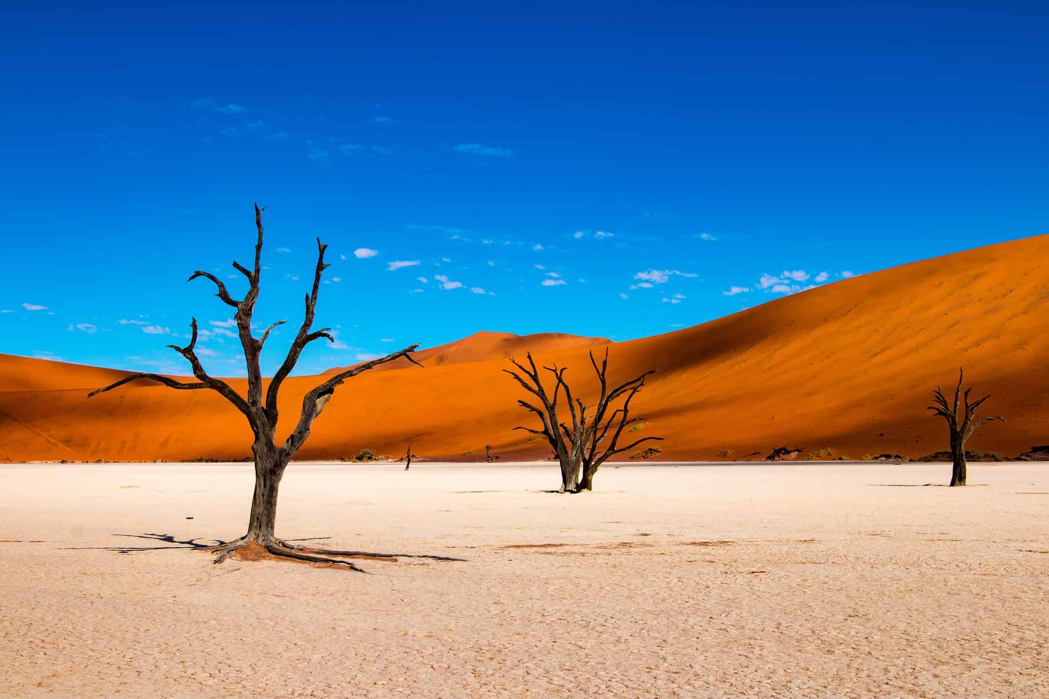
Deadvlei is one of the most photographed landscapes in Namibia, and it is easy to see why. The white clay pan sits among the towering red dunes of the Namib near Sossusvlei, while the dark remains of camel thorn trees rise from the ground like sculptures. Water once reached the area and supported the trees, but shifting dunes eventually cut the pan off from regular flooding. The dead trunks have survived for centuries in the extremely dry climate. Visitors can reach Deadvlei on foot from the nearby access area, making this strange-looking landscape one of the more accessible wonders on this list.
Big Thicket
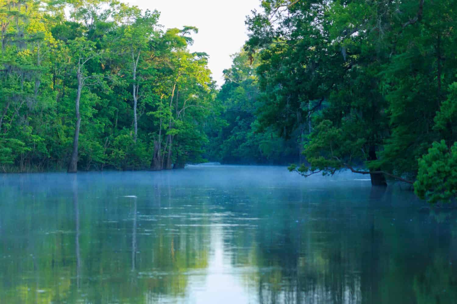
Big Thicket National Preserve in southeast Texas is sometimes described as jungle-like, but it is not technically a tropical rainforest. Its real claim to fame is arguably more interesting. Several different ecosystems converge here, including pine forests, hardwood forests, cypress swamps, wetlands, and bayous, creating remarkable biodiversity in a relatively compact area. Bigfoot stories have become part of the region’s folklore, but the verified attractions are plenty unusual on their own. Visitors can hike, paddle, camp, birdwatch, and explore a landscape that can look completely different from one trail to the next.
Giant’s Causeway
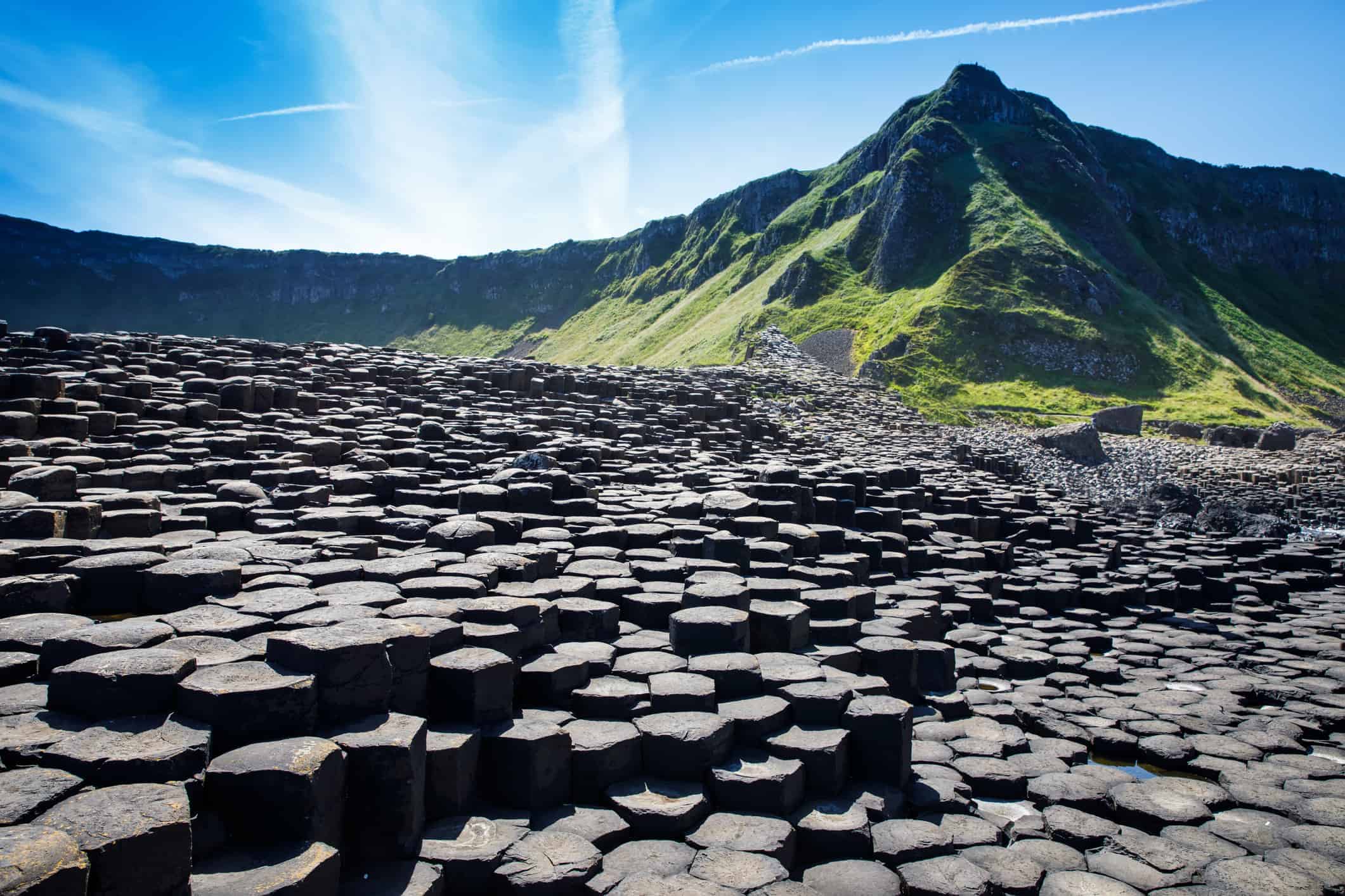
It looks almost too orderly to be natural, but Northern Ireland’s Giant’s Causeway was built by geology, not people. Roughly 40,000 basalt columns line this stretch of County Antrim coast, many of them forming remarkably neat hexagonal shapes. They developed as lava from volcanic activity cooled and contracted around 50 to 60 million years ago. Today, the UNESCO World Heritage Site is one of Northern Ireland’s signature attractions, with coastal trails and viewpoints that let visitors see the formations up close.
Christ of the Abyss
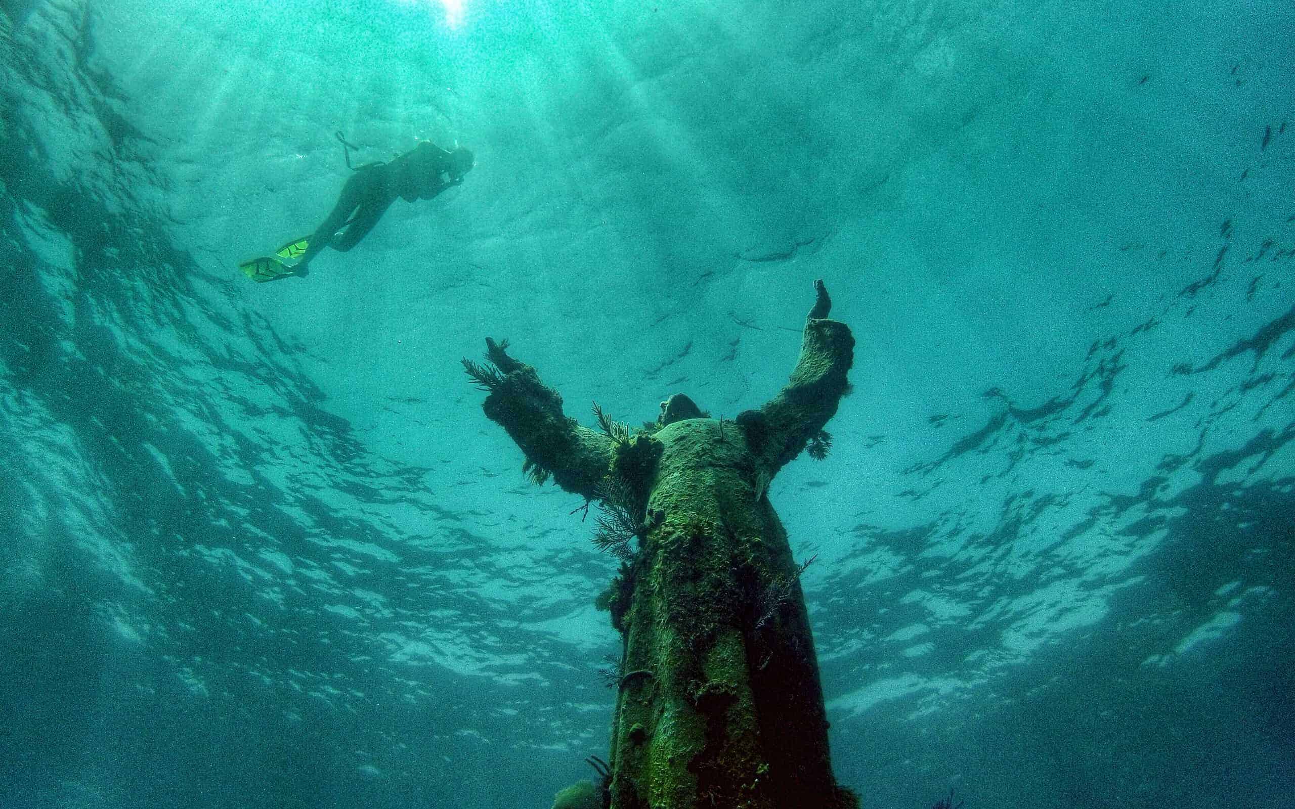
Off Key Largo, Florida, divers and snorkelers can encounter a nine-foot bronze statue of Christ standing beneath the Atlantic. The Florida statue, commonly called Christ of the Abyss or Christ of the Deep, was placed at Key Largo Dry Rocks in 1965 and sits in less than 25 feet of water. That shallow location has helped make it a popular stop for both scuba divers and snorkelers. It is a replica cast from the same mold as the original Il Cristo degli Abissi installed off the Italian coast near San Fruttuoso in 1954.
Magnetic Hill, New Brunswick
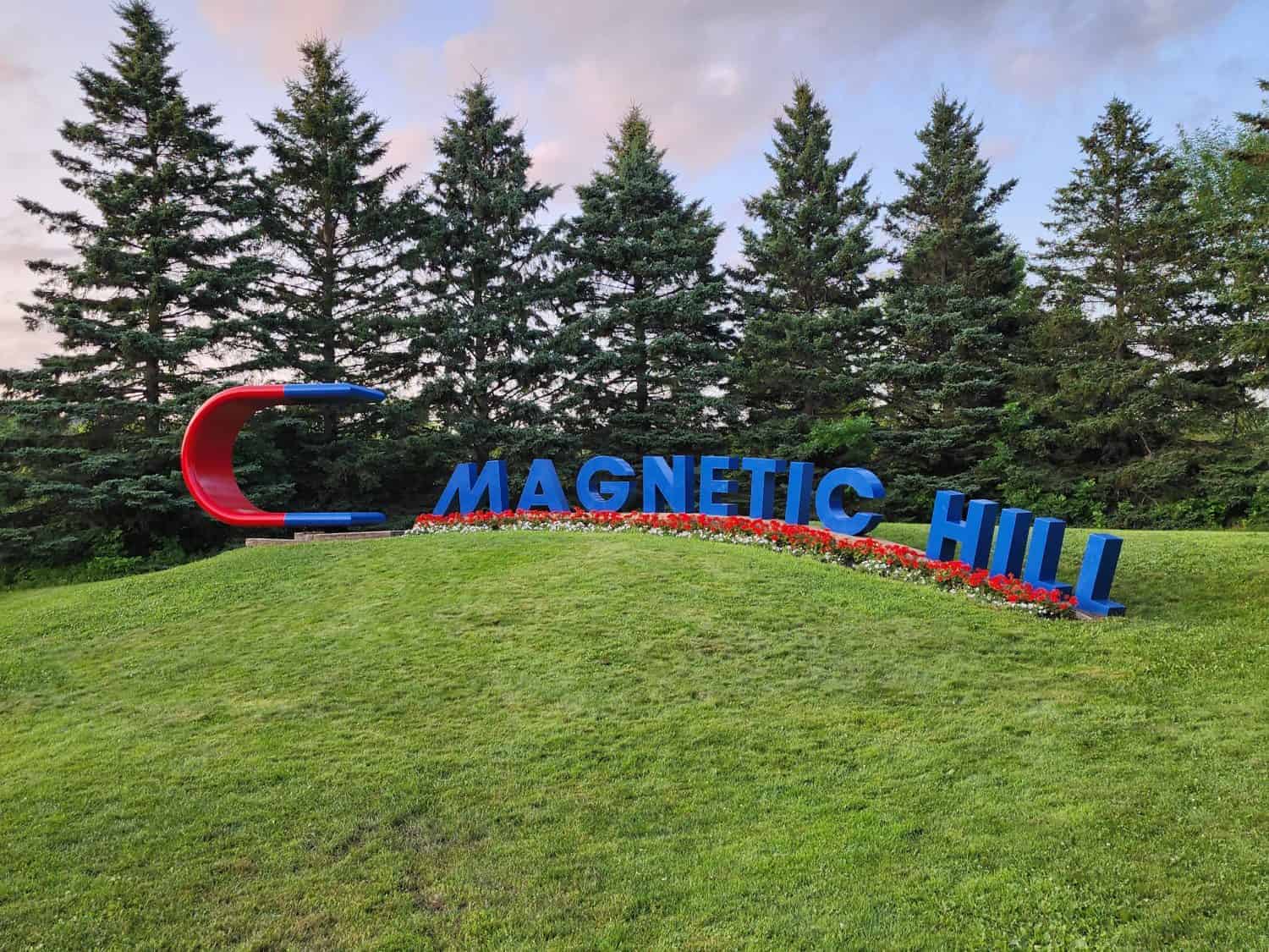
Magnetic Hill in Moncton, New Brunswick, is a classic “gravity hill” where the surrounding landscape fools your eyes. Drivers position their vehicles at the designated spot, put them in neutral, and appear to roll uphill. Gravity has not taken the day off. The road actually slopes downward, but the obscured horizon and surrounding terrain make the descent look like an ascent. The roadside illusion has been drawing curious travelers for generations and remains one of Moncton’s best-known attractions.
Goblin Valley State Park
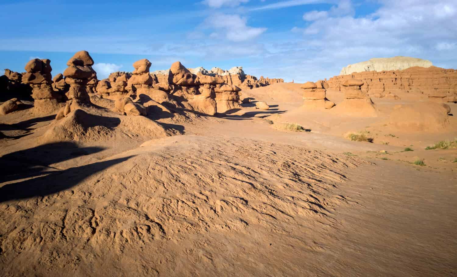
Utah’s Goblin Valley State Park is packed with thousands of strangely shaped sandstone hoodoos that locals dubbed “goblins.” The rock originated in sediments deposited around 170 million years ago, when the region included tidal flats near an ancient sea. Wind, water, and time gradually sculpted the softer sandstone into the formations visitors see today. The park’s remote location also makes darkness one of its attractions. Goblin Valley was designated an International Dark Sky Park in 2016, making the landscape nearly as impressive after sunset as it is during the day.
Lençóis Maranhenses National Park
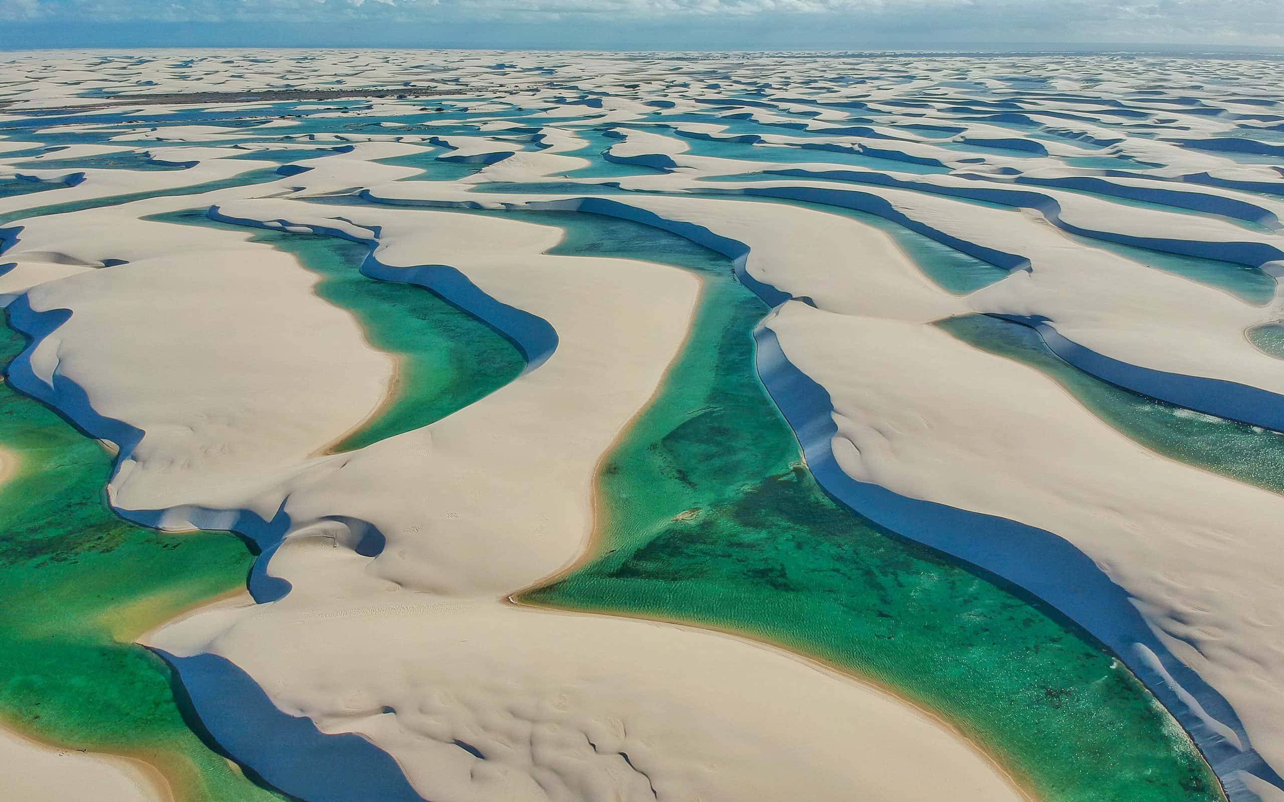
At first glance, Lençóis Maranhenses National Park in northeastern Brazil looks like an enormous white-sand desert. Then the rainy season arrives and thousands of blue and green lagoons appear between the dunes. The UNESCO World Heritage Site covers roughly 387,000 acres, but despite its desert-like appearance, it receives enough seasonal rainfall to raise the water table and fill depressions between the dunes with freshwater. The lagoons are most dramatic after the rains. Access to the dune field is regulated, and visitors generally explore with authorized local transportation and guides rather than driving private vehicles into the park.
The Great Rann of Kutch
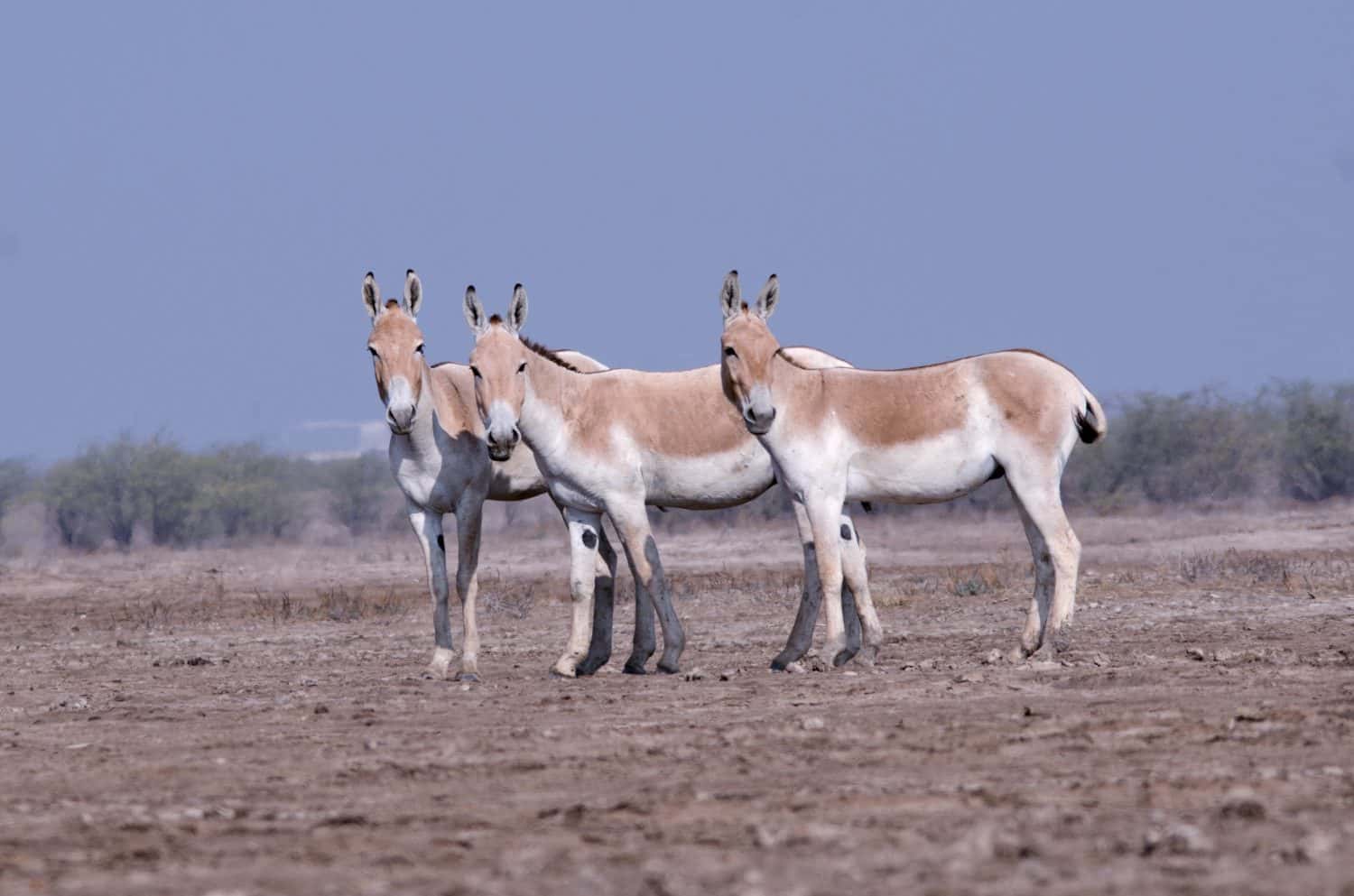
The Great Rann of Kutch in Gujarat, India, is an enormous seasonal salt marsh that turns into a stark white expanse during the dry months and floods during the monsoon. The region was once connected to the Arabian Sea before geological and hydrological changes transformed the landscape. It is easy to confuse the Great and Little Rann of Kutch, but they are distinct areas. Roughly 200 kilometers to the east, the Little Rann contains the Indian Wild Donkey Sanctuary, a protected landscape covering about 4,953 square kilometers and one of the last strongholds of the Indian wild ass.
North Sentinel Island
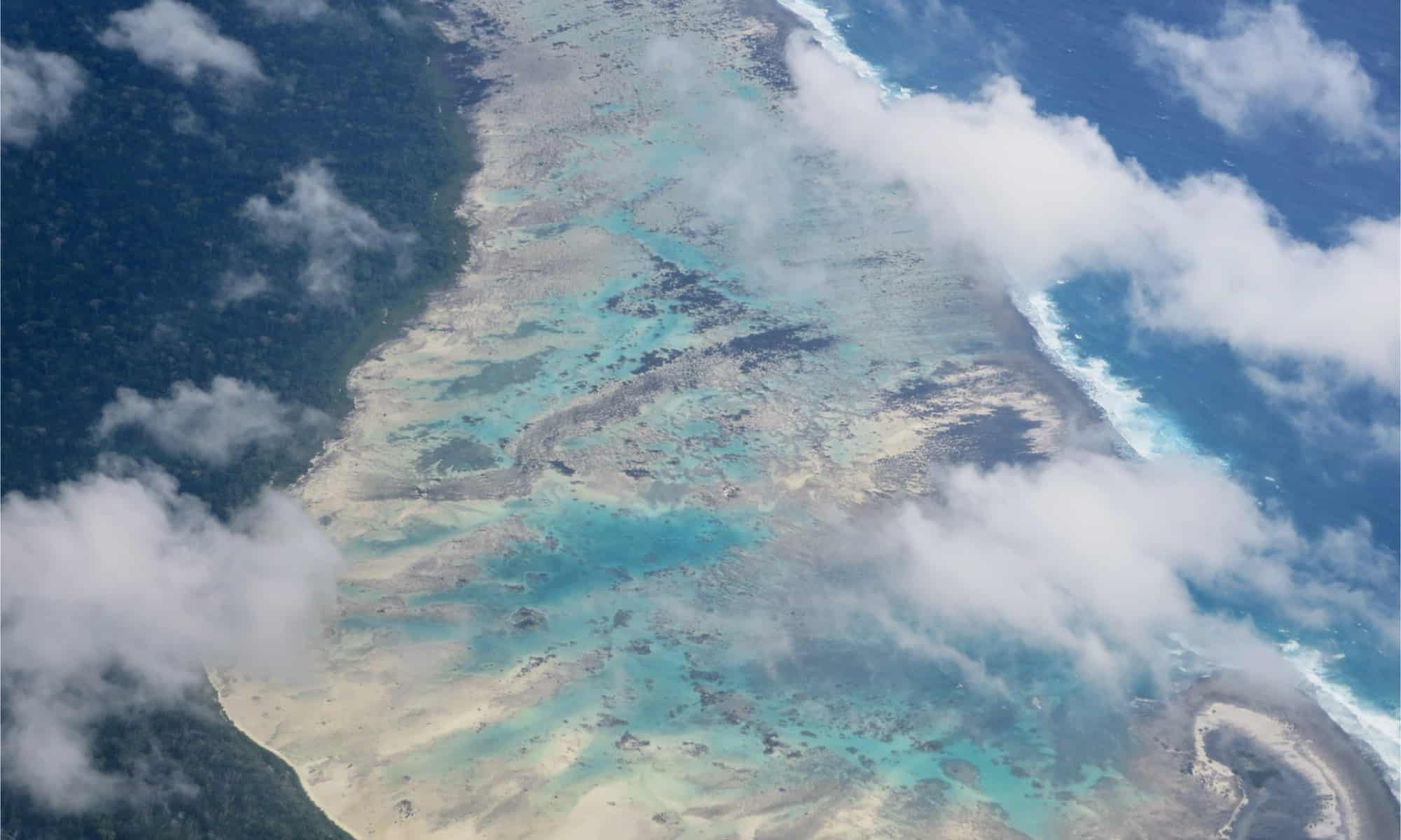
North Sentinel Island in India’s Andaman and Nicobar Islands is home to the Sentinelese, an Indigenous people who have chosen to remain largely isolated from the outside world. This is not a destination travelers should attempt to visit. Indian law prohibits outsiders from entering the island and the surrounding protected waters, both to respect the Sentinelese people’s autonomy and to reduce the danger that outside contact could introduce diseases to which they may have little immunity. The island is one of the world’s most isolated inhabited places, but it should remain something travelers learn about rather than put on an itinerary.
The Paris Catacombs
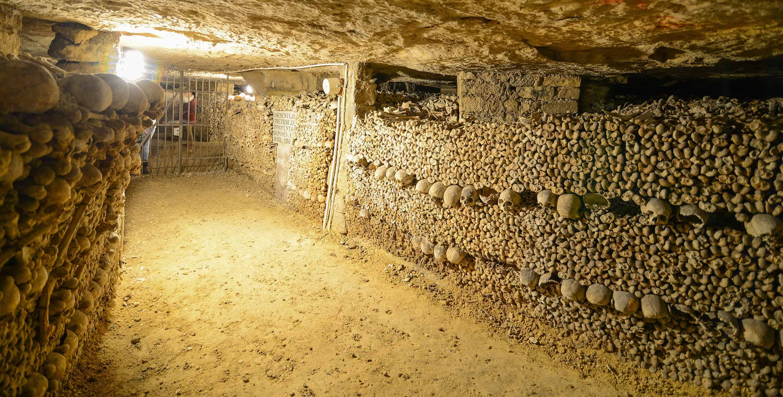
About 65 feet beneath the streets of Paris, the official Catacombs route passes through an ossuary containing the remains of several million Parisians. The bones were transferred underground beginning in the late 18th century as overflowing and unsanitary cemeteries created serious problems in the city. Paris has a much larger network of former quarry tunnels, but visitors to the Catacombs follow a managed public route rather than wandering through that labyrinth on their own. It is macabre, historic, and considerably more organized than the legends about getting permanently lost beneath Paris might suggest.
Manpupuner Rock Formations
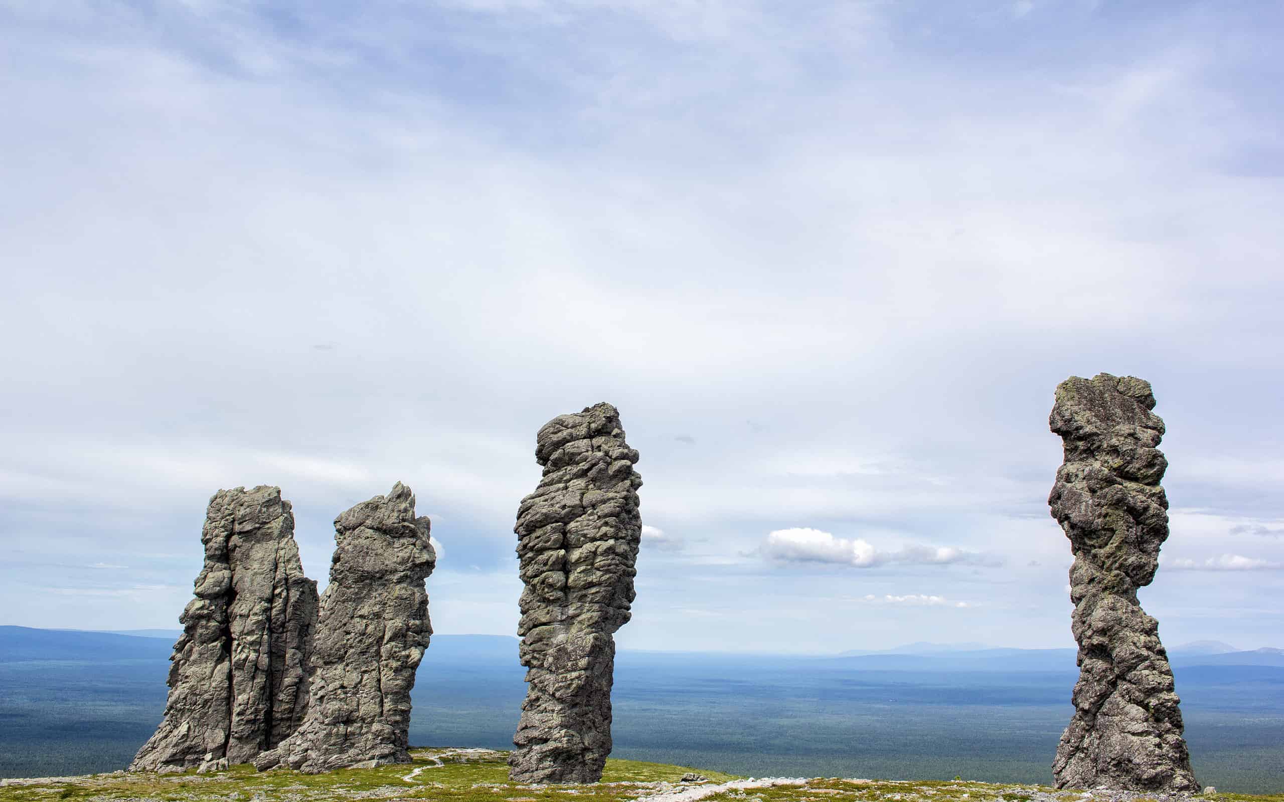
Seven enormous weathered stone pillars rise almost by themselves from the Manpupuner Plateau in Russia’s Komi Republic. Sometimes called the Seven Strong Men, the formations are remnants of rock that resisted erosion while the surrounding material gradually wore away. Their remote location within the northern Ural region makes reaching them a serious undertaking rather than a casual roadside stop. There is also a more immediate travel consideration in 2026: the U.S. State Department currently advises Americans not to travel to Russia.
Isla Madre de Dios
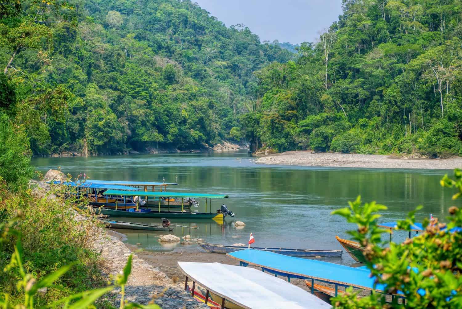
Chile’s Isla Madre de Dios lies in the remote channels of southern Patagonia, roughly 150 kilometers west of Puerto Natales. The island and surrounding archipelago are known for dramatic limestone karst, caves, archaeological sites, and exceptionally wet, windswept conditions. Annual rainfall can exceed 20 feet in parts of the region, while winds can become severe enough to complicate marine travel. Reaching the area generally requires a long boat journey, and much of the island is better suited to scientific expeditions and carefully organized visits than a conventional sightseeing trip.
Plain of Jars
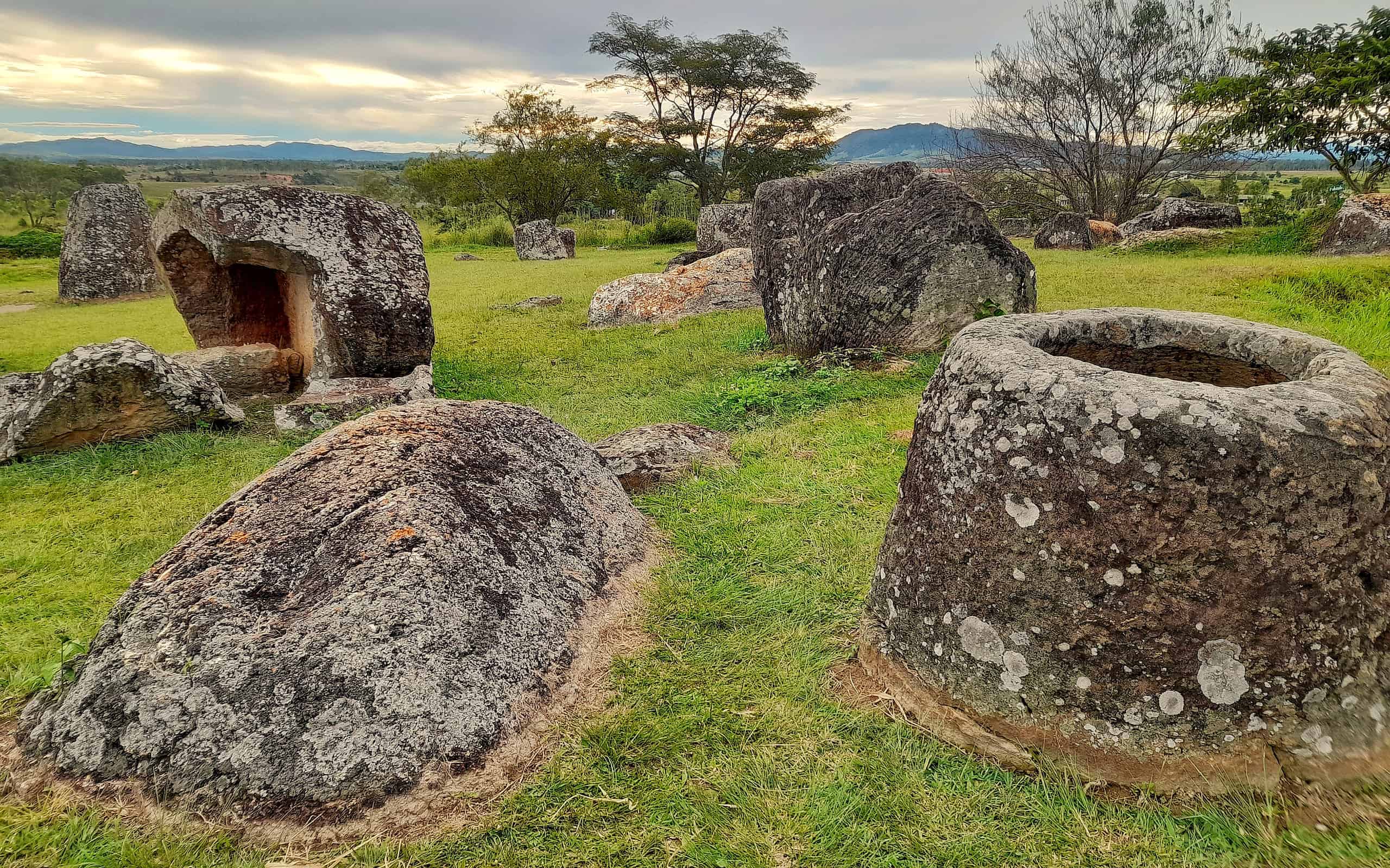
More than 2,100 enormous stone jars are scattered across archaeological sites in central Laos, some dating from roughly 500 B.C. to A.D. 500. Researchers generally connect the jars and surrounding archaeological features to Iron Age funerary practices, although many details about the people who created them remain unknown. The UNESCO World Heritage components have been cleared of unexploded ordnance, but unexploded bombs remain a real danger elsewhere in Xieng Khouang Province. Visitors should stay on marked roads and paths and never touch unfamiliar metal objects.
Jervis Bay
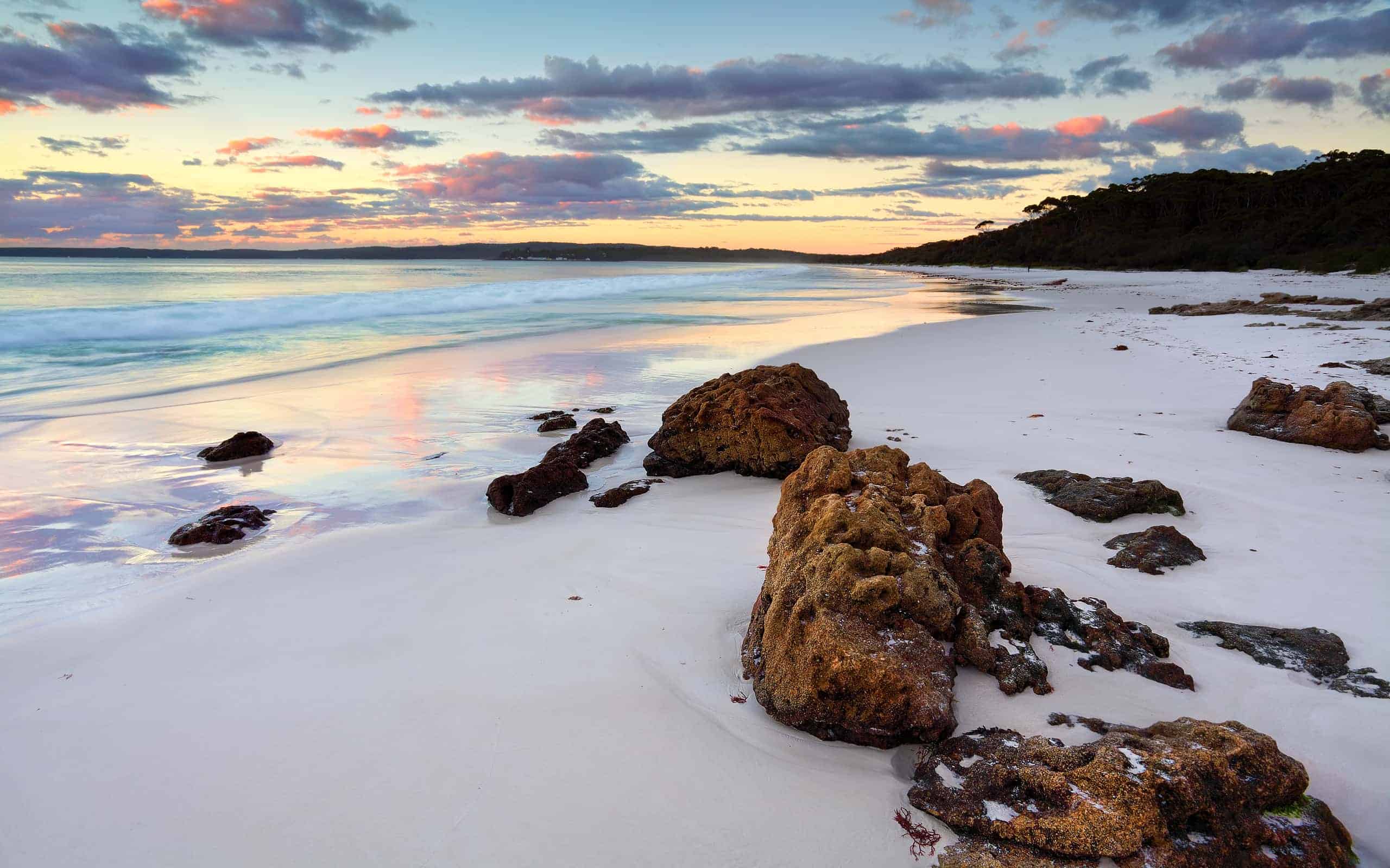
Jervis Bay on the coast of New South Wales, Australia, is famous for clear water and bright white beaches, but occasionally the show continues after sunset. Under the right conditions, microscopic marine organisms can create bioluminescent blooms that make breaking waves and disturbed water glow blue at night. Jervis Bay is not one of only a handful of places where this occurs, and there is no guaranteed bioluminescence season. Blooms are natural and unpredictable, so travelers should treat a glowing shoreline as a lucky bonus rather than something they can schedule a trip around.
Rakotzbrücke

Rakotzbrücke is a 19th-century stone bridge in Kromlau, Germany, famous for its steep semicircular arch and the reflection it can create in the water below. Built in the 1860s as part of the landscaped park, it belongs to a European tradition of dramatically engineered bridges nicknamed “Devil’s Bridges.” Folklore often credited the devil with structures that seemed too difficult for ordinary people to build, but Rakotzbrücke was very much a human creation. The historic bridge underwent a major restoration and reopened in 2021, although visitors admire it from the surrounding park rather than crossing it.

