
The Oregon Trail remains one of the most famous routes in American history, stretching roughly 2,000 miles from Missouri toward the valleys and settlements of the Pacific Northwest. From the 1830s through the late 1860s, hundreds of thousands of pioneers followed this difficult path west in search of land, opportunity, religious freedom, and a new start.
Today, the trail is more than a chapter in a history book. Many of its most memorable landmarks can still be visited, from rugged river crossings and dramatic rock formations to historic forts, wagon ruts, and scenic overlooks that help tell the story of westward migration. The route passed through what are now Missouri, Kansas, Nebraska, Wyoming, Idaho, and Oregon, with some of the most striking stops found as the trail neared the Pacific Northwest.
For travelers, these places offer a mix of history, scenery, and perspective. Whether you are planning a road trip, exploring Oregon history, or looking for meaningful stops across the Northwest, these must-see Oregon Trail landmarks reveal the beauty, hardship, and lasting legacy of one of America’s most important historic routes.
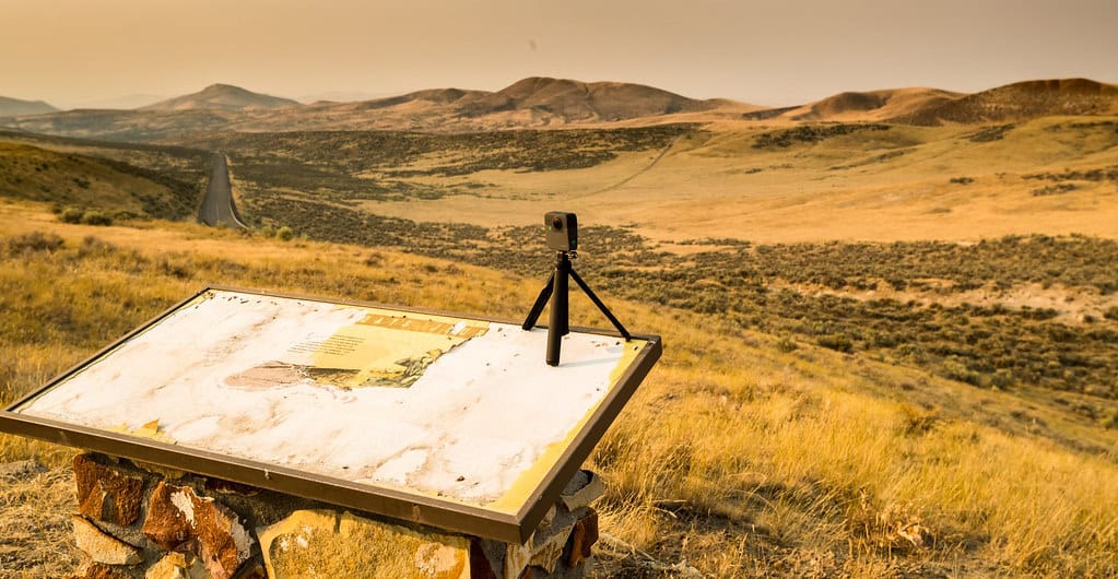
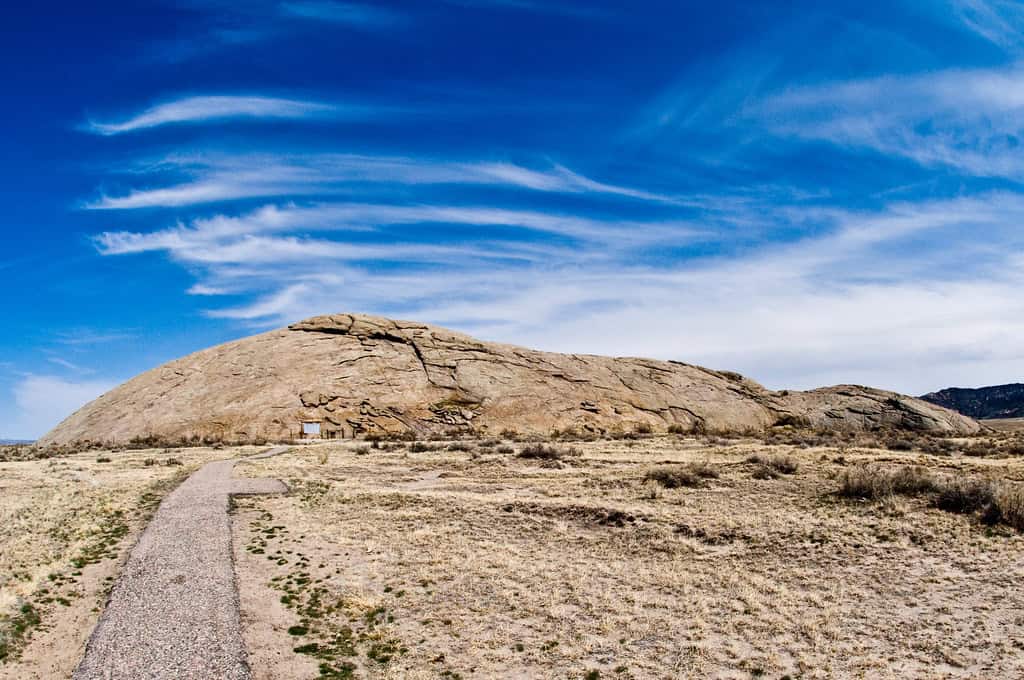
Independence Rock
©"Independence Rock - Wyoming" by hyku is licensed under BY-SA 2.0. - Original / License
This massive granite outcropping in Wyoming was a crucial milestone for pioneers heading west. Often called the “Register of the Desert,” travelers carved their names into the rock, many of which are still visible today. The site is now preserved as a state historic site with hiking trails and interpretive signs.
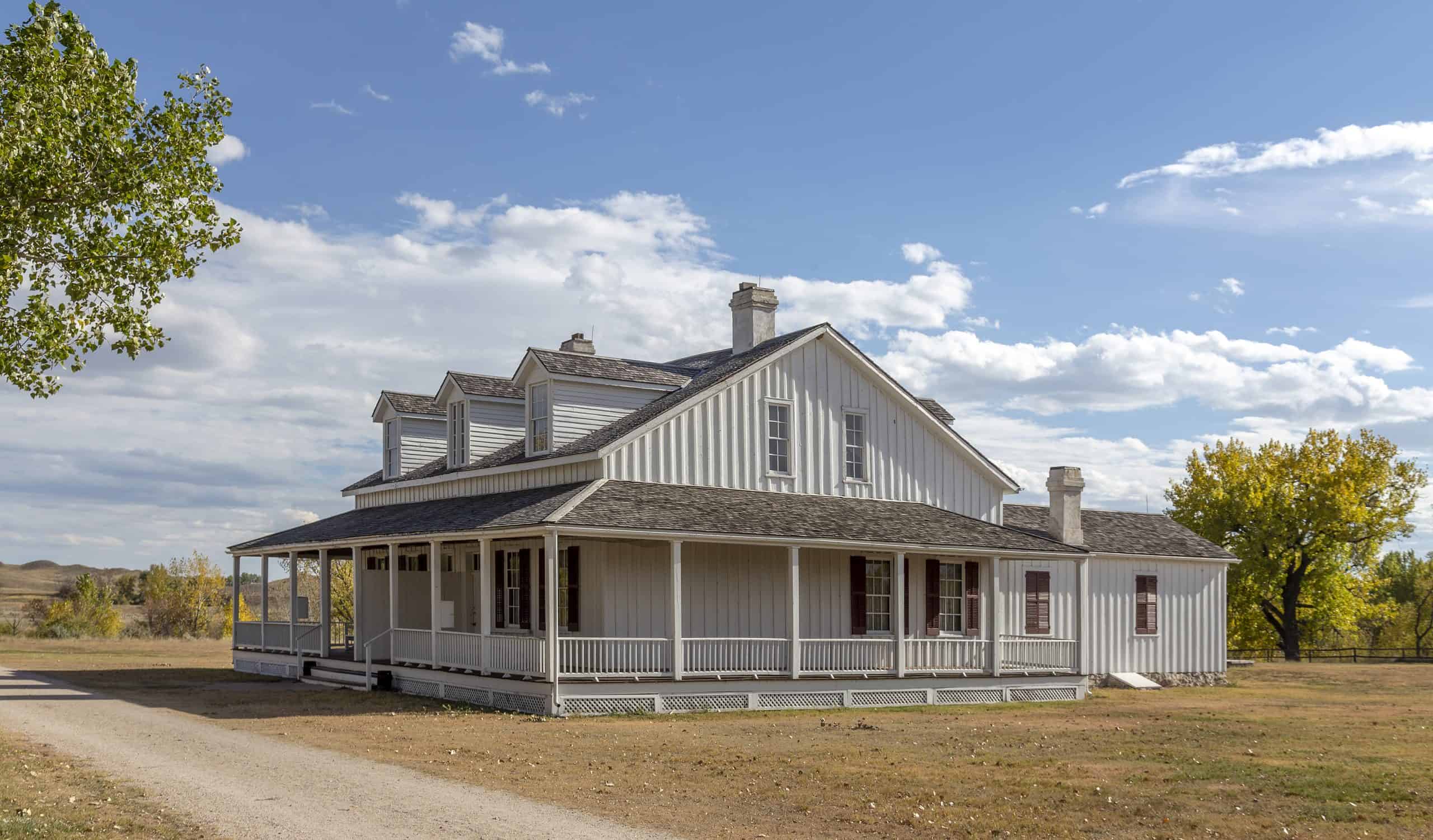
Fort Laramie National Historic Site
©"Fort Laramie NHS WY3" by Acroterion is licensed under BY-SA 4.0. - Original / License
Located in present-day Wyoming, Fort Laramie began as a private fur trading post and became a major resupply point for pioneers on the Oregon Trail. The fort was a cultural crossroads, bringing together Native Americans, trappers, and settlers. Visitors today can explore restored buildings and learn about 19th-century military and civilian life.
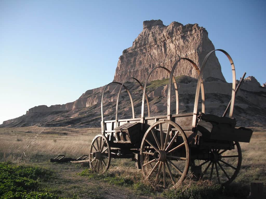
Scotts Bluff National Monument
©"Scott's Bluff, Nebraska" by MT_Image is licensed under BY 2.0. - Original / License
This striking geological formation in western Nebraska served as a key landmark for travelers on the Oregon, California, and Mormon Trails. Rising 800 feet above the North Platte River, the bluffs were both a navigational aid and a symbolic gateway to the West. The monument includes preserved wagon ruts and a scenic drive to the summit.
Three Island Crossing State Park
©"Snake River Area of Critical Environmental Concern, Idaho" by mypubliclands is licensed under BY 2.0. - Original / License
Located along the Snake River in Idaho, this site marks where pioneers had to make a critical decision: to ford the river or take a longer but safer route. The crossing was one of the most dangerous points on the trail, and many lost livestock or lives in the swift currents. Today, the state park offers river access, replica wagons, and an excellent interpretive center.
Baker City and the National Historic Oregon Trail Interpretive Center
©"Baker County Tourism – basecampbaker.com 7624" by TravelBakerCounty is licensed under BY-ND 2.0. - Original / License
Nestled in Oregon’s Blue Mountains, Baker City offers one of the best museums dedicated to the Oregon Trail experience. The Interpretive Center features panoramic views, life-size dioramas, and extensive historical exhibits. It sits near actual trail ruts and brings the emigrant story to life in vivid detail. The city itself retains 19th-century charm and is a great base for trail exploration.
Flagstaff Hill
©"Baker County Tourism – www.travelbakercounty.com 63232" by TravelBakerCounty is licensed under BY-ND 2.0. - Original / License
Just east of Baker City, Flagstaff Hill provides commanding views over the Powder River Valley, the same view that greeted pioneers after a grueling journey through the mountains. The area includes preserved trail ruts and is integrated into the interpretive center’s educational programming. This elevated point was often a place of rest and reflection for weary travelers.
The Blue Mountains Crossing
©"Storm on Blue Mountains, Oregon" by Bonnie Moreland (free images) is licensed under PDM 1.0. - Original / License
Crossing the Blue Mountains was among the most difficult segments of the Oregon Trail due to steep, forested slopes and unpredictable weather. Pioneers frequently had to unload wagons and navigate treacherous switchbacks. Today, parts of the original trail remain visible in forest clearings and are marked with signage.
Farewell Bend State Recreation Area
©"Farewell Bend, Oregon" by Sam Beebe, Ecotrust is licensed under BY 2.0. - Original / License
Located along the Snake River near the Idaho-Oregon border, Farewell Bend was the last point at which the Oregon Trail followed the Snake River. The name reflects the emotional departure pioneers made from the waterway that had guided them for hundreds of miles. The park offers camping, historical markers, and river access, making it a scenic and significant stop.
Whitman Mission National Historic Site
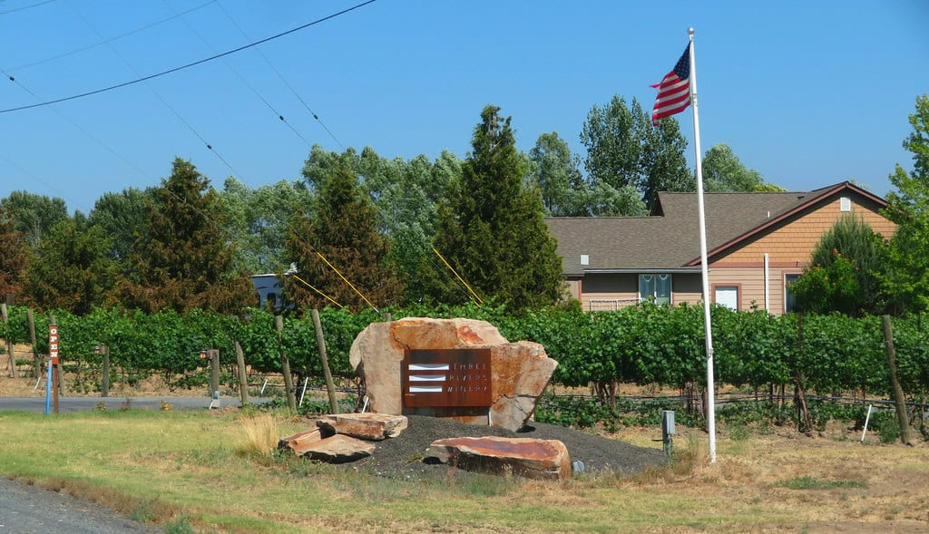
©"Winery Near Whitman Mission National Historic Site, Walla Walla, Washington" by Ken Lund is licensed under BY-SA 2.0. - Original / License
Near Walla Walla, Washington, the Whitman Mission was founded in 1836 and became a key stop for emigrants. The site is also known for the tragic Whitman Massacre of 1847, which heightened tensions between settlers and Native tribes. Today, visitors can walk trails, view the mission ruins, and learn about the cultural and political complexities of early Oregon settlement.
The Dalles, Oregon
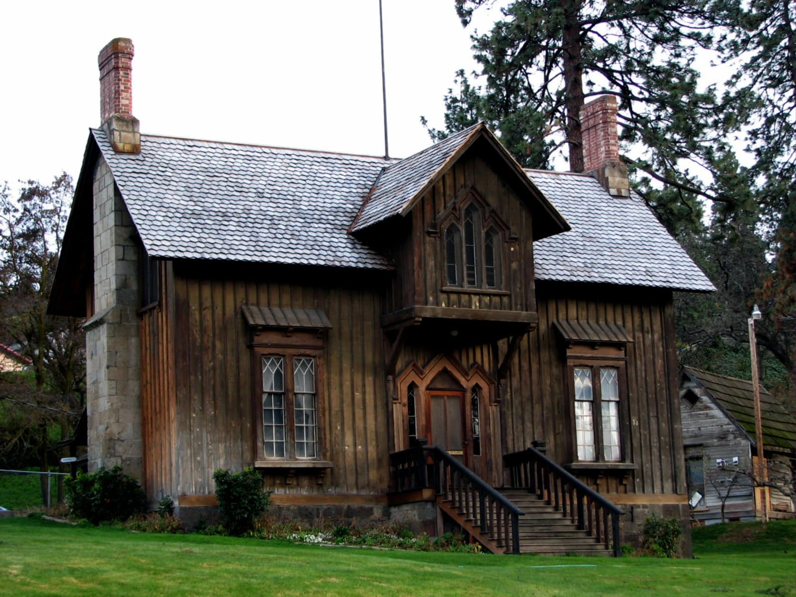
©"Fort Dalles Surgeons Quarters - The Dalles Oregon" by Ian Poellet is licensed under BY-SA 4.0. - Original / License
The Dalles was a major transition point for emigrants deciding whether to raft down the Columbia River or brave the overland Barlow Road route. It became an essential supply town and resting area at the tail end of the Oregon Trail. It remains one of the oldest continuously occupied settlements in the Pacific Northwest.
Barlow Road
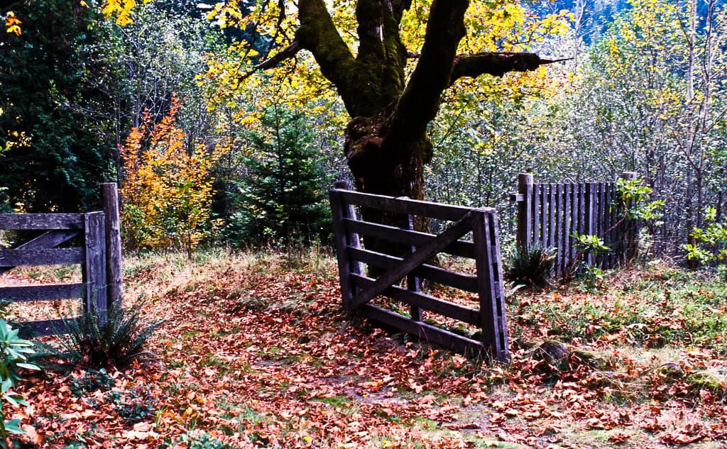
©"Autumn at Barlow Road Tollgate-Mt Hood" by Forest Service Pacific Northwest Region is licensed under PDM 1.0. - Original / License
Constructed in the 1840s, Barlow Road allowed emigrants to bypass the treacherous Columbia River descent. It wound through the Cascade Range, including Mount Hood’s southern slopes, and was the last overland segment of the trail. Remnants of the toll road and signage still exist today in Oregon’s forested highlands.
Mount Hood and Laurel Hill
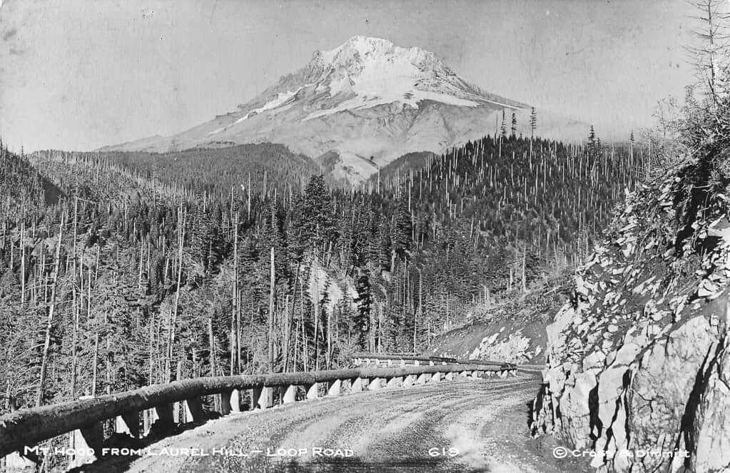
©"619 Mt. Hood from Laurel Hill - Loop Road - C&D" by Forest Service Pacific Northwest Region is licensed under PDM 1.0. - Original / License
Mount Hood loomed as both a beacon and a barrier for Oregon Trail travelers. Laurel Hill, in particular, was a dangerous descent where wagons had to be lowered by chains down nearly vertical slopes. Today, the area is accessible via Highway 26 and features historical signs and viewpoints.
Champoeg State Heritage Area

©"Hudson's Bay Company Granary & Clerk's House Site2 NRHP 91001574 Marion County, OR" by Jon Roanhaus is licensed under BY-SA 4.0. - Original / License
Champoeg, located south of Portland, is where early settlers voted in 1843 to form a provisional government. While not directly on the Oregon Trail, it’s closely tied to the region’s settlement. The park includes historic buildings, museum exhibits, and trails along the Willamette River. It provides insight into the legal and political foundations of Oregon.
End of the Oregon Trail Interpretive Center
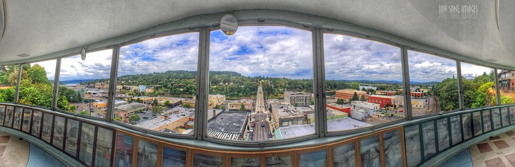
©"End Of The Trail" by Ian Sane is licensed under BY 2.0. - Original / License
Located in Oregon City, this center marks the symbolic end of the Oregon Trail. The city was the first U.S. city west of the Rockies to be incorporated and served as the final destination for thousands of emigrants. The museum offers hands-on exhibits, costumed interpreters, and detailed histories of emigrant families.
Willamette Valley

©"A smokey orange sky and orange dahlias, Willamette Valley, Oregon" by Bonnie Moreland (free images) is licensed under CC0 1.0. - Original / License
The Willamette Valley was the promised land for many Oregon Trail pioneers, offering rich soil, abundant water, and a mild climate. Today, it’s known for vineyards, farmlands, and charming small towns like Salem and McMinnville. Visitors can enjoy the scenery while imagining the relief and excitement felt by the trail’s early travelers.
Fort Vancouver National Historic Site
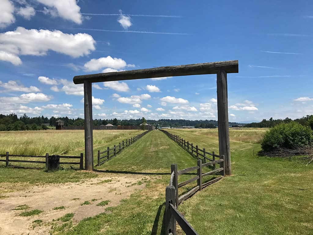
©"Fort Vancouver National Historic Site" by Landscapes in The West is licensed under PDM 1.0. - Original / License
Located along the Columbia River in present-day Vancouver, Washington, Fort Vancouver was a major resupply post for Oregon Trail emigrants. Operated by the Hudson’s Bay Company, the fort provided everything from food to livestock for incoming settlers. The site also served as a cultural exchange point between European traders, missionaries, and local Native American tribes.
Narcissa Whitman Gravesite
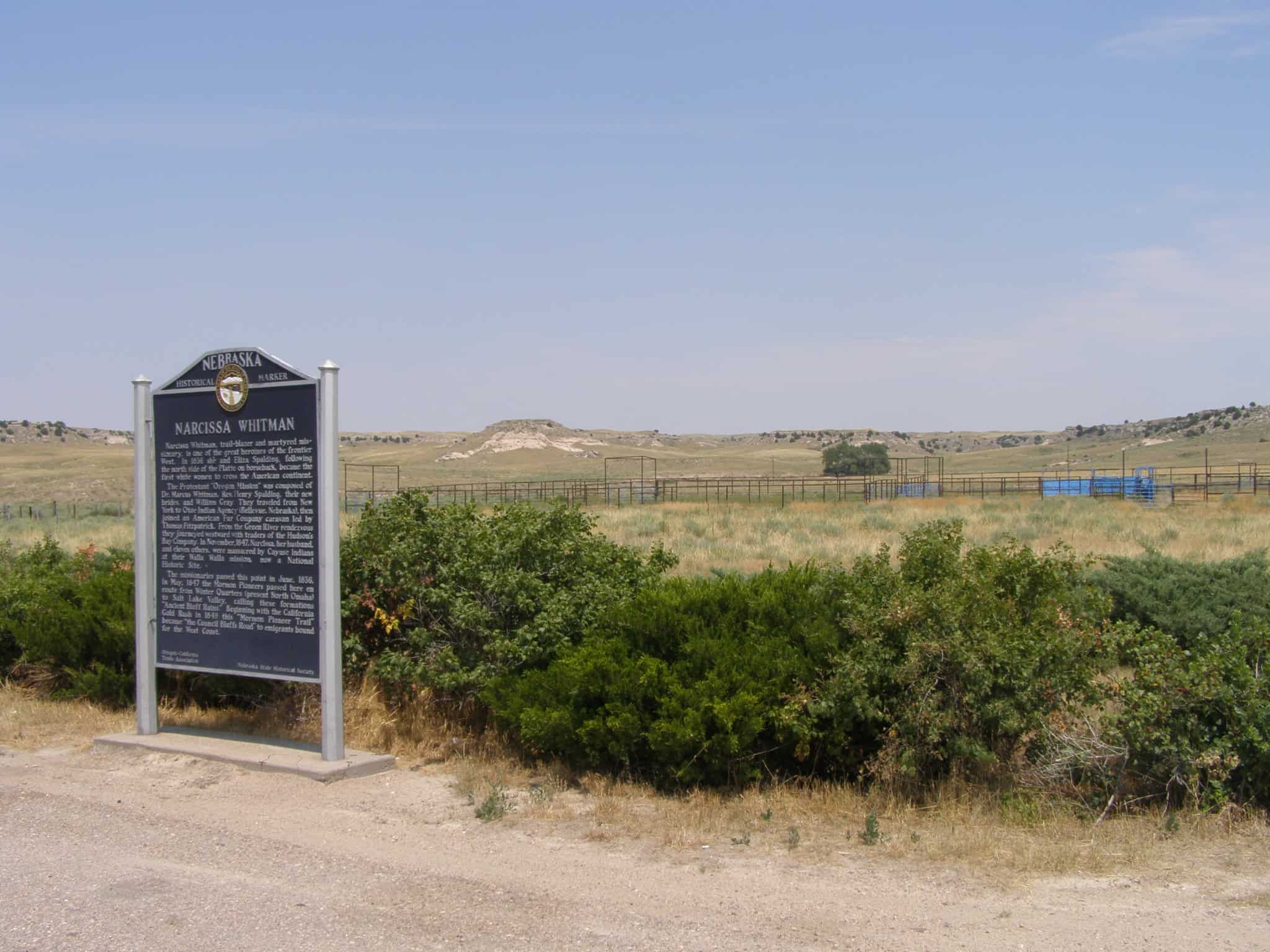
©"Narcissa Whitman marker P7170188" by Chris Light is licensed under BY-SA 4.0. - Original / License
Narcissa Whitman, one of the first white women to cross the Rockies, is buried near the Whitman Mission in Walla Walla. Her tragic death during the Whitman Massacre marked a turning point in the interactions between settlers and the Cayuse people. Her grave has become a site of reflection on the human cost of westward expansion.
Columbia River Gorge Scenic Area
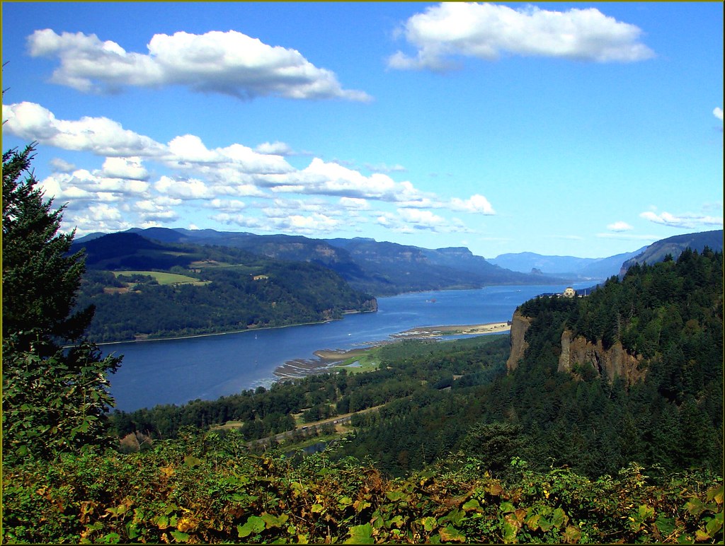
©"Columbia River Gorge, OR, Crown Point 8-30-13" by inkknife_2000 (11.5 million views) is licensed under BY-SA 2.0. - Original / License
Although known for its stunning waterfalls and cliffs, the Columbia River Gorge was also a significant natural corridor for Oregon Trail emigrants entering Washington and Oregon. Pioneers often floated rafts down the Columbia River, passing through this breathtaking landscape. Today, the gorge offers scenic drives, hikes, and historic viewpoints connected to trail history.
Fort Walla Walla Museum
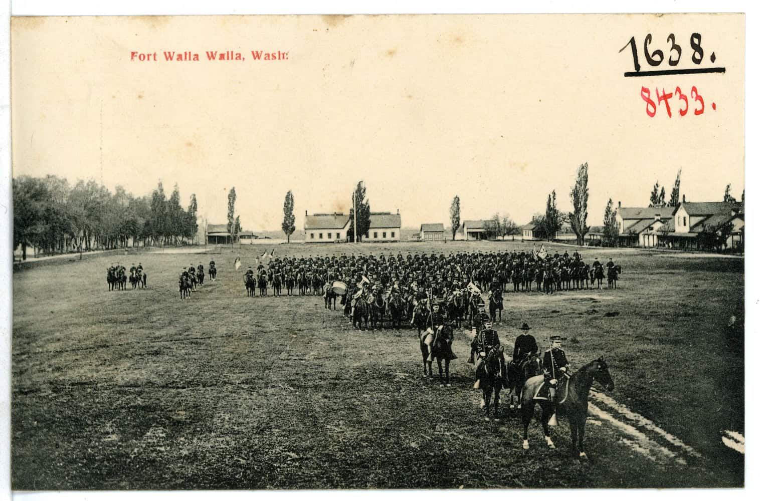
©"08433-Walla Walla-1906-Fort, Walla Walla, Wash.-Brück & Sohn Kunstverlag" by Brück & Sohn Kunstverlag Meißen is licensed under CC0 1.0. - Original / License
Located in southeastern Washington, Fort Walla Walla Museum preserves the legacy of the trail and pioneer life through more than 15 historic buildings and thousands of artifacts. The museum covers the region’s military, agricultural, and settler history, making it a comprehensive stop for Oregon Trail enthusiasts. Costumed interpreters often bring stories of the past to life.
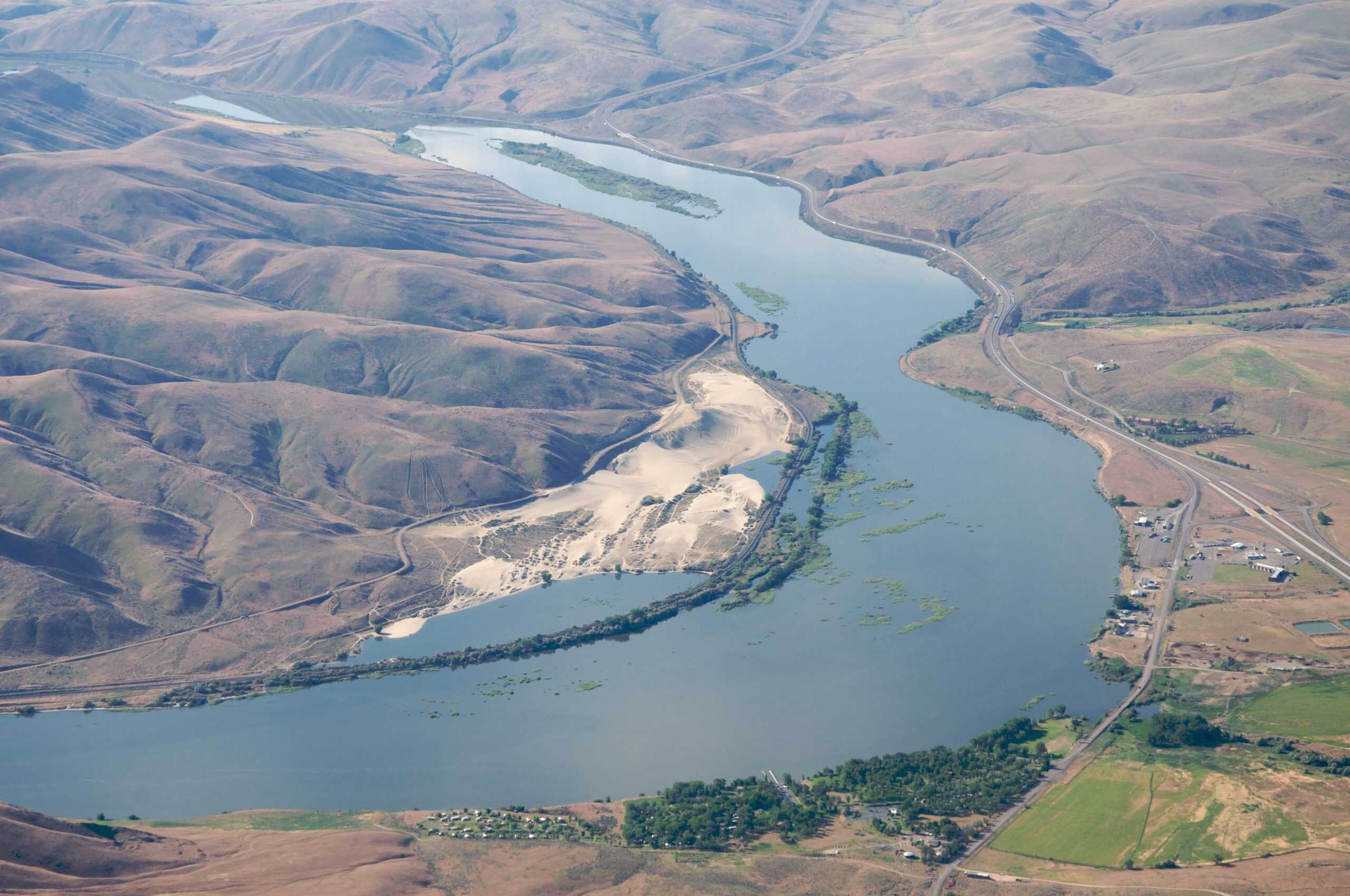
Wallula Gap
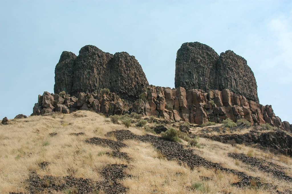
©"Two Sisters in the Wallula Gap" by davidjlee is licensed under BY-SA 2.0. - Original / License
Wallula Gap is a geological formation near the confluence of the Walla Walla and Columbia rivers that helped shape the trail route into the Pacific Northwest. It served as a natural gateway for early pioneers and still bears the scars of ancient floods and geological upheaval. Today, it is studied for both its trail relevance and geologic importance.
