

Puget Sound features some of the most picturesque and exciting islands in the continental United States. We’ve compiled a comprehensive list of every single island in Puget Sound and also discuss some of the attractions and things to do on each island.
Before we detail each island, here’s a helpful interactive map showing the location of each island in Puget Sound:
And here’s a table of contents, where you can quickly navigate to a specific island you may be interested in:
Now we’ll begin discussing each island, starting with Anderson Island:
Anderson Island, WA
Size: 7.75 square miles
Population: 1,037
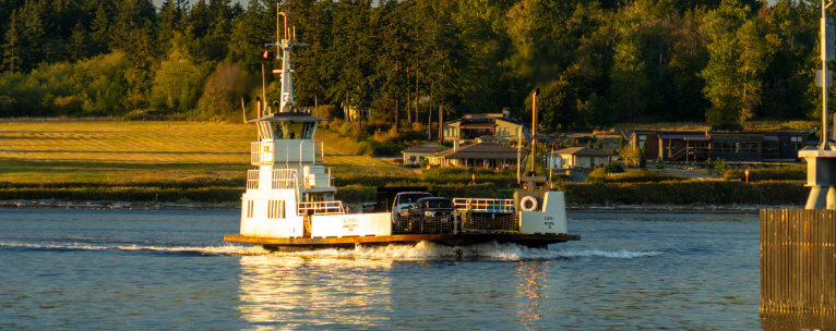
Anderson Island is the southernmost island of the Puget Sound and is accessible by boat or ferry ride from Steilacoom, WA. It’s a small and sparsely populated island that is a census-designated place of Pierce County, WA. The population swells in the summer to about 4,000, which includes both residents and vacationers.
The Anderson Island General Store is the only grocer on the island. The Anderson Island Farm serves as the island’s cultural hub and features a variety of exhibits designed to preserve the region’s culture. In terms of recreation, there’s the Riviera Club which includes hiking trails, a marina, lakes, and a 9-hole golf course. Despite its small size, there is also an elementary school that serves students from kindergarten to fifth grade.
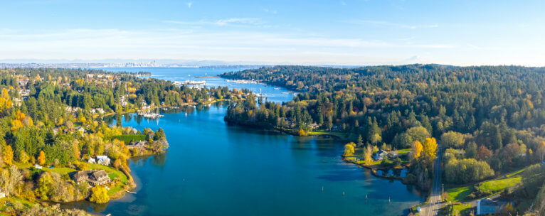
Bainbridge Island, WA
Size: 65.08 square miles
Population: 24,846
A short ferry ride from downtown Seattle, Bainbridge Island is the second-largest city in Kitsap County, WA. Originally home to the Suquamish people, it’s now a bustling island full of residents and tourists alike. The island is located in the Puget Sound Basin and is just west of Seattle.
With a small-town feel, there are three local weekly newspapers, post offices, commercial shops, restaurants, and grocery stores. Bainbridge Island School District houses six public schools with an additional six private schools. This area is also concerned with preserving the local nature and greenspace of the island, so there is control over the amount of development that happens in this community.

Blake Island, WA
Size: 1.76 square miles
Population: 0
Located in Kitsap County, Blake Island, WA lies south of Bainbridge Island and is preserved as Blake Island Marine State Park. This island is only accessible by boat. With over eight miles of hiking trails, visitors can bike or hike and take in the beautiful scenery.
Tillicum Village, located on the northeast side of the island, is rich with Northwest Native culture, food, and art. There are over five miles of shoreline views featuring the Olympic Mountain Range and the nearby Seattle skyline. There is a variety of wildlife on Blake Island, including deer, who like to swim from the mainland.

Blakely Island, WA
Size: 6.507 square miles
Population: 56
Blakely Island is part of the San Juan Islands group in Washington. There is no public ferry to the island, making it only accessible by boat or private ferry. There is a private airstrip available for property owners.
Like many of the islands in Puget Sound, there are no grocery stores or public services. Blakely Island does have a general store and cafe, both located in the island’s marina, and they are typically only open seasonally. There are two 70 acre freshwater lakes deep within over 3000 acres of lush forest perfect for hiking, camping, and fishing. Blakely Island property owners have access to amenities such as potable water, a tennis court, and air and water taxi services.
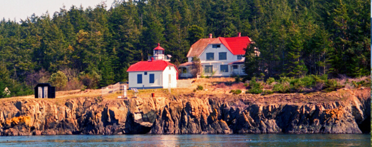
Burrows Island, WA
Size: .515 square miles
Population: 0
Burrows Island State Park is only accessible by boat with a handful of accessible beaches. This can be a tumultuous island to get to, as the narrow channels to get to it are full of strong currents. In a remote camping area, there is one campsite that is near the Northeast tip of the island.
The Burrows Island Lighthouse started operation in 1906. Burrows Island shoreline is mostly jagged, sharp rocks with steep drop-offs. The flora of the island is similar to other parts of the Pacific Northwest, with evergreen trees making up the interior.
Camano Island, WA
Size: 94.9 square miles
Population: 15,661
Located between Whidbey Island and the mainland, Camano Island is accessible by road and boat. It’s an island filled with outdoor activities, including beachcombing, hiking, ziplining, and more. From quaint grocery stores to a robust art community with galleries and festivals, Camano Island is a popular vacation getaway.
Camano Island’s population tends to increase somewhat slightly in the summer months—around 2000 more residents. The summer months see many part-time vacation homeowners. Camano Island shares a school district with Stanwood, which has two elementary schools nearby. A public library is open to all residents of the island.
Center Island, WA
Size: .275 square miles
Population: 49
A 30-minute boat ride to the mainland and no cars in sight, Center Island is a small 115-acre oasis. The main transportation on the island is by golf cart, and most of the residents share amenities such as the clubhouse, beach lots, boat storage, and docks. There are daily mail deliveries and a private airstrip that residents can use.
Center Island’s community clubhouse is a spot where residents can rent vehicles, do their laundry, or spend some time on the porch grilling and enjoy the ocean views. Many residents live here during the summer months, though there are a handful of year-round occupants.
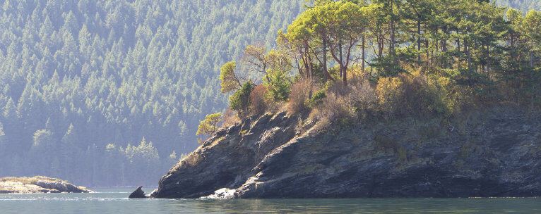
Cypress Island, WA
Size: 8.6 square miles
Population: 49
Cypress Island is the westernmost part of Skagit County, Washington. Travel is limited to the island by private boat or water taxi. A direct trip to Fidalgo Island is only a 15-minute boat ride away, making for a convenient transportation option.
Strawberry Bay is the island’s main community. The majority of the island is managed by the Washington Department of Natural Resources who has installed waterfront parks with picnic tables and buoys for boat campers. There are freshwater lakes in the center of this small island, which provides bountiful views for hikers.
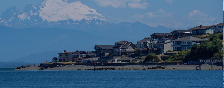
Fox Island, WA
Size: 6.4 square miles
Population: 3692
Fox Island’s views include Mt. Rainer, the Olympic Mountains, and the Tacoma Narrows Bridge. The Fox Island Bridge connects the island with Artondale, a small town in Pierce County, Washington. Fox Island Nature Center hosts activities like bird watching, identifying plants, and hiking. The Nature Center also acts as a wildlife preserve that includes wetland areas and deciduous forests.
Fox Island has a post office, grocery store, and other small businesses, including a wedding chapel, doggie daycare, and a preschool offering 2-year-old through Pre-K classes. The island boasts beautiful beaches and great fishing.
Gedney Island, WA
Size: .692 square miles
Population: 260
Gedney Island, also known as Hat Island, is a small, sparsely populated island in Snohomish County, Washington. The Hat Express is the island’s private walk-on ferry, used by residents and their guests to go back and forth to Everett, Washington.
There are no grocery stores or schools on Gedney Island. Still, there is a renovated marina capable of docking over 120 boats, a fire station, and a nine-hole golf course. The official publication, Viewpoint, is a quarterly publication for all community members that gives news, upcoming events, and other goings-on in the community.
Guemes Island, WA
Size: 8.6 square miles
Population: 605
A small island in western Skagit County, Guemes Island is accessible by private boat and the Guemes Island Ferry. The ferry runs every 30 minutes, making it an easy and quick 5-minute trip from Anacortes, Washington.
The Guemes Island General Store is located close to the ferry stop and boasts freshly made pastries, cookies, and desserts, on top of snacks and drinks. Stop for lunch at a pizza food truck, DIGS Kitchen. This tiny island has two parks, Schoolhouse Park and Young’s Park, with a wide variety of wildlife and hiking trails.
Harstine Island, WA
Size: 18.651 square miles
Population: 1002
Harstine Island is located in southern Puget Sound, just north of Olympia, WA. A bridge was built in 1969, connecting it to the mainland, making it accessible by car or boat. There are three state parks on Harstine Island, making it a popular summer destination. McMicken Island State Park has an active shellfish population and is available to harvesters throughout the year.
There are no restaurants on the island. Recreational activities on Harstine Island include cycling, fishing, and beachcombing. The Wild Felid Advocacy Center is a wild cat sanctuary, providing resources to big cats and education to its visitors.
Herron Island, WA
Size: .4759 square miles
Population: 152
Herron Island is a privately owned island on Puget Sound. It’s accessible by ferry, the MV Charlie Wells, for property owners and guests. This small island is located about 60 miles south of Seattle. This is a heavily wooded area with views of the Olympic Mountain Range.
Residents and guests enjoy activities that include fishing, boating, and sailing. There are also many types of bird and marine life that can be observed in their natural habitat. A place of great beauty with its open spaces, beaches, and mountain views, Herron Island is a peaceful environment.
Hope Island State Park
Size: 106 acres
Population: 0
This small island can only be reached by watercraft. It’s located on the west side of the Puget Sound and is covered in deciduous forests and saltwater marshes. Hope Island State Park has a 1.5-mile long beach, which makes it a popular spot for shellfish harvesters. The park offers several campsites for its visitors to use.
Walks on the beach and hiking trails are popular here. Many like to pack a picnic and enjoy their meal surrounded by fruit orchards. Because of the vast amount of shellfish, bald eagles and blue heron are common sights for visitors.
Hope Island, WA
Size: .3125 square miles
Population: 0
Hope Island is a 200-acre marine park at the northern end of Skagit Bay in Skagit County, Washington. There are several campsites making it an attractive area for boaters and hikers alike. Hope Island is a serene area with meadows and forests, as well as acting as a natural area preserve that hopes to protect the Puget Sound ecosystem.
This island is only accessible by boat, and there are five mooring buoys on the north side of the island. There is a trail that runs across the island for its campers to enjoy. During mating season, herons will nest on the island, making for a spectacular sight to see.
Indian Island, WA
Size: 4.35 square miles
Population: 44
Twenty miles north of the Hood Canal Bridge lies Indian Island. Also known as Naval Magazine Indian Island, this area is home to the US Navy’s only west coast deep-water ammunition port. Navy combat ships frequent this island’s docking area.
This island has a wealth of natural resources and a rich history. There are many Native American and pioneer sites, and, because of its Naval history, there are also several buildings built during WWII. Home to a wide variety of plants and animals, bald eagles, deer, and otters are abundant.

James Island State Park
Size: .1765 square miles
Population: 0
James Island State Park is a small 113-acre marine camping park. Part of the San Juan Islands, there are beautiful views of the western San Juan Islands. There are designated campsites and trails, though most of the island has been designated as a protected National Forest Area.
There is no fuel station or grocery store on this island—the nearest stop for its visitors is Anacortes, Washington. There is a total of 1.5 miles of looping hiking trails for campers to enjoy. 13 campsites span throughout the island, with no drinkable water. This is a secluded camping area and visitors must bring all of their necessities with them.
Jones Island, WA
Size: .184 square miles
Population: 0
Jones Island is a small island that is only accessible by boat and there is no residential population. It acts as a popular campsite and trail area for campers, hikers, and boaters. There are seven mooring buoys and over 120 feet of dock moorage.
There are 24 non-serviced campsites on Jones Island that can’t be reserved—they are on a first-come, first-serve basis. This island is home to a large herd of black-tail deer, which have become accustomed to humans and may even come up to say hello.
Ketron Island, WA
Size: .344 square miles
Population: 17
Ketron Island, Washington is a small, privately-owned island that is only reachable by ferry. Bought initially with plans to build 200 homes, schools, and stores, these plans were abruptly put to an end in the 1940s due to the high costs of a sewer system.
There are no grocery stores, gas stations, garbage pickups, or restaurants. In order to get supplies, residents and visitors must use the ferry, which comes four times a day, or use their own boats to reach the mainland.
Lopez Island, WA
Size: 29.5 square miles
Population: 2177
The third-largest island of the San Juan Islands, Lopez Island is accessible by boat only. The primary way of traveling to and from the island is by ferry. It takes around 40 minutes to get to the mainland of Anacortes, Washington. The Lopez Island Airport offers commercial flights.
Though the population is small, it significantly increases during the summer months. There are several restaurants, a bookstore, coffee shops, a museum, and two public marinas, making it a popular destination from June through September. Many choose biking as a means of transportation throughout the island due to low-speed limits and minimal traffic.

Lummi Island, WA
Size: 9.255 square miles
Population: 822
Accessible by a 20-car ferry, residents, and visitors can enjoy a quick six-minute ride from the mainland to Lummi Island. Lummi Island’s population nearly doubles every summer with tourists from both the US and Canada enjoying the beautiful views, weather, and abundance of activities.
Mushroom season is during the off-months, so visitors and residents can enjoy mushroom hunting and sightseeing from October through Christmas. Grange Hall is a gathering place for family reunions, weddings, and other get-togethers. There is a Saturday Market where one can buy fresh flowers, local honey, and produce. Though the island is small, there is an elementary school that accommodates grades K-5.
Marrowstone Island WA
Size: 6.3 square miles
Population: 844
Marrowstone Island boasts breathtaking views of Puget Sound. Two hours north of Seattle, this little island is accessible to the mainland by a bridge. It’s home to Fort Flagler State Park, with views across the water to Whidbey Island. This park has old military buildings, a military museum, and tours of the old bunkers.
The amenities on Marrowstone include a vineyard, the Nordland General Store, and cultural events such as the annual Strawberry Festival and the Tractor Days Parade. There are five miles of walking trails on the island with views that include volcano Glacier Peak and Whidbey Island.
Matia Island, WA
Size: .226 square miles
Population: 0
Matia Island is a small area that was originally established as a refuge for migratory birds and is now a National Wildlife Refuge. There are five acres of the island that are designated for public use. Only accessible by boat, this island is a spot for primitive camping, saltwater fishing, and clam digging.
Camping facilities on Matia Island include a mile-long loop trail, six non serviced campsites, and a composting toilet. Visitors are required to pack out their garbage, drinking water is not provided, and fires of any kind are banned. To protect the natural habitat and wildlife that call this island home, most of the island is closed to the public.
McNeil Island, WA
Size: 6.63 square miles
Population: 214
McNeil Island is located in south Puget Sound, just southwest of Tacoma. At one point, this island was a federal penitentiary and was the last island prison in the US that could only be accessible by either plane or boat.
The only residents on McNeil Island are those who live at a facility for former prison inmates. These men have served their sentences, though remain confined on the island. Each of the 214 residents of the island was convicted of at least one violent sex crime.

Orcas Island, WA
Size: 57.3 square feet
Population: 5387
Orcas Island is the largest of the San Juan Islands. At 57 square miles, residents and visitors have the opportunity to see lush forests, beautiful lakes, and unique culture. Island access is through the Washington State Ferries system. However, it can also be accessed through other sea charters or air services. There are public docks that private boats can use to come onto the island. Orcas Island is also home to a handful of state parks with hiking trails, campsites, and kayaking opportunities.
There are three schools on Orcas Island— an elementary, middle, and high school. There is also a public library for its residents to take advantage of. Unlike many islands in the Puget Sound, Orcas Island has health care services so that locals may be serviced when needed.
Patos Island, WA
Size: .323 square miles
Population: 0
Spanish for “duck,” Patos Island is part of the San Juan Islands in Washington. Visitors can get to the island by personal boat, chartered boat, or by kayaking from nearby Orcas Island. There is no dock and strong currents can make docking difficult.
Patos Island is home to several camping spots that have fire pits, pit toilets, and beautiful views. Like many of the other islands in the Puget Sound, this island does not have potable water, so visitors need to bring all their necessary supplies with them during their stay. Lighthouse tours are offered during the summertime months and other activities include clamming, crabbing, and diving.
San Juan Island, WA
Size: 55.05 square miles
Population: 6822
San Juan Island is the second-largest island in the San Juan Islands group in the Puget Sound. Though not the largest island, it is the most populous at just under 7000 residents. Washington State Ferries services this island, though visitors and residents can also use boats, seaplanes, or other aircraft.
There are a number of weekly newspapers and online news sites on San Juan Island. It’s a major farmland with tourism making up most of its economy. There is a hospital located onsite and a handful of attractions including multiple museums, state parks, and aquaculture farms. The San Juan Island School District operates four schools: an elementary school, a middle school, a high school, and an alternative high school.
Squaxin Island Indian Reservation
Size: 2.216 square miles
Population: 0
Squaxin Island is an Indian reservation in Southeastern Mason County. Though it’s a traditional reservation, there are currently no residents on this island. The Squaxin Tribe now lives on off-reservation trust land and Harstine Island. While Squaxin makes up the largest part of this tribe’s reservation territory, it is unpopulated. At one point in time, this island contained a state park, though it eventually closed and the land was given back to its original people.
Stretch Island, WA
Size: .47 square miles
Population: 120
Located in Case Inlet in the southern area of Puget Sound, Stretch Island is a small area of land that has less than 120 residents. Though small, this island has an abundance of outdoor recreation that includes shellfish harvesting, sailing, and fishing.
Stretch Island’s climate makes it a great habitat for many different types of flora and fauna, including salmon, blue herons, and bald eagles. There are a handful of smaller markets on the island, with chain grocery stores and restaurants just a quick 15-minute drive away. There is also a ferry that residents and visitors can drive to in around 40 minutes that will drop you off right in downtown Seattle.
Stuart Island, WA
Size: 2.881 square miles
Population: 20
Stuart Island makes up part of Washington’s San Juan Islands and is close to the Canadian border. This island doesn’t have a ferry service, so visitors and residents use private boats and watercraft to access. Stuart Island is not close to other islands and often has strong currents, which can make it difficult to access if coming by kayak.
There are no stores or hotels on Stuart Island, but visitors love coming to camp, hike, or kayak. The lighthouse on the island is a popular destination for those wanting to explore the area. There are primitive campsites around the island with no garbage service, though potable water is available May through September.
Sucia Island, WA
Size: 1,058 square miles
Population: 4
Just 2.5 miles north of Orcas Island, Sucia Island is part of the San Juan Islands in Washington. A horseshoe-shaped island, it’s only accessible by watercraft. Sucia Island is filled with lush forests and beautiful views that showcase the famous west coast sunsets.
Sucia Island is a state park and is considered to be a world-class boating destination. Though the population is small, summertime brings a large crowd hoping to explore the island and its many bounties. There are over 10 miles of trails that hikers can use to take advantage of the beautiful scenery.

Trump Island, WA
Size: .045 square miles
Population: 0
Trump Island is a private Island located between Decatur and Lopez Islands in Puget Sound. It’s part of the San Juan Island chain and the only way to access it is by boat, seaplane, or water taxi. Trump Island is currently for sale and there are no current occupants of the island.
It should be noted that Trump Island bears no relation to Donald Trump!
Vashon Island, WA
Size: 80.81 square miles
Population: 10,624
Puget Sound’s largest island is made up of two islands that are connected by a land bridge. With Seattle to the northeast and Tacoma to the south, Vashon Island is accessible by two ferries or by personal boat (there are some public docks available).
The island has a number of attractions, including the Vashon Island Coffee Roasterie. Unlike many of the smaller Puget Sound islands, Vashon is home to many retail shops, restaurants, farmers’ markets, and museums. Vashon Park is part of the Cascade Maine Trails System, which houses beach campsites and primitive accommodations. There are three public schools and two private schools on the island for children in grades K-12.
Waldron Island, WA
Size: 4.595 square miles
Population: 104
Waldron Island is another island that is part of the San Juan Islands in Washington. There are ferry and water taxi services that service the island. In addition to a public dock, there is a public grass airstrip.
This private island is generally used to grow flowers or vegetables for other nearby islands in the Puget Sound. There is a small schoolhouse and post office for its residents to use. Due to a non-development clause, no more docks will be built in the island’s future.
Whidbey Island, WA
Size: 168.67 square miles
Population: 69,480
Thirty miles north of Seattle lies Whidbey Island. The economy of Whidbey Island is mainly the presence of the Whidbey Island Naval Air Station and tourism. It’s connected to the mainland by way of Fidalgo Island. There are also ferries that service the area. This island has a zero-fare bus as part of its public transportation.
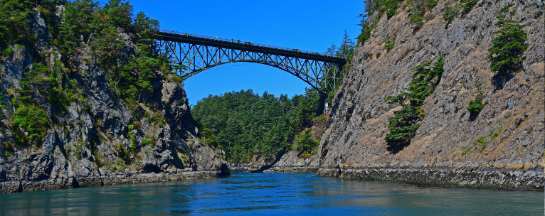
Whidbey Island is home to a number of festivals, including the Whidbey Island Kite Festival, Wag’n’Walk, and the Whidbey Island Area Fair. There are three public school districts in the area and two college campuses. A large island, there is a handful of Washington State Parks like Deception Pass State Park, Fort Casey State Park, and Joseph Whidbey State Park. It’s the fourth-longest island in the continental US and is home to gray whales, orca, and over 230 bird species.
