

The Pacific Northwest has no shortage of hikes that can make your legs hurt and your palms sweat. Mount Rainier alone offers routes where hikers can go from comfortable trail conditions to snowfields, whiteouts, and serious alpine terrain in a matter of hours. But difficulty is only part of what makes a trail dangerous. Heat, flash floods, exposed ledges, fast-changing weather, wildlife, poor route finding, and simply being a very long way from help can all turn a beautiful hike into an emergency.
Those risks are hardly limited to the Northwest. Across the United States, some famous trails climb knife-edge ridges or slick granite. Others drop into desert canyons where summer temperatures can become brutal, or disappear into remote country where a rescue may take hours to reach you. A few have well-documented histories of fatal falls, drownings, bear encounters, or search-and-rescue calls.
This is not an attempt to calculate a precise death-risk ranking. The hazards are too different for that to mean much. Instead, Seattle Travel looked at 17 challenging hikes and routes around the country, including several in the West and Pacific Northwest, and checked current information from the agencies that manage them. Some are manageable with experience and preparation. Others deserve considerably more respect than their Instagram photos might suggest.
1. Angel’s Landing – Utah
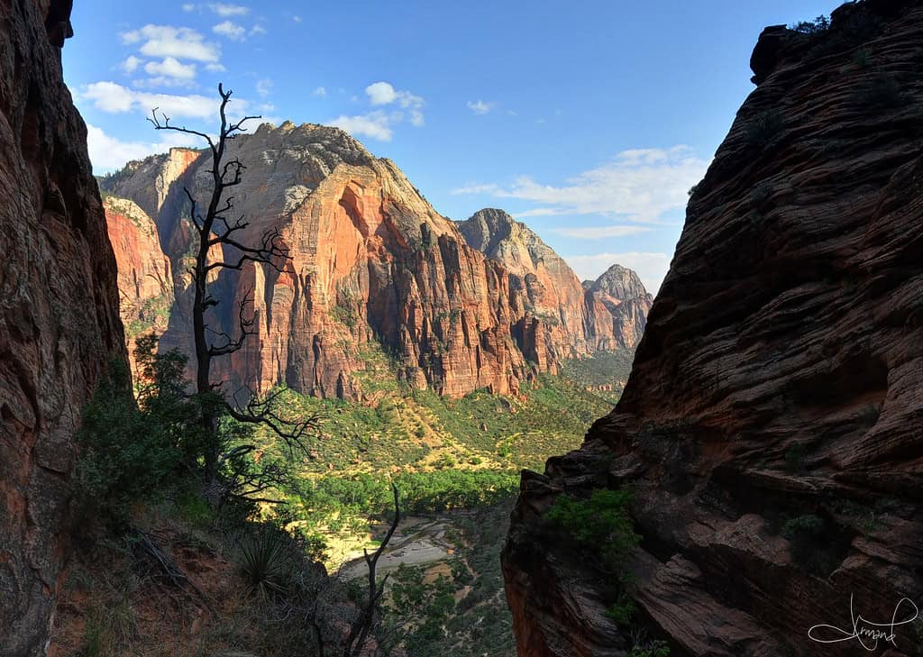
©"Descending Angel's Landing, Zion National Park, Utah" by tsaiproject is licensed under BY 2.0. - Original / License
Angel’s Landing is one of Zion National Park’s most famous hikes, and the statistics alone explain why it demands respect. The route is about 5.4 miles round trip with 1,488 feet of elevation gain. The real test comes near the end, when hikers enter a narrow, exposed ridge where a chain provides something to hold onto while cliffs fall away on either side.
Angel’s Landing – Utah
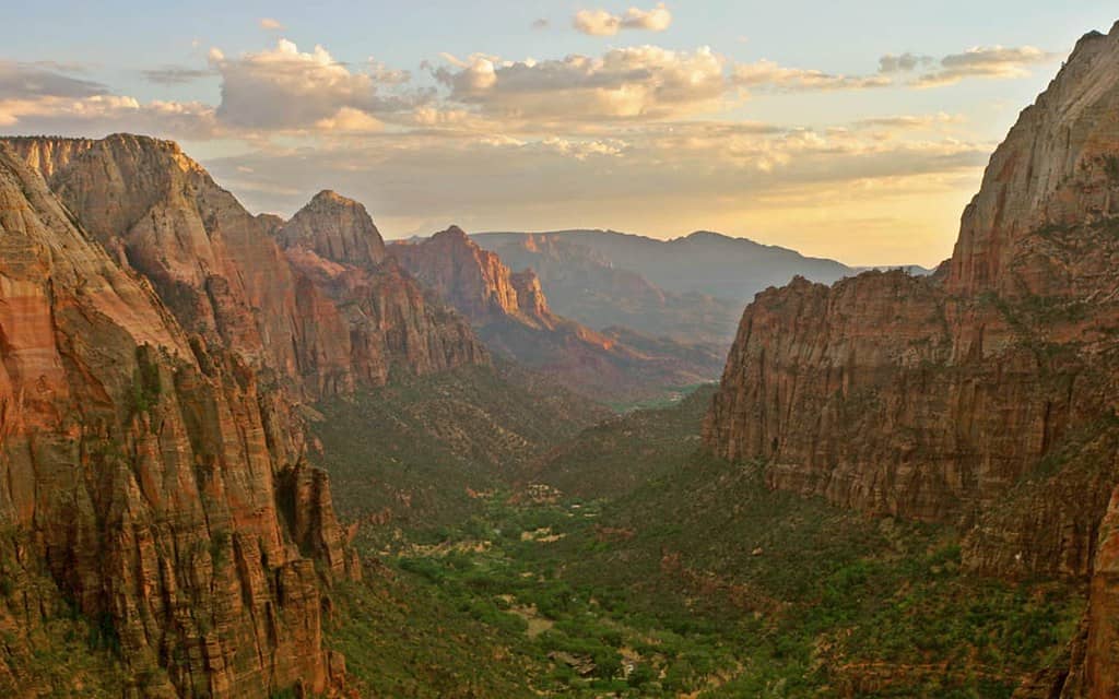
©"Zion Canyon - Angels Landing, Utah" by Trodel is licensed under BY-SA 2.0. - Original / License
A permit is required to hike the chained section, and the National Park Service says the majority of deadly accidents on Angel’s Landing since 1930 have occurred along that final half-mile. Wet or icy rock makes the route especially dangerous. The risk remains very real: a hiker died after falling from the chained section in April 2026. Zion advises hikers to skip the ascent when storms are nearby or when the route is wet or icy.
2. Bright Angel Trail – Arizona
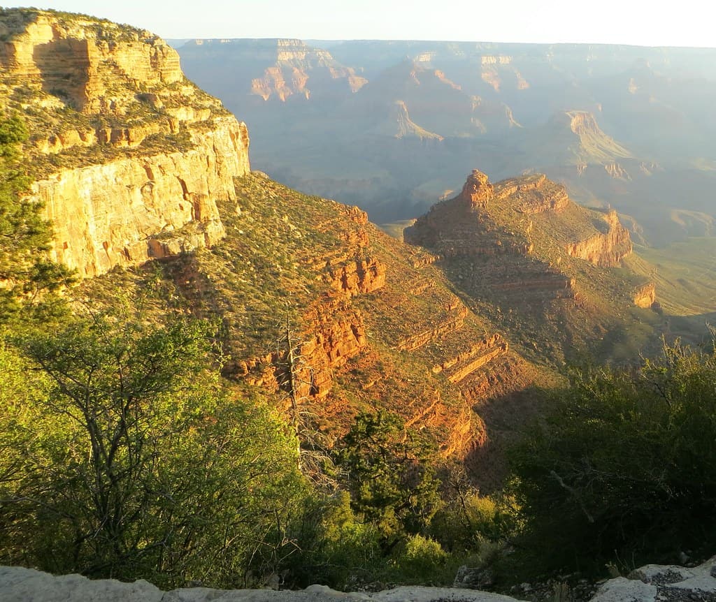
©"Grand Canyon Arizona USA - 021 Bright Angel Trail" by WasifMalik is licensed under BY 2.0. - Original / License
Bright Angel is the most popular trail descending from the South Rim of Grand Canyon National Park, but its easy access can create a false sense of security. Every step down has to be climbed again, and the National Park Service warns that hiking out can take about twice as long as hiking down. A trip as far as Havasupai Gardens is already about nine miles round trip with more than 3,000 feet of elevation change.
Bright Angel Trail – Arizona
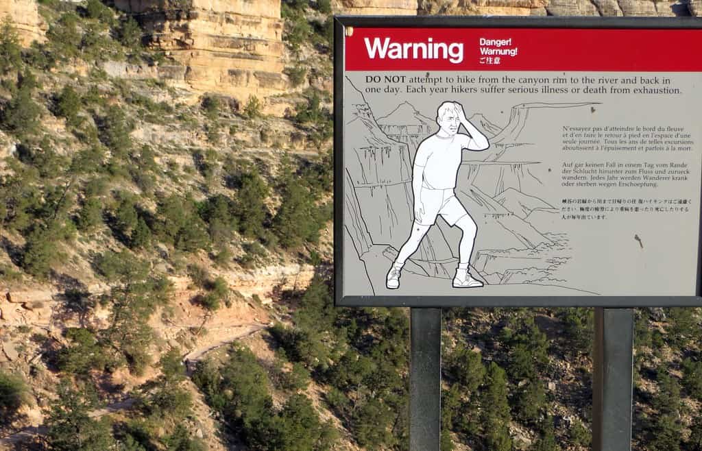
©"Grand Canyon Arizona USA - 025 Bright Angel Trail" by WasifMalik is licensed under BY 2.0. - Original / License
Heat is one of the biggest dangers. Summer temperatures inside the canyon can exceed 110 degrees, and water stations along Bright Angel are seasonal and can be interrupted by pipeline problems. The park does not recommend trying to hike from the South Rim to the Colorado River and back in a single day. In June 2026, an 18-year-old hiker died from a heat-related illness below Havasupai Gardens while attempting a rim-to-river-and-back day hike.
3. Mist Trail and Half Dome Cables – California
©Tyler Meester/Shutterstock.com
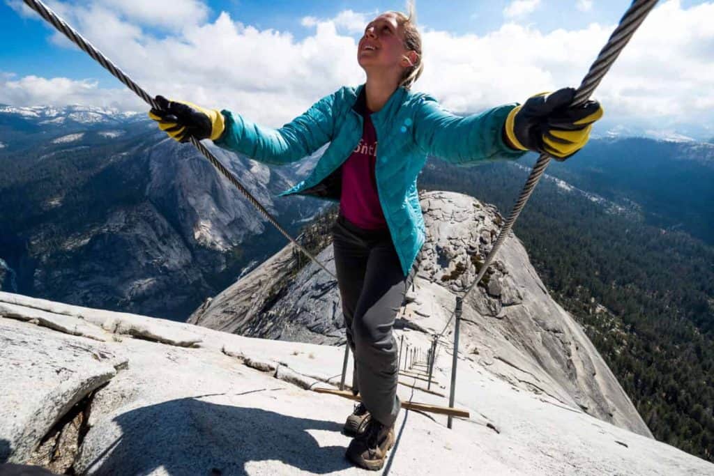
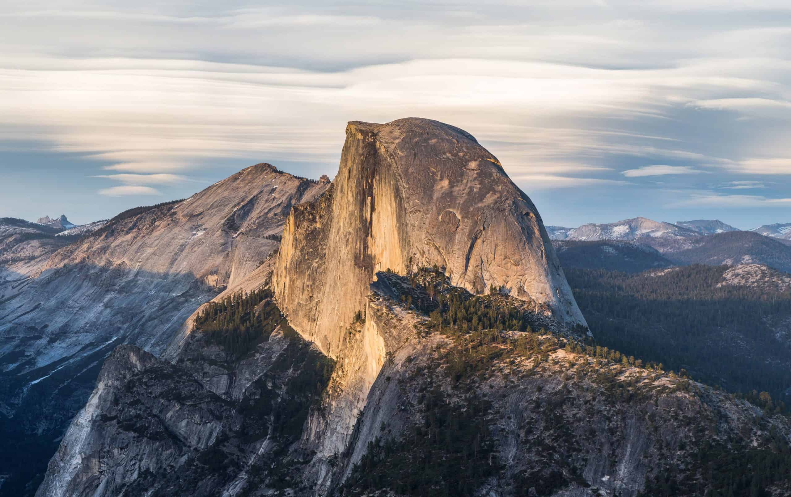
Yosemite’s Mist Trail corridor leads toward Vernal Fall, Nevada Fall, and eventually Half Dome, making it one of the busiest hiking areas in the park. Half Dome itself is tightly controlled during cable season. A maximum of 300 permitted hikers per day can continue beyond the base of the subdome, generally divided between about 225 day hikers and 75 backpackers.
Mist Trail and Half Dome Cables – California
©"Half Dome from Glacier Point, Yosemite NP - Diliff" by Diliff is licensed under BY-SA 3.0. - Original / License
The famous cables cover the final 400 feet of the climb, allowing hikers to ascend the steep granite without traditional rock-climbing equipment. That last section is also where conditions matter most. Yosemite warns hikers not to attempt the cables when storm clouds are nearby or the rock is wet. Nearly all fatal falls from the cables have occurred on wet rock, which can become extremely slick.
4. Abrams Falls – Tennessee
©"Abram Falls - Smokey Mountains" by tsmartin is licensed under BY 2.0. - Original / License
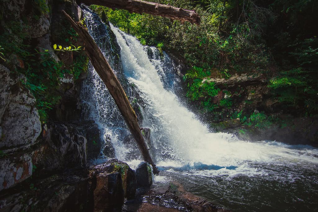
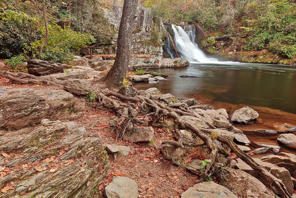
Abrams Falls Trail in Great Smoky Mountains National Park is only about five miles round trip, so the mileage is not what puts it here. The trail ends at a 25-foot waterfall dropping into a deep pool. The falls are not especially tall by Smokies standards, but the volume of water is considerable and the pool below contains powerful currents.
Abrams Falls – Tennessee
©"Rugged Abrams Falls" by Bold Frontiers is licensed under BY 2.0. - Original / License
The National Park Service strongly discourages swimming because of slippery rocks and a potentially deadly undertow. There is also a temporary 2026 access wrinkle: from Aug. 24 through Sept. 30, Abrams Falls Trail is closed Mondays through Thursdays while crews replace aging footlog bridges. It remains open Fridays through Sundays during that work period, along with Labor Day.
5. Buckskin Gulch – Utah
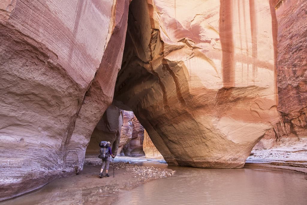
©"#conservationlands15 Social Media Takeover, June 15th, Bucket List Location Buckskin Gulch" by mypubliclands is licensed under BY 2.0. - Original / License
Buckskin Gulch runs through roughly 16 miles of sandstone narrows in the Paria Canyon-Vermilion Cliffs Wilderness and is considered one of the longest continuous slot canyons in the world. Some sections are only a few feet wide with walls rising hundreds of feet above. Day-use permits are required, with the current fee set at $6 per person and $6 per dog.
Buckskin Gulch – Utah
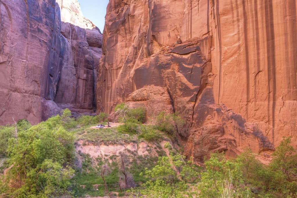
©"#conservationlands15 Social Media Takeover, June 15th, Bucket List Location Buckskin Gulch" by mypubliclands is licensed under BY 2.0. - Original / License
The biggest danger is not getting squeezed between the walls. It is water. Flash floods can race through a slot canyon even when rain is falling miles away upstream, leaving very few places to escape. Federal land managers also warn about difficult footing, deep mud, quicksand, cold pools, rock and log jams, limited water sources, and long stretches without a marked trail. This is a place where checking the weather is part of the hike, not an optional extra.
6. Huckleberry Lookout – Montana
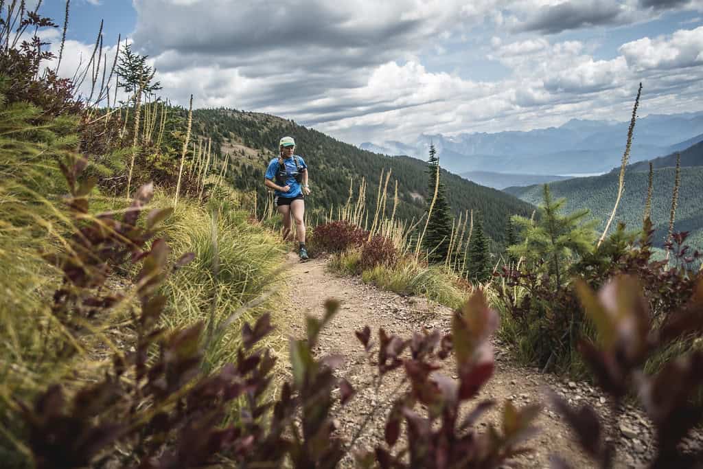
©"Huckleberry Lookout Trail" by GlacierNPS is licensed under PDM 1.0. - Original / License
Huckleberry Lookout in Glacier National Park is a substantial hike even before wildlife enters the equation. The lookout is about six miles from the trailhead, making this roughly a 12-mile round trip with about 2,725 feet of elevation gain. The route also passes through prime bear habitat in a national park that supports both black bears and grizzlies.
Huckleberry Lookout – Montana
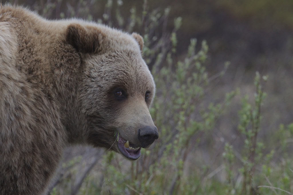
©"Grizzly bear (Ursus arctos ssp.)" by Gregory 'Slobirdr' Smith is licensed under BY-SA 2.0. - Original / License
Berry patches are obvious feeding areas, so hikers need to stay especially alert when huckleberries and other foods are drawing bears. Glacier recommends hiking in groups, making noise, and carrying accessible bear spray. The warning is not theoretical. In 2020, a trail runner on Huckleberry Lookout Trail collided with a young grizzly during a surprise encounter and suffered non-life-threatening injuries.
7. Camp Muir – Washington
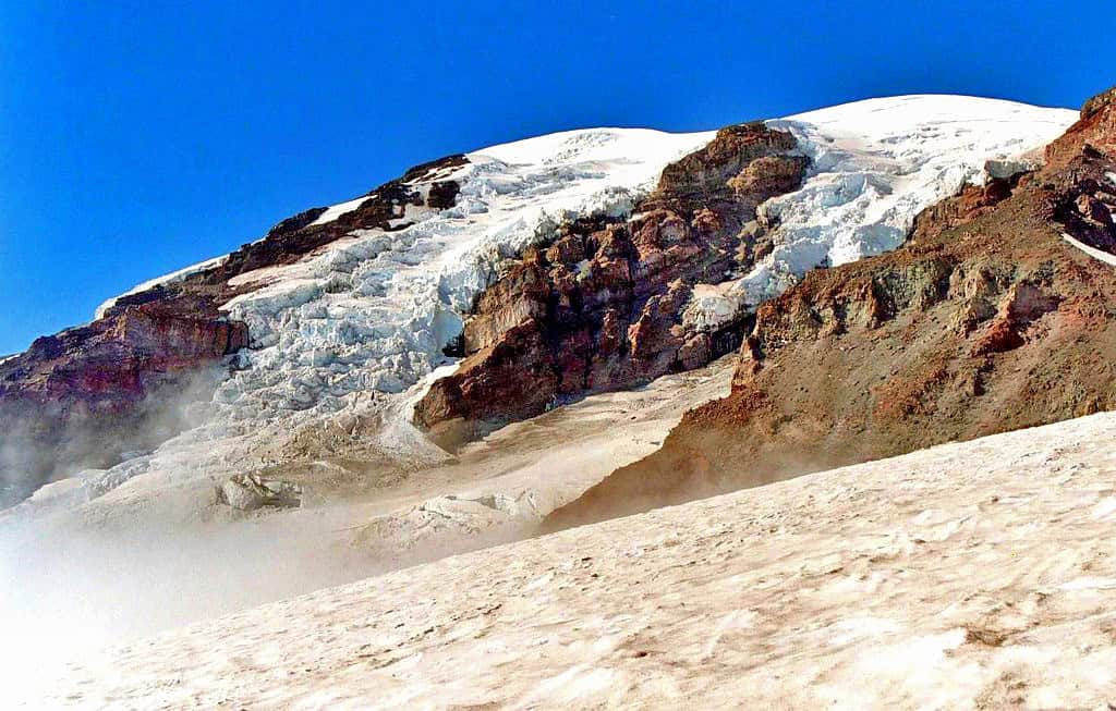
©"Mt. Rainier from Just Under Camp Muir" by Andrew E. Larsen is licensed under BY-ND 2.0. - Original / License
The trip from Paradise to Camp Muir on Mount Rainier covers only about 4.5 miles one way, but it gains roughly 4,600 feet before reaching Camp Muir at just over 10,000 feet. Much of the upper route crosses the Muir Snowfield, where the experience starts looking a lot less like an ordinary day hike and considerably more like alpine travel.
Camp Muir – Washington
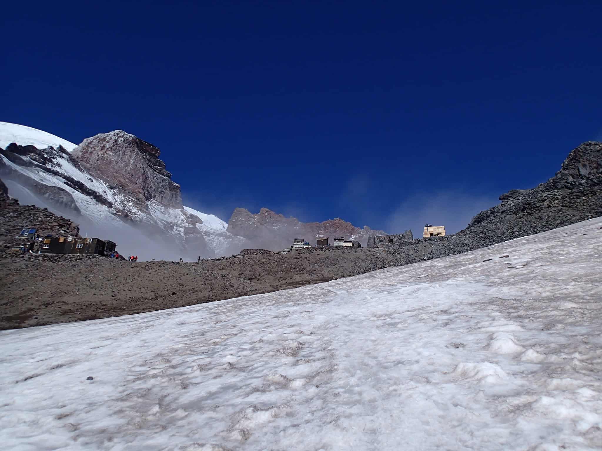
©"<div class='fn'> Camp Muir Mount Rainier National Park Washington</div>" by David Geeraerts is licensed under BY 3.0. - Original / License
Weather and navigation are the major concerns. Mount Rainier warns that whiteouts have caused hikers to become lost and have contributed to fatalities on the route. Late in the season, snow can melt enough to expose hard glacier ice and small but deep crevasses. In poor visibility, even a minor navigational mistake can take hikers toward surrounding glaciers or cliffs. A 2020 incident on the Muir Snowfield left one hiker dead after two people became lost in high winds, heavy rain, and whiteout conditions.
8. Kalalau Trail – Hawaii
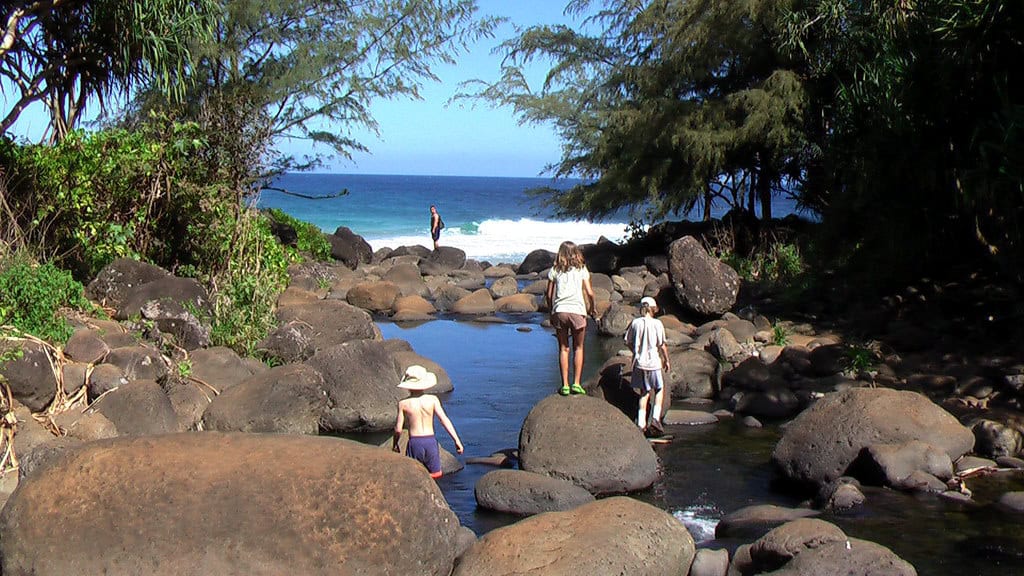
©"Kalalau Trail day hike to Hanakapiai Beach, Kauai, Hawaii" by Rick McCharles is licensed under BY 2.0. - Original / License
Kauai’s Kalalau Trail runs 11 miles one way along the rugged Nāpali Coast, crossing valleys and narrow sections high above the ocean. Mud, steep drop-offs, falling rocks, flash floods, swollen stream crossings, and rapidly changing surf conditions all add risk. Day-use reservations are required to access the first section from Hāʻena State Park, and anyone continuing beyond Hanakāpīʻai Valley must hold a valid Nāpali Coast camping permit, even if they do not plan to camp.
9. Maze Overlook – Utah
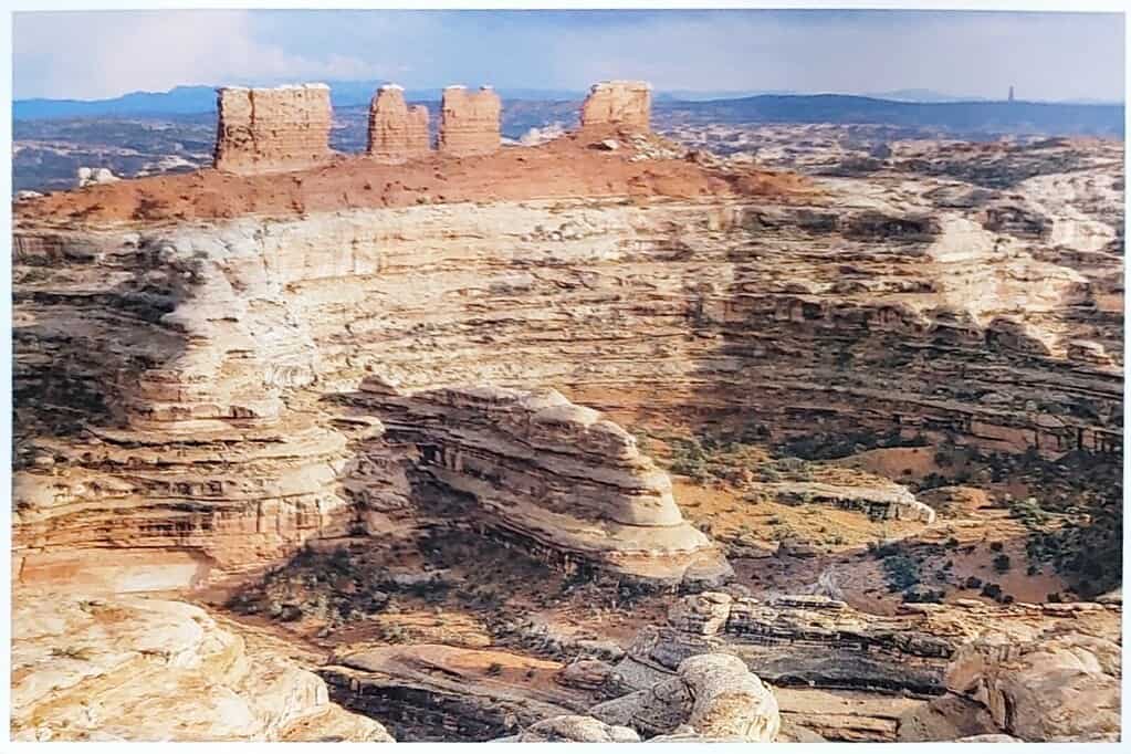
©"NL-4818431" by Bluriel's Postcards is licensed under PDM 1.0. - Original / License
The Maze is not in Maryland. It is the most remote district of Canyonlands National Park in Utah, and just reaching many of its trailheads can be an adventure. The National Park Service describes Maze trails as steep, minimally maintained, and often unmarked. Route finding can be difficult because many of the canyons look remarkably similar once you are inside them.
Maze Overlook – Utah
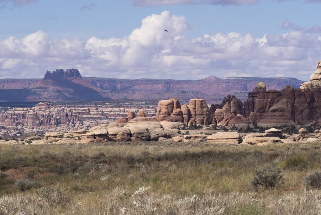
©"Maze District from Chesler Park, Needles District Canyonlands National Park." by Ranger Robb is licensed under PDM 1.0. - Original / License
The Maze Overlook route itself requires basic climbing moves over steep slickrock and pour-offs, and the park says a 25-foot rope is often necessary for raising and lowering packs. There is no running water or other visitor service in the Maze district, cell service is unreliable, and the backcountry is so remote that hikers are expected to be prepared for self-rescue. Even the roads beyond Hans Flat Ranger Station require high-clearance four-wheel drive.
10. Devil’s Path – New York
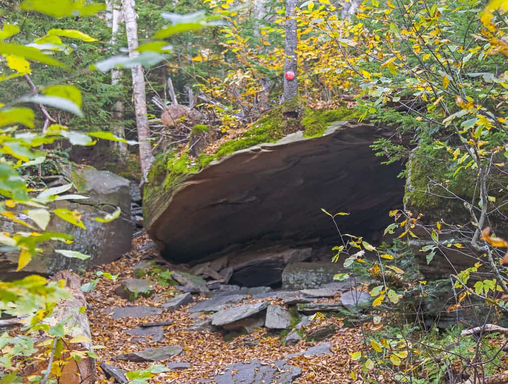
©"Cave on Devil's Path, West Kill Mountain, Spruceton, NY" by Daniel Case is licensed under BY-SA 2.0. - Original / License
Devil’s Path earns its name through sheer relentlessness. The New York Department of Environmental Conservation lists the red-marked route at 25.2 miles as it crosses some of the roughest terrain in the Catskills. The trail repeatedly climbs and drops over several major peaks, with steep rock sections that can require hikers to use their hands as much as their legs.
Devil’s Path – New York
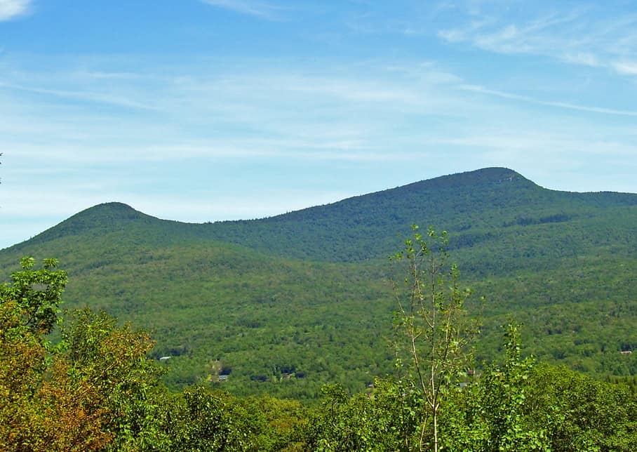
©"Kaaterskill High Peak" by Daniel Case is licensed under BY-SA 3.0. - Original / License
There is no single dramatic cable section or desert heat warning here. Instead, the danger comes from the accumulated difficulty: long mileage, rugged footing, repeated steep ascents and descents, exposed rock, and Catskills weather that can make an already tough route slippery. A full traverse is an endurance hike that should be treated very differently from a casual day on a well-graded trail.
11. Mount McKinley (Denali) – Alaska
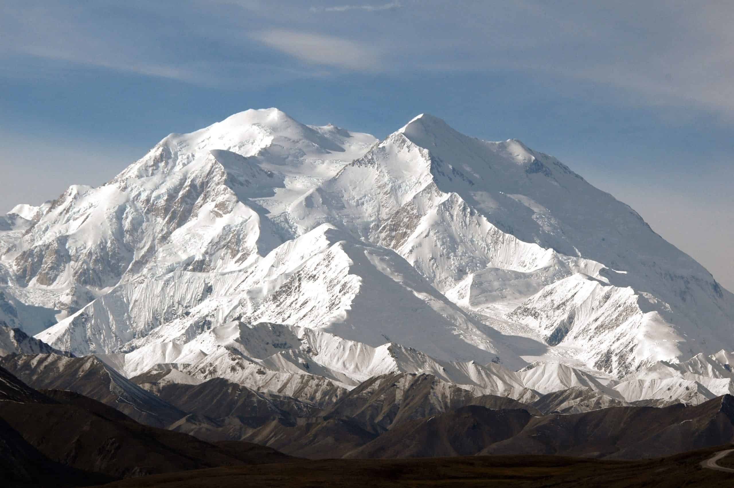
©"Mount Mc Kinley 6193 m (Denali = Indian for 'the Great') from the Denali Visitors Center in August 2006 by my son Bas on his second trip to Alaska - panoramio" by Henk Monster is licensed under BY 3.0. - Original / License
At 20,310 feet, Mount McKinley, widely known as Denali and located inside Denali National Park and Preserve, is the highest peak in North America. This is really a mountaineering expedition rather than a conventional hike. Climbers face extreme altitude, glaciers, crevasses, storms, cold injuries, avalanches, and days or weeks in a remote alpine environment. The 2026 climbing season was particularly tragic: the National Park Service reported five deaths on the West Buttress route, along with numerous high-altitude rescues.
12. Barr Trail – Colorado
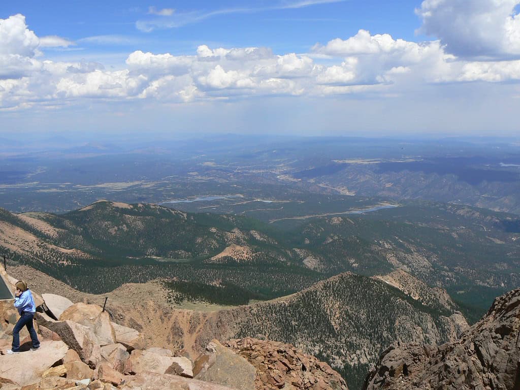
©"View from the top pikes pike's peak colorado springs manitou springs co usa looking towards Kansas" by Tim Pearce, Los Gatos is licensed under BY 2.0. - Original / License
Barr Trail climbs from Manitou Springs to the summit of Pikes Peak, covering about 13 miles one way and gaining roughly 7,400 feet. The lower trail begins around 6,700 feet and finishes above 14,000 feet, so hikers are dealing with more than tired legs by the time they reach the upper mountain. Altitude, rapidly changing weather, thunderstorms, exposure, and simple exhaustion can all become serious problems. A summit attempt is a full-day undertaking for most hikers, not something to squeeze in before lunch.
13. Presidential Traverse – New Hampshire
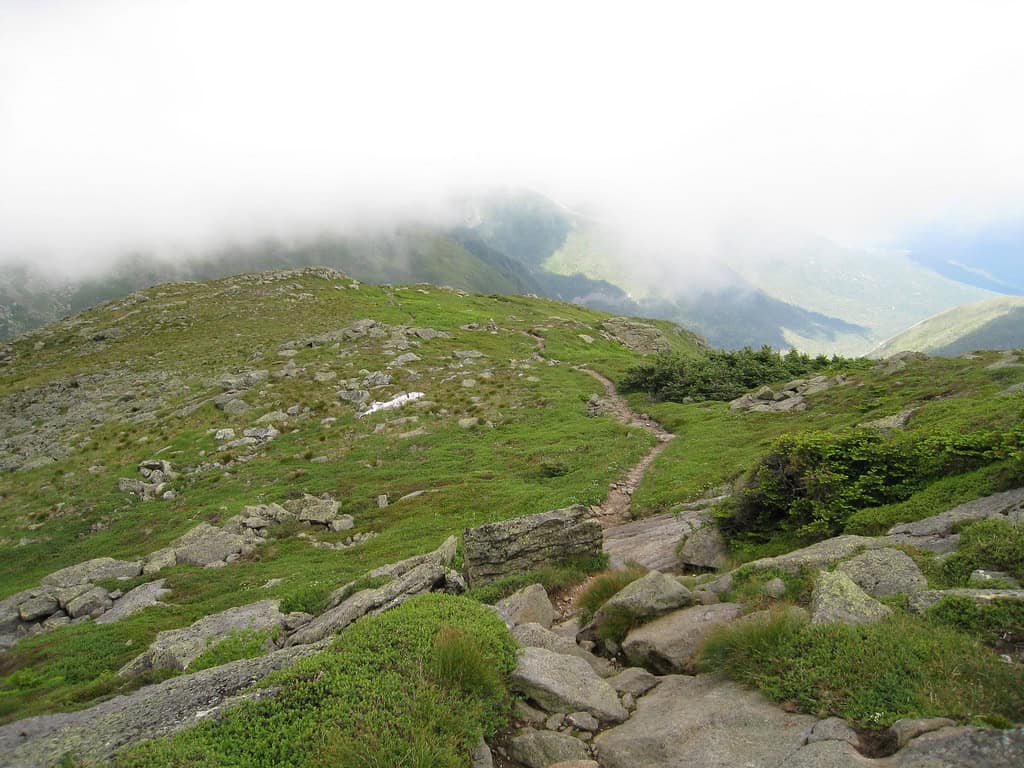
©"Presidential Traverse" by jfdervin is licensed under BY-SA 2.0. - Original / License
The Presidential Traverse crosses New Hampshire’s White Mountains and can vary from roughly 19 to 23 miles depending on the route, with about 9,000 feet of cumulative elevation gain. Much of the trip is above treeline, including terrain around Mount Washington. The real wildcard is weather. Conditions in the White Mountains can deteriorate quickly, and hikers need to be prepared for strong wind, rain, fog, cold, and poor visibility even when things looked perfectly reasonable at the trailhead.
14. Rover’s Run – Alaska
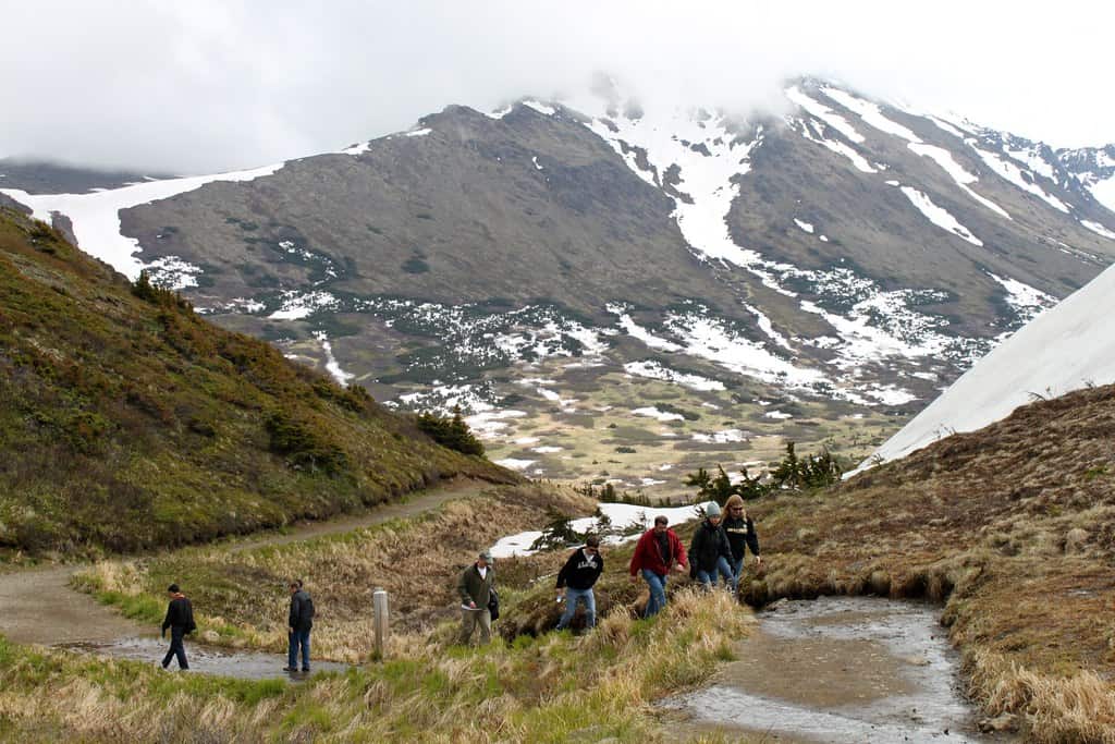
©"Anchorage: Hiking Around Flattop Mountain" by eliduke is licensed under BY-SA 2.0. - Original / License
Rover’s Run in Anchorage’s Far North Bicentennial Park has an unusual problem for a trail so close to a city: it closely follows salmon-bearing Campbell Creek through brown bear habitat. Alaska wildlife officials have documented serious bear attacks on trail users, including attacks on cyclists and a runner in 2008 and another cyclist in 2010. Agencies have temporarily closed Rover’s Run during periods of elevated bear activity, including a 2025 closure tied to increased salmon and close encounters. Bear awareness here is not just a sign at the trailhead.
15. The Incline – Colorado
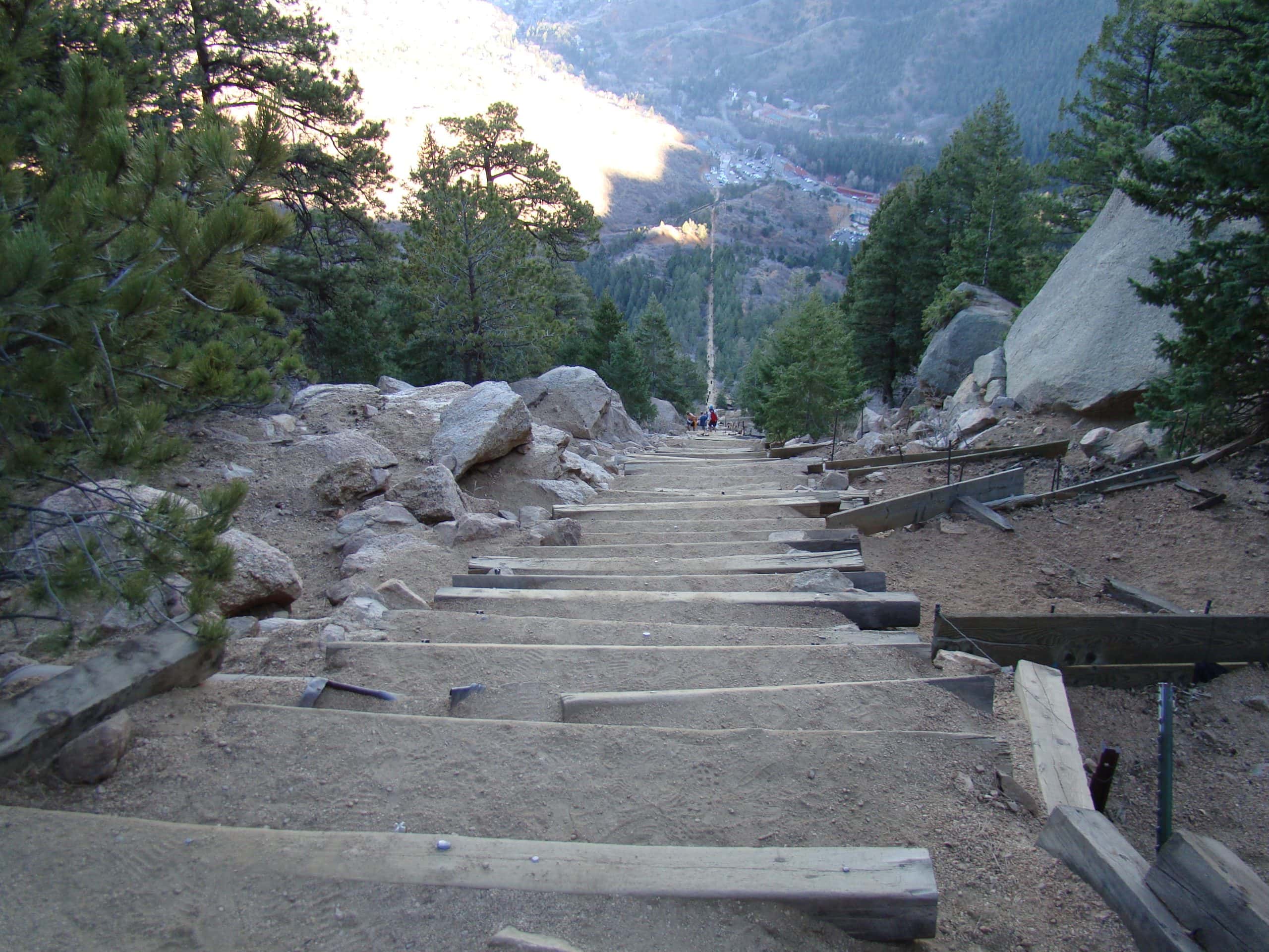
©"File:The Manitou Incline just before the false summit 21 Nov 12.jpg" by Ahodges7 is licensed under BY-SA 3.0. - Original / License
The Manitou Incline does not need much mileage to hurt. The climb gains about 2,000 feet in less than a mile through 2,768 steps, some of them brutally steep. The standard return using connecting trails and Barr Trail makes the complete outing longer, but the ascent itself is essentially a staircase pointed at the sky. Colorado Springs currently requires a free reservation and signed waiver to use the Incline.
The Incline – Colorado
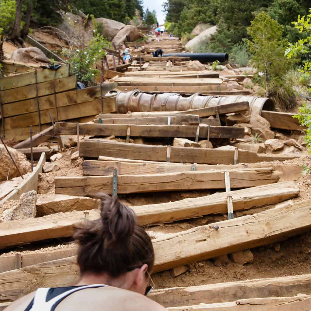
©"Climbing the Incline" by ken_kangogo is licensed under BY 2.0. - Original / License
There really is no universally safe season. Snow and ice can make winter footing much worse, while warm-weather hikers still have to think about dehydration, altitude, sun exposure, and Colorado’s fast-moving mountain storms. The city classifies the Incline as an extreme trail and recommends using Barr Trail for the descent rather than trying to walk back down thousands of steep steps.
16. Grinnell Glacier Trail – Montana
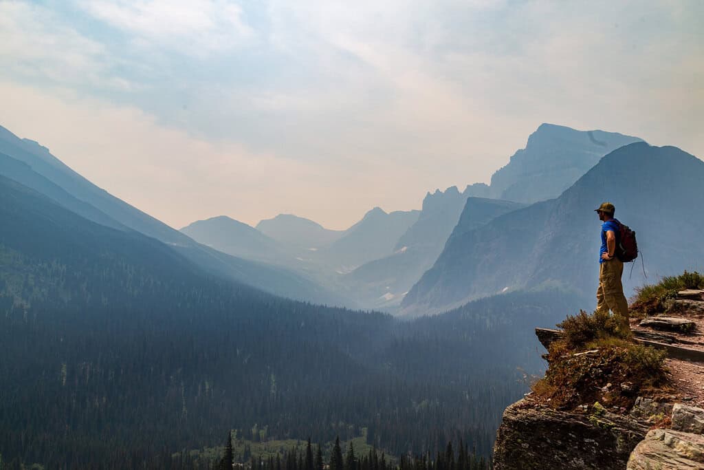
©"Overlook from Grinnell Trail in Glacier National Park" by aparlette is licensed under BY 2.0. - Original / License
Grinnell Glacier Trail is one of Glacier National Park’s signature hikes. From the Grinnell Glacier Trailhead or Many Glacier Hotel area, the route to the glacier viewpoint is about 5.3 miles one way with roughly 1,600 feet of elevation gain. The mileage is manageable for experienced hikers, but this is high mountain terrain where snow can linger well into summer and trail conditions can change quickly.
Grinnell Glacier Trail – Montana
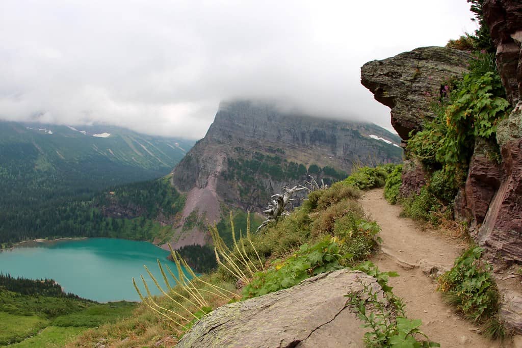
©"Grinnell Glacier lake and the trail" by daveynin is licensed under BY 2.0. - Original / License
Snowfields and wildlife are two of the bigger concerns. Glacier warns that higher trails may remain snowy into July and can be temporarily closed because of bear activity. In May 2026, a 32-year-old hiker suffered a fractured arm during a surprise encounter with a grizzly on a snowfield about 3.5 miles up Grinnell Glacier Trail. The park temporarily closed the route afterward and again reminded visitors to hike in groups, make noise, and carry bear spray.
17. The Notch Trail – South Dakota
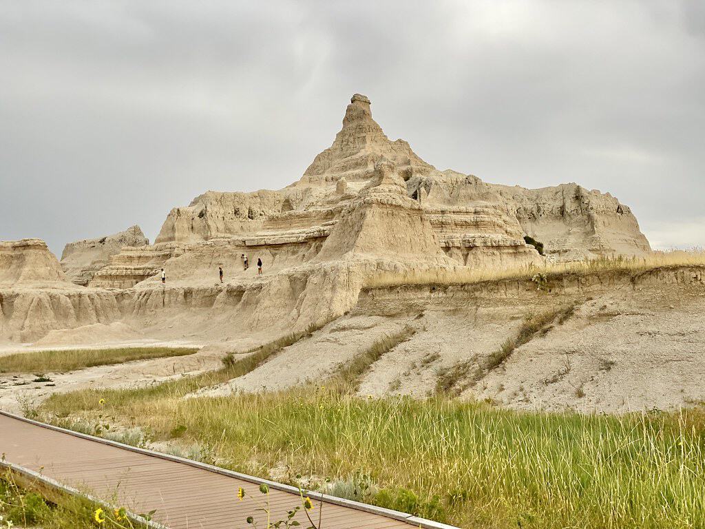
©"Pinnacles from Notch and Door Trails, Badlands National Park, Wall, SD" by w_lemay is licensed under BY-SA 2.0. - Original / License
Notch Trail in Badlands National Park proves a hike does not need to be long to get serious. The route is roughly 1.5 miles round trip and climbs through a canyon before reaching its best-known feature: a steep log ladder leading to an exposed ledge. The National Park Service rates it moderate to strenuous, warns hikers about drop-offs and loose gravel, and does not recommend it for anyone uncomfortable with heights.
The Notch Trail – South Dakota
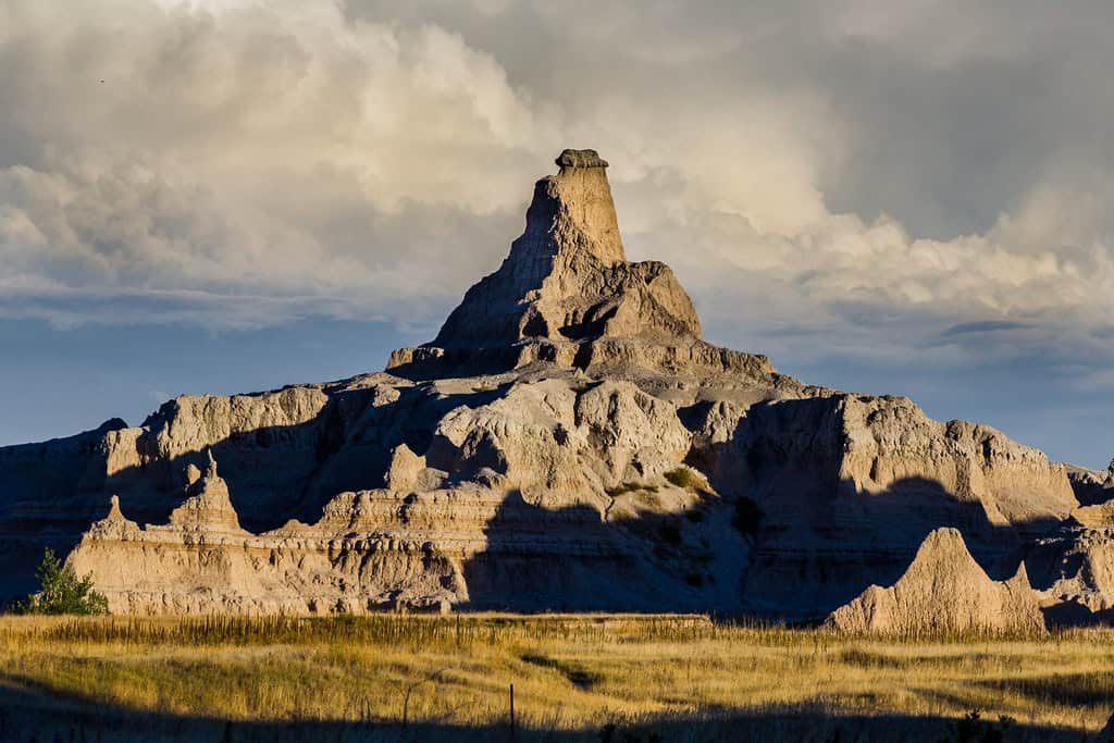
©"side notch" by Christian Collins is licensed under BY-SA 2.0. - Original / License
Rain, snow, and ice can make the ledges treacherous, while summer brings heat and heavy sun exposure. There is also a very current reason to check conditions before showing up: Badlands National Park closed Notch Trail on Aug. 31, 2026, until further notice after part of the ladder became a safety hazard. Park crews are repairing the damaged section before reopening the route.

