
Most people know the headline acts: the volcanoes, the rainforests, the dramatic coast. The weird stuff sitting right underneath or next to all of it, not so much. A lake that vanishes down a drain every summer or a waterfall cliff the size of ten Niagaras with no water in it. These are the landmarks that have been shaped by forces so outsized that they barely make sense at human scale.
Dry Falls, Washington
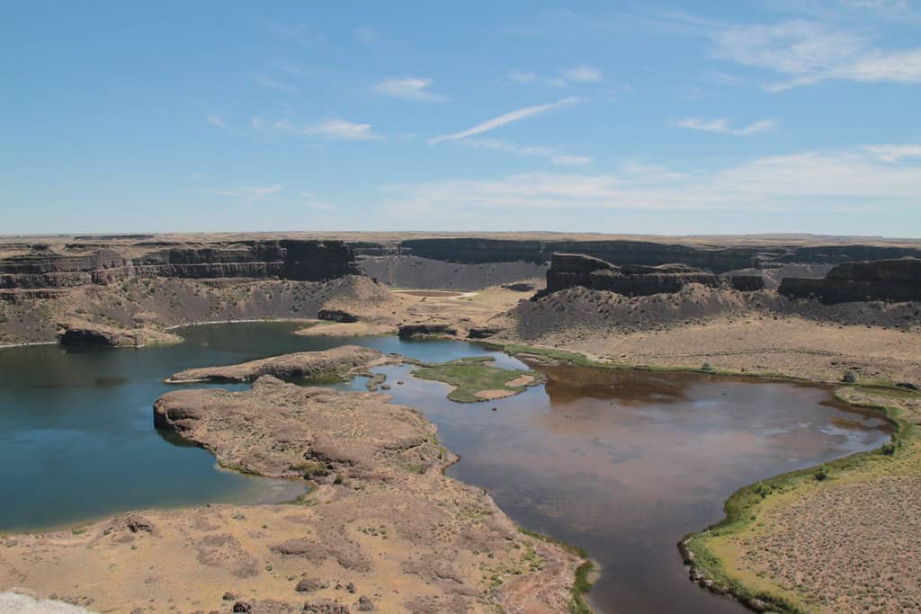
©"Dry Falls - Washington" by dierken is licensed under BY 2.0. - Original / License
Eastern Washington is not what most people picture when they think of the Pacific Northwest. Standing at the overlook, you’ll be looking at a cliff face 3.5 miles wide and 400 feet high. No water. Just a huge curved precipice with plunge pools still carved into the rock below.
That’s what’s left of one of the most powerful waterfalls to have ever existed. At the end of the last ice age, a glacial dam in what is now Montana failed repeatedly, sending catastrophic floods across eastern Washington. During those events, Dry Falls carried a flow ten times that of every river on the planet combined. The ice melted for good, the water stopped, and it’s just been sitting there ever since.
The Channeled Scablands, Washington
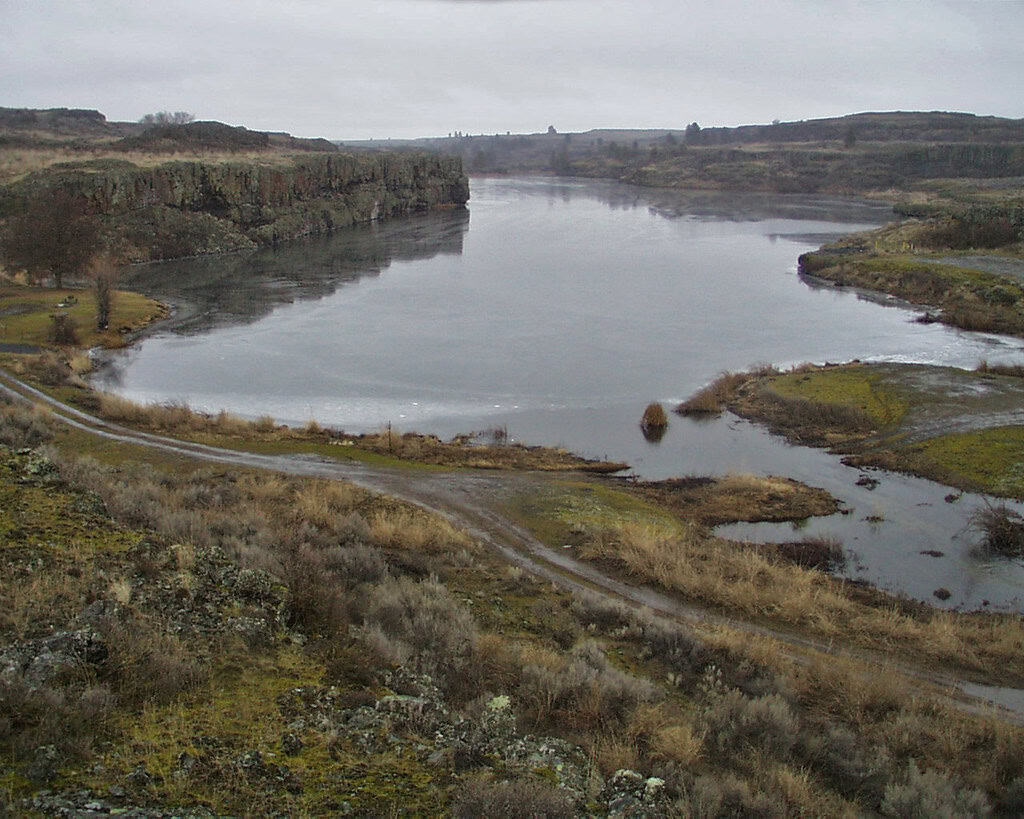
©"Twin Lakes Recreation Area" by BLM Oregon & Washington is licensed under BY 2.0. - Original / License
Eastern Washington shouldn’t look the way it does. Rolling wheat fields gave way without warning to raw basalt, dry canyons, and isolated mesas, as if something scraped the ground down to bedrock and left it there. That is almost exactly what happened.
The Channeled Scablands were created by the same catastrophic ice-age floods that formed Dry Falls, which ran through the region more than 40 times over roughly two million years. Each one stripped away topsoil and gouged channels into solid basalt, leaving behind a terrain that confused geologists for decades. A teacher named J Harlen Bretz proposed the flood explanation in 1923 and was mocked by the scientific establishment for suggesting that geology could work this fast. He was eventually vindicated, winning the Penrose Medal, geology’s highest honor, at the age of 96.
Lost Lake, Oregon
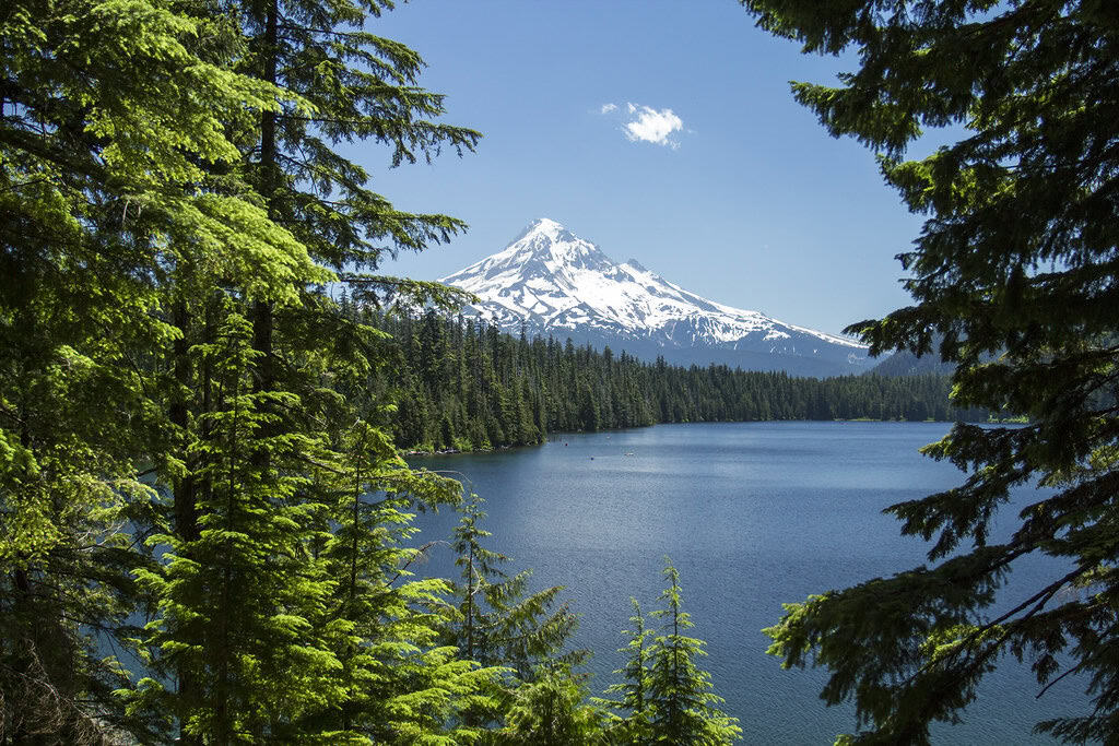
©"Lost Lake, Hood River County, Oregon" by Bonnie Moreland (free images) is licensed under PDM 1.0. - Original / License
Lost Lake in Hood River County fills up every winter and disappears every summer, draining through three holes in the lakebed, each about six feet wide. Next spring, it fills back up, and that’s the way it has been for as long as anyone can remember.
The holes are old lava tubes from volcanic eruptions roughly 3,000 years ago. When rain falls faster than the tubes can drain it, the lake fills. When the dry season hits, the tubes win. It takes seven to ten years for the water to pass through the porous volcanic rock below before emerging as groundwater on the valley floor. The lake’s own drain is feeding an aquifer that people drink from today.
Thor’s Well, Oregon
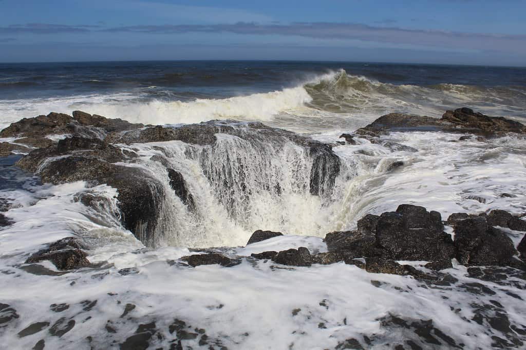
©"Thor's Well" by Gunn Shots ! is licensed under BY 2.0. - Original / License
From a distance, Thor’s Well looks like the Oregon coast has a drain. A round hole in the basalt near Cape Perpetua, about 20 feet deep, it sits right at the waterline, and during high tide, water surges into it and appears to get sucked straight down into the earth. The effect is good enough that early observers truly believed it was bottomless.
It formed when a sea cave eroded into the volcanic rock over thousands of years, until the roof eventually collapsed. The bottom opened to the ocean, and now water cycles in and out with each wave, shooting upward in a geyser effect during storms. Watching it at sunset during a high tide, with spray catching the light, is one of the more dramatic things you can watch on the coast.
Painted Hills, Oregon
©"Painted Hills" by tsaiproject is licensed under BY 2.0. - Original / License
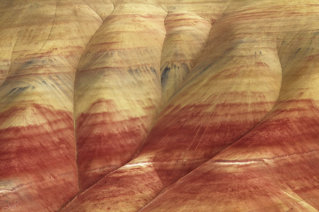
In central Oregon’s high desert, a series of rounded mounds are striped in red, black, gold, and ochre. The colors shift visibly depending on whether the clay is wet or dry.
Each stripe has memories from a different era. The red comes from laterite soils that formed during warm, wet periods tens of millions of years ago. The black layers are lignite, compressed plant matter from ancient swampy lowlands. Gold and tan record drier eras. Reading them in order is reading the regional climate going back to the Eocene, through the transition into the cooler, drier Oligocene that followed.
Beacon Rock, Washington
©"Beacon Rock and Hamilton Mt, Columbia River Gorge NSA.jpg" by Forest Service Pacific Northwest Region is licensed under PDM 1.0. - Original / License
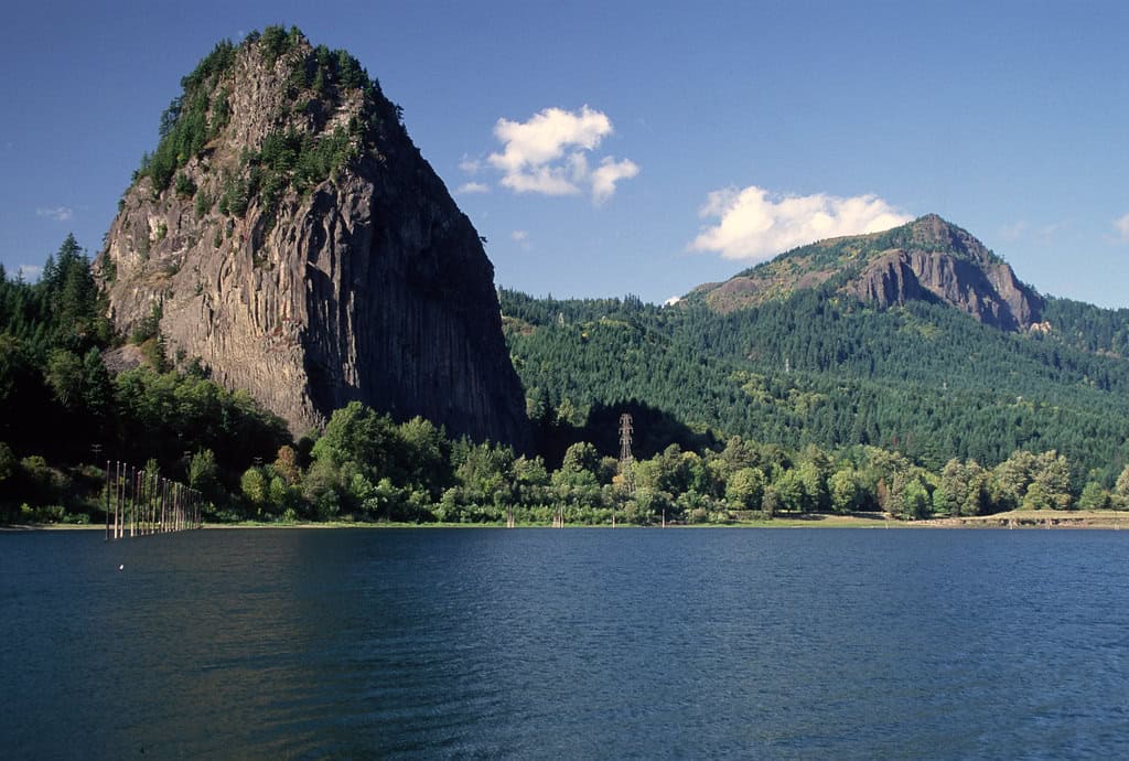
From the road, Beacon Rock looks like a large cliff rising out of the Columbia River. Turns out this cliff is really the solidified core of a volcano, left standing after ice-age floods stripped away everything around it. The outer material eroded. The basalt plug, harder than the rest, stayed.
At 848 feet, Beacon Rock is widely cited as the second-largest free-standing monolith in the Northern Hemisphere. Lewis and Clark named it in 1805 and noted it marked the upper limit of tidal influence on the river. A century later, the Army Corps of Engineers wanted to blast it apart for jetty material. In 1904, a private buyer named Charles Ladd purchased the rock and blocked it. Washington State eventually acquired it for a park only after Oregon let it be known they were interested in buying it themselves.
Crack in the Ground, Oregon
©"Crack in the Ground" by BLM Oregon & Washington is licensed under BY 2.0. - Original / License
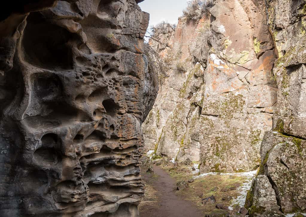
Central Oregon’s Crack in the Ground is a volcanic fissure over two miles long and up to 70 feet deep, running through the high desert near Christmas Valley. You can descend into it and walk along the bottom. In places, the walls close to shoulder width, and it stays noticeably cooler down there than above, with ice sometimes persisting into summer at the lowest points.
The fissure formed when lava flows draped over an underlying fault zone created a tension fracture. The volcanic rock is at least 14,000 years old, and erosion has had almost no time to widen or fill the crack.
Palouse Falls, Washington
©"Palouse Falls, Washington State Park" by TomCollins is licensed under BY-ND 2.0. - Original / License
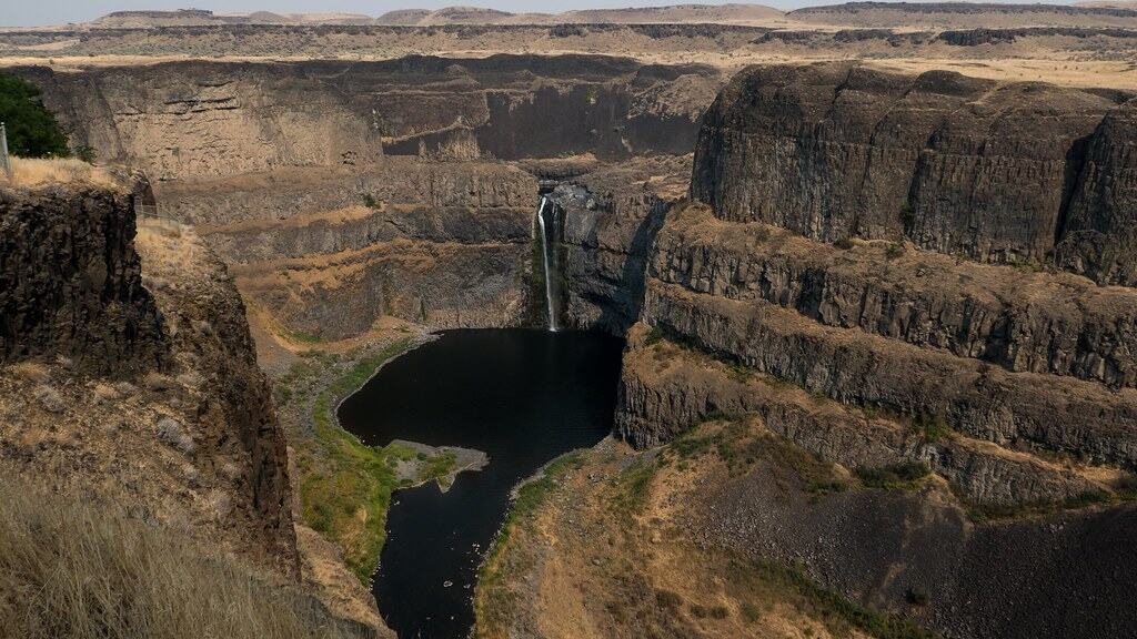
Palouse Falls drops 200 feet into a canyon carved by the Missoula Floods. The river itself is modest, while the canyon is enormous.
During the ice-age floods, water hundreds of feet deep poured through this location and scoured out the basalt canyon you see today. Now a relatively small river runs through it, dropping over a ledge into a space built for something far more powerful.
The canyon walls expose a cross-section of the Columbia River Basalt Group, layers of ancient lava flows stacked up over millions of years. Palouse Falls became Washington’s official state waterfall in 2014, which is a bit of a downgrade for a canyon that used to carry the equivalent of ten times all the world’s rivers.
Newberry Volcano, Oregon
©"Newberry Volcano" by Joshua Schreiner is licensed under BY-ND 2.0. - Original / License
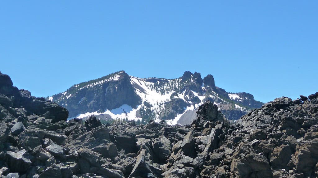
Most people drive past Newberry Volcano without realizing it exists as a single feature. It’s too big to be identified as a volcano from the road. In fact, it’s the largest volcano in the Cascade Arc, covering roughly 1,200 square miles.
This massive volcano last erupted around 690 AD and is still considered active. The caldera at the top, four by five miles wide, holds two lakes: Paulina Lake and East Lake. Inside the caldera, you can also find an obsidian flow from that same eruption, a field of black volcanic glass stretching across the landscape. Native peoples quarried obsidian here for thousands of years and traded it across a wide region. The Newberry National Volcanic Monument now protects the whole complex, which also includes Lava River Cave, the longest continuous lava tube in Oregon.
Pillars of Rome, Oregon
©"Pillars of Rome Oregon" by Knowles Gallery is licensed under BY 2.0. - Original / License
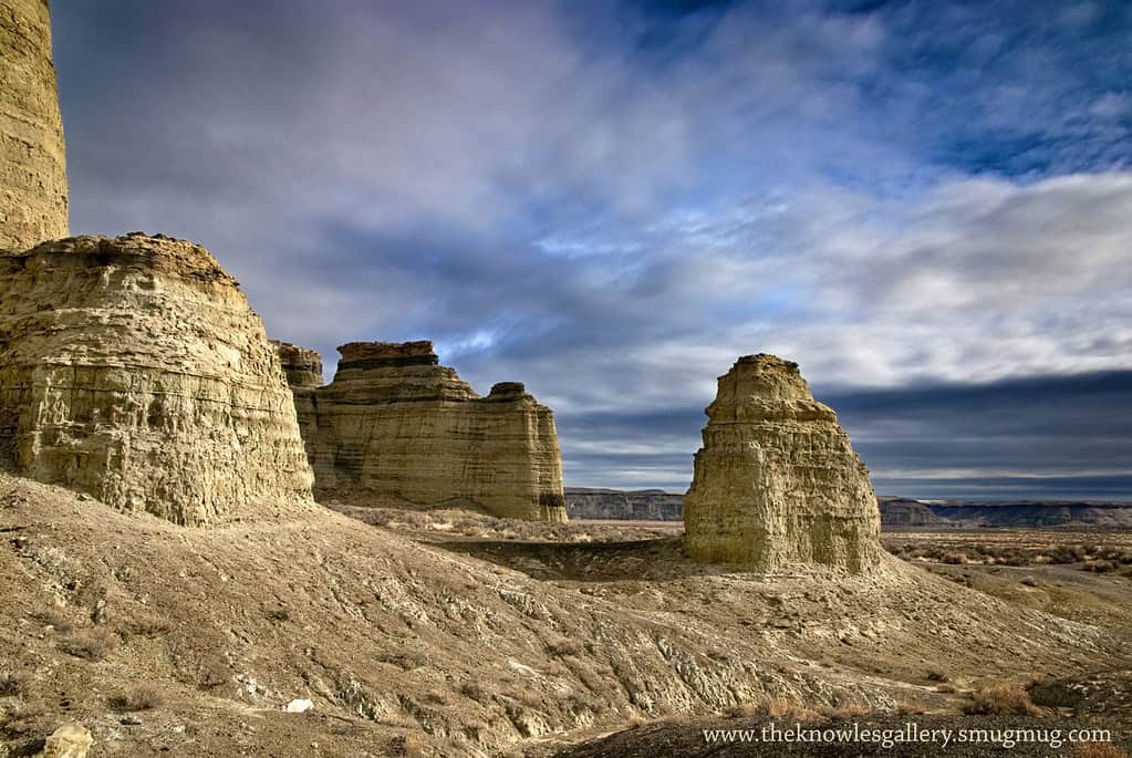
Eastern Oregon’s Pillars of Rome have nothing to do with Italy, but the pioneers who named them in the 1800s weren’t entirely wrong to make the comparison. A series of 100-foot-high white cliffs stretch for nearly five miles near the Owyhee River, shaped into columns, spires, and overhangs by millions of years of wind and water erosion. They rise out of a landscape so arid and remote that most Oregonians have never seen them.
The rock is volcanic ash and clay, deposited when this part of Oregon was covered by an ancient lake. The lake is long gone. A pale sculpted ridgeline is all that remains, sitting in the middle of the southeastern Oregon desert, surrounded by terrain that looks nothing like the Oregon of the tourist brochures.
Fossils of prehistoric animals have been found in the area, including species that lived here when the lake still existed. Getting there requires a rough road you wouldn’t want to attempt in a standard sedan, which is most of the reason it stays off the radar.

