
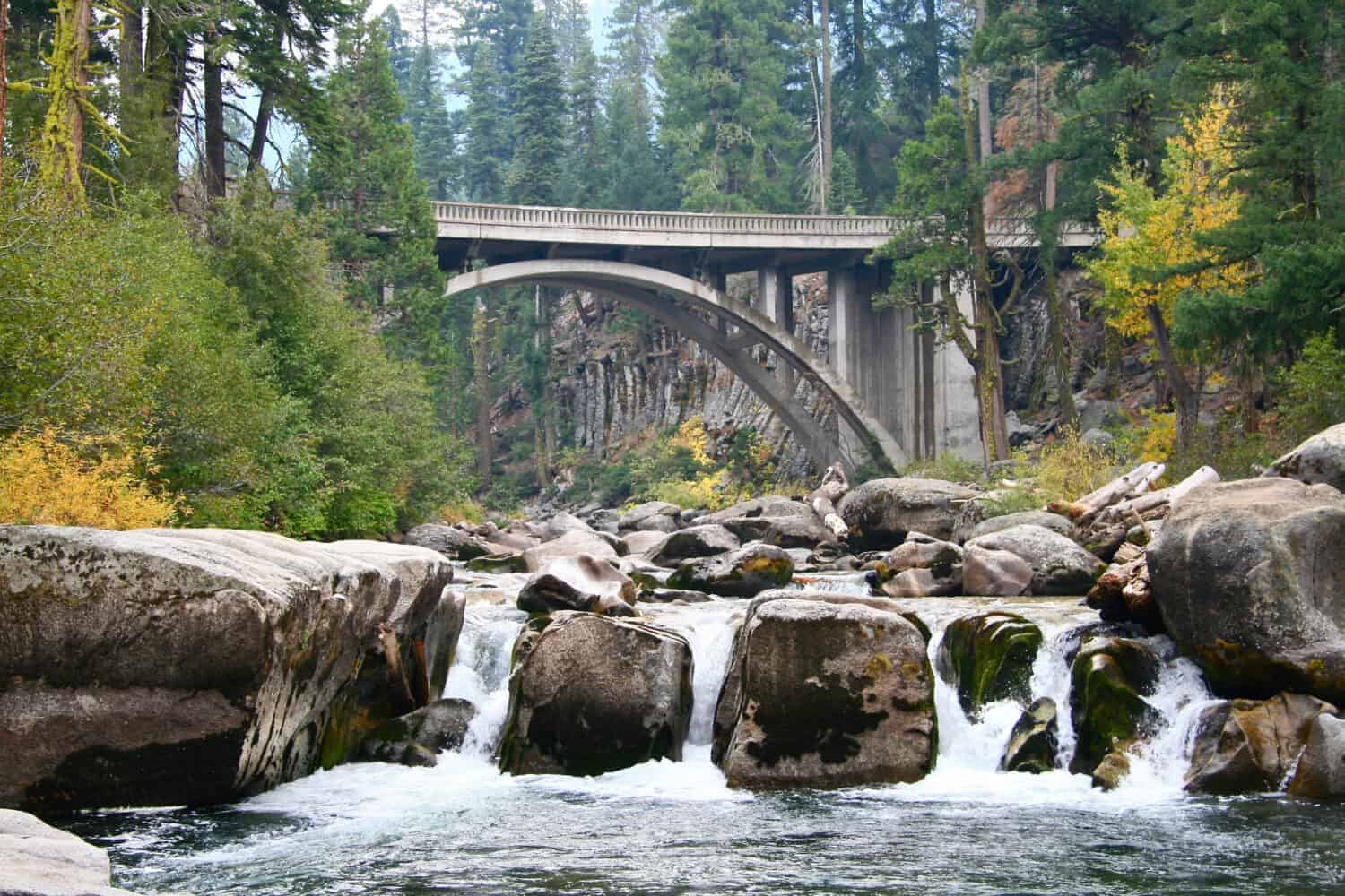
Water cuts through everywhere in the PNW. The wide Columbia River marking the Oregon-Washington border, the deep tidal passages of Puget Sound, the forested river valleys of the Olympic Peninsula. Building the bridges across any of it is no small feat. And some of these bridges have turned into destinations themselves. Every bridge on the list was chosen for some combination of scale, setting, engineering ambition, or historical weight.
Deception Pass Bridge, Whidbey Island, Washington
©Denise Lett/Shutterstock.com
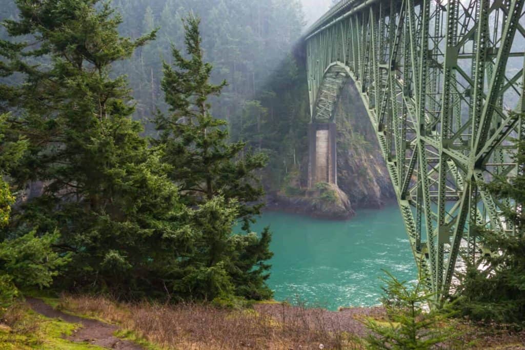
The Deception Pass Bridge rises 180 feet above the churning tidal water of Deception Pass, and the views from Fidalgo Island stretch to all sides: rocky cliffs and the turbulent waters that, before 1935, could only be crossed by ferry.
It’s two spans connected on tiny, rocky Pass Island. Deception Pass Bridge stretches for 976 feet and Canoe Pass Bridge 511 feet. The construction of the last center segment was done in the early hours of the morning because it had expanded due to the heat in the summer and didn’t fit. That level of precision, over 180 feet of open water, is something to ponder while crossing in about 45 seconds.
Astoria-Megler Bridge, Oregon and Washington
©"Astoria-Megler Bridge, Jill Erickson" by OregonDOT is licensed under BY 2.0. - Original / License
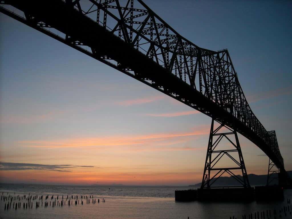
The Astoria-Megler Bridge spans the Columbia River at its mouth for four miles, where the water is so expansive and the currents so fickle that building a crossing proved too much for engineers for over a century, until the bridge opened in 1966. This was the last link in U.S. Route 101, completing the Pacific Coast Highway route between Los Angeles and Olympia, Washington.
The bridge reaches 205 feet at its highest point to clear the deep-draft cargo ships that still navigate the Columbia estuary regularly. On the Oregon side, the approach climbs steeply before the full scale becomes visible. On the Washington side, the landscape is flat and gray, and the bridge just stops, which somehow makes the scale of the thing stranger.
Tacoma Narrows Bridge, Tacoma, Washington
©"Tacoma Narrows Bridge" by ramcharger76 is licensed under BY 2.0. - Original / License
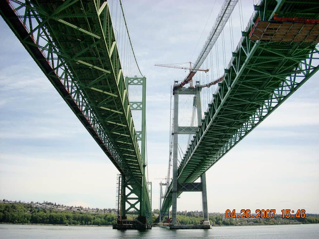
The original Tacoma Narrows Bridge opened in July 1940 and collapsed into Puget Sound four months later, torn apart by violent oscillations in 42-mile-per-hour winds. The video of this collapse has been turning up in physics classes ever since. The bridge was rebuilt in 1950, with a second parallel bridge opening in 2007. The twin suspension bridges connect Tacoma to the Kitsap Peninsula.
The original bridge, nicknamed “Galloping Gertie” for the way it swayed even under ordinary traffic, went down in history (literally) as one of the most studied structural failures in engineering.
St. Johns Bridge, Portland, Oregon
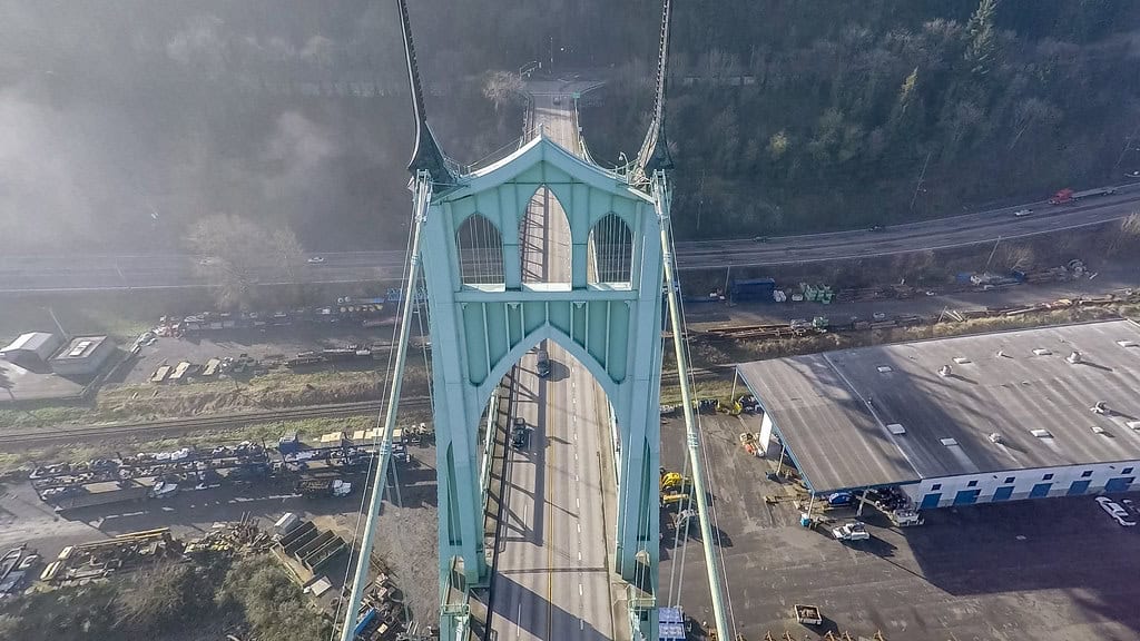
©"St. Johns Bridge" by Twelvizm is licensed under BY-ND 2.0. - Original / License
Portland has been nicknamed Bridgetown, with 12 bridges crossing the Willamette River alone. While most are crossed out of necessity, people drive across town and through St. Johns to admire the bridge itself. It’s a suspension bridge with two Gothic-styled towers reaching 400 feet like medieval cathedrals rising from the face of the river. Completed in 1931, St. Johns Bridge was the longest suspension bridge west of the Mississippi River at that time.
Cathedral Park below offers the best view. The Gothic arches frame the Willamette in such a way that it’s hard to believe you are looking at a highway bridge.
Bridge of the Gods, Cascade Locks, Oregon
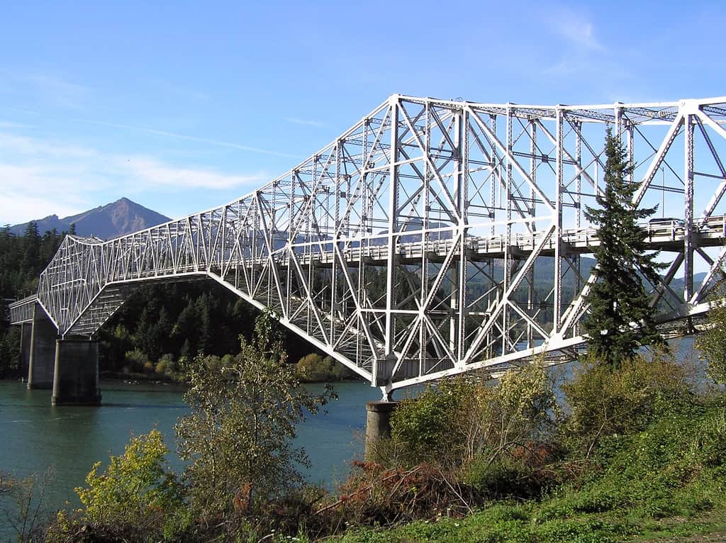
©"Bridge of the Gods, Peter Murphy" by OregonDOT is licensed under BY 2.0. - Original / License
This steel bridge crossing the Columbia River in Cascade Locks was named after a landslide that took place more than 1,000 years ago, blocking the river entirely and creating a natural land bridge that was used by the Native peoples.
The natural bridge is long gone, but the name carried over to the steel span built at the same crossing in 1926. The bridge was elevated in 1938 to cope with the rising water level behind the newly constructed Bonneville Dam.
The deck is steel grating. You can look straight down at the water 140 feet below your feet. If you’re not afraid of heights, that is.
High Steel Bridge, Mason County, Washington
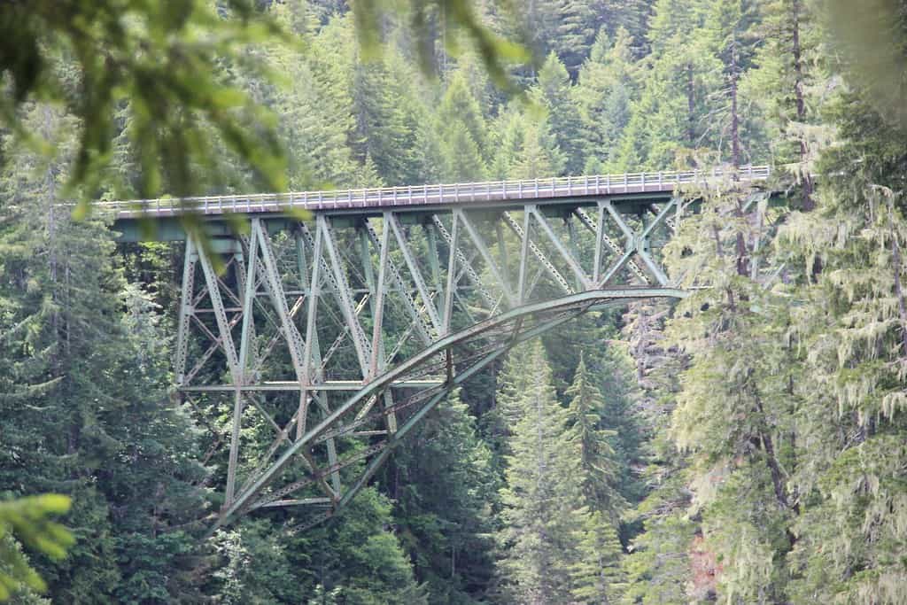
©"High Steel Bridge, Olympic National Forest" by Forest Service Pacific Northwest Region is licensed under PDM 1.0. - Original / License
The road from Shelton leads into the Skokomish River basin, followed by an extension of gravel, before arriving at the bridge. Hanging above a forested valley, 375 feet above the South Fork of the Skokomish River, the High Steel Bridge is an arched span that crosses one of the deeper chasms of the Olympic Peninsula.
The bridge was constructed in 1929 as a railroad trestle for the Simpson Logging Company, making it the highest railway arch bridge ever built in the United States. Logging trains crossed it for two decades, bringing out the old-growth timber from the Olympics. In 1950, the railroad was retired and the bridge was transformed for road traffic.
Yaquina Bay Bridge, Newport, Oregon
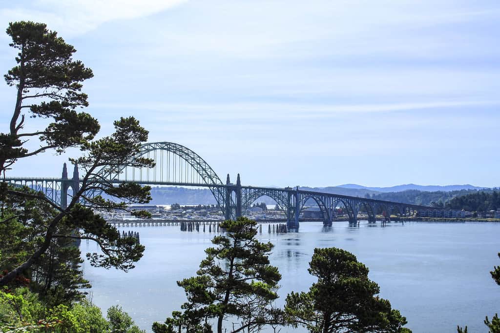
©"Yaquina Bay Bridge, Newport, Oregon" by Bonnie Moreland (free images) is licensed under CC0 1.0. - Original / License
Conde McCullough designed eleven major bridges along the Oregon coast during the 1930s for the New Deal-era Oregon Coast Highway project. The Yaquina Bay Bridge is the crown of the series.
Completed in 1936, it crosses Yaquina Bay in Newport, Oregon, decorated with ornate concrete arches and Art Deco towers, a geometric and heavily ornamented style typical of the decade’s public works. At over 3,200 feet long, the bridge mixes structural efficiency with the kind of ornamentation that government-funded projects could still justify in the 1930s but would never spend money on today.
Hoffstadt Creek Bridge, Spirit Lake Memorial Highway, Washington
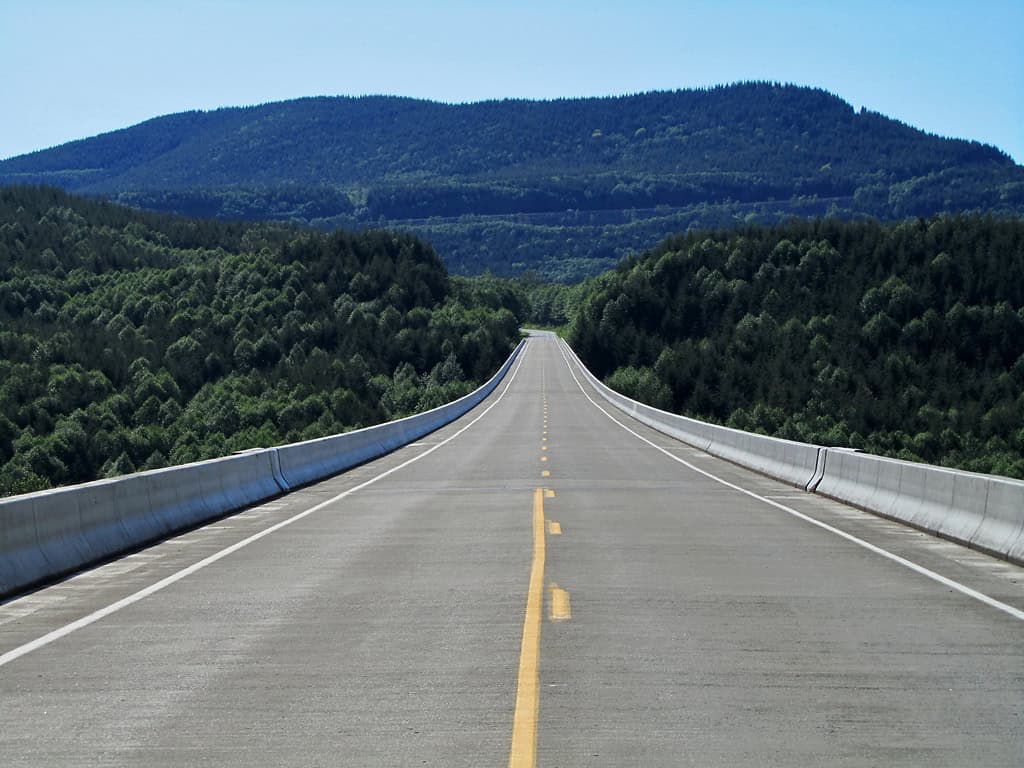
©"Hoffstadt Creek Bridge in Washington" by Landscapes in The West is licensed under PDM 1.0. - Original / License
The Hoffstadt Creek Bridge sits on the Spirit Lake Memorial Highway, where the road crosses the North Fork Toutle River valley, 370 feet above the valley bottom. The valley was reshaped by the 1980 eruption, burying the highway under lahars and forcing its complete reconstruction.
If the weather is clear, you can see the summit at the end of the road. The wide, gray, sediment-filled river channel, the still-regenerating slopes, and the absence of the old-growth forest below are all the work of the volcano.

